Haltwhistle Burn facts for kids
Quick facts for kids Haltwhistle Burn |
|
|---|---|

Haltwhistle Burn
|
|
|
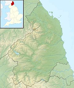
Location within Northumberland
|
|
| Country | United Kingdom |
| County | Northumberland |
| Physical characteristics | |
| River mouth | 54°58′00″N 2°26′37″W / 54.9666°N 2.4437°W |
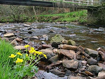
The Haltwhistle Burn is a small river in Northumberland, England. It flows east of the town of Haltwhistle. This river starts in the peaty uplands near the Whin Sill ridge. It then travels through a cool sandstone gorge. The burn eventually reaches the South Tyne Valley.
The Haltwhistle Burn covers an area of about 42 square kilometers. Today, it's a great spot for wildlife. It's also popular for walks. For a long time, from Roman times until the 1930s, the burn was important for industries. Its minerals and water power helped create jobs.
Contents
Rocks and Old Industries
The ground under this part of Northumberland has many layers of rock. These rocks formed during the Carboniferous Period. This was a time when sea levels changed a lot. Because of this, different layers were laid down. These layers include limestone, shale, sandstone, and coal.
The Haltwhistle Burn has cut through these rock layers. This made it easy to find building stone, clay, and coal. This led to many industries growing here. People started quarrying for stone. They also burned lime in lime kilns. Factories made bricks, tiles, and pipes. There was also coal mining and the making of coke (fuel) and coal-gas. Even ironstone, found near the coal, was melted here.
How Water Power Helped
The Haltwhistle Burn flows downhill at a gentle slope. This slope was enough to power machines. In the 1700s and 1800s, it ran a corn mill. It also powered three wool factories. The first wool process to use machines was fulling. Records show this happening as early as 1612.
Later, new technology allowed more processes to be done by water. This included carding and spinning wool. These tasks were also done in watermills. When steam-powered mills arrived, the wool factories on the burn closed. Two mills were taken down in the 1930s. The last fulling mill is now a house.
Roman Fort History
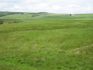
The remains of the Haltwhistle Burn Roman Fort are on the east side of the burn. It's just north of where the B6318 road crosses. This road is sometimes called the Military Road. It was built in the 1700s.
Between the fort and the Military Road is the Stanegate Roman road. This road was built in 71 AD. It was an earlier northern border before Hadrian's Wall. The Haltwhistle Burn Roman fort was built to serve this road. You can still see a large curved earth bank. This bank carried the Stanegate road from the fort down to the river. Another part of the bank carried the Stanegate up through a Roman cutting on the west side of the river.
Just north of the fort, there are also three separate Roman marching camps. These were temporary camps used by soldiers.
Community Science Project
The Haltwhistle Burn was a test site for a cool new project. This was a citizen science research project. Newcastle University led the project. It helped local people monitor the weather and water. They used simple, low-cost tools. They measured rainfall, river levels, and floods.
This project gave locals and scientists more information. They want to keep the Haltwhistle Burn healthy. This knowledge helps them manage flood risk. It also helps with water quality and how the river changes shape. These citizen science observations help fill in missing data. This helps understand and solve local problems. The project started in 2013. It was one of the first in the UK to use citizen science in this way.
 | Toni Morrison |
 | Barack Obama |
 | Martin Luther King Jr. |
 | Ralph Bunche |


