Hamlin Valley facts for kids
Quick facts for kids Hamlin Valley |
|
|---|---|

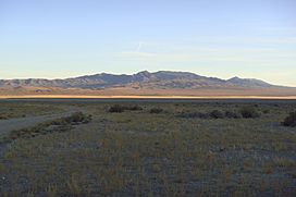
Valley's northeast, view of northwest Mountain Home Range, (southeasterly view from Snake Range)
|
|
| Floor elevation | 6,000 ft (1,800 m) |
| Length | 60 mi (97 km) |
| Width | 10 mi (16 km) |
| Area | 750 sq mi (1,900 km2) |
| Geography | |
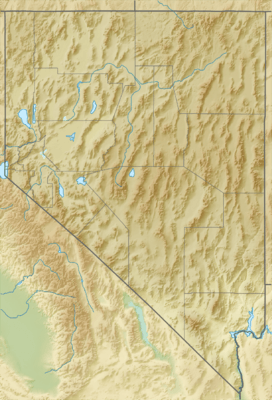
| Location | Utah & Nevada, United States |
| Borders on | Mountain Home Range–NE & E Indian Peak Range–E, SE & S Needle Mountains–SSW White Rock Mountains–SW Limestone Hills–W Snake Range-NNW Snake Valley–NNE |
| Rivers | Hamlin Valley Wash, Big Springs Creek |
Hamlin Valley is a long valley in the Great Basin region. It stretches mostly from north to south. This valley is special because it crosses both the Nevada and Utah state lines in the United States. It is about 60 miles (97 km) long. The northern end of Hamlin Valley connects with another valley called Snake Valley (Great Basin).
Where is Hamlin Valley?
Hamlin Valley is surrounded by several mountain ranges. To the east, you'll find the Mountain Home Range. The Indian Peak Range is to the southeast and south. On the west side, there are the Needle Mountains, White Rock Mountains, and Limestone Hills.
The northern part of Hamlin Valley joins with Snake Valley (Great Basin). This happens about 11 miles (18 km) south of a town called Garrison. The Snake Range to the north-northwest makes the valley narrower here. It then turns towards the northeast as it blends into Snake Valley.
The very northern tip of the valley is located at 38°45′20″N 114°4′30″W / 38.75556°N 114.07500°W. The southern tip is at 37°57′33″N 113°56′50″W / 37.95917°N 113.94722°W. A place called Rosencrans Well is just southwest of the valley's middle.
Water in the Valley
The main waterway in Hamlin Valley is the Hamlin Valley Wash. This is an ephemeral stream. This means it only flows after it rains or snow melts. It runs mostly north-northwest, then straight north through the valley.
The stream starts in the hills north of Modena, Utah. This area is about 8 miles (13 km) wide. From there, the wash flows northwest, following Hamlin Valley into Nevada. This part of the valley, and the mountain ranges on either side, also run north-northwesterly for about 25 miles (40 km).
The Hamlin Valley Wash disappears near the northern end of the valley. About 2.5 miles (4.0 km) to the west, another stream called Big Springs Creek begins. It starts from Big Springs, at the base of the Snake Range. This creek flows north past Burbank and into Snake Valley. It then joins Lake Creek and eventually empties into Pruess Lake.
Both Hamlin Valley and Snake Valley are part of a closed drainage basin. This means that any water that flows into these valleys stays there. It does not flow out to the ocean. Instead, it either sinks into the ground or evaporates.
 | Bayard Rustin |
 | Jeannette Carter |
 | Jeremiah A. Brown |


