Hanging Rock, Ohio facts for kids
Quick facts for kids
Hanging Rock, Ohio
|
|
|---|---|
|
Village
|
|

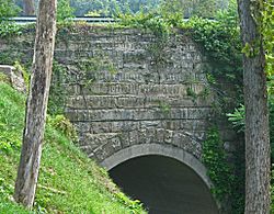
Stone arch bridge over Osborne Run
|
|

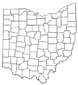
Location of Hanging Rock, Ohio
|
|

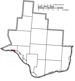
Location of Hanging Rock in Lawrence County
|
|
| Country | United States |
| State | Ohio |
| County | Lawrence |
| Township | Hamilton |
| Area | |
| • Total | 0.64 sq mi (1.66 km2) |
| • Land | 0.56 sq mi (1.44 km2) |
| • Water | 0.08 sq mi (0.22 km2) |
| Elevation | 545 ft (166 m) |
| Population
(2020)
|
|
| • Total | 204 |
| • Estimate
(2023)
|
195 |
| • Density | 366.91/sq mi (141.57/km2) |
| Time zone | UTC-5 (Eastern (EST)) |
| • Summer (DST) | UTC-4 (EDT) |
| ZIP code |
45638
|
| Area code(s) | 740 |
| FIPS code | 39-33194 |
| GNIS feature ID | 2398238 |
Hanging Rock is a small village in Lawrence County, Ohio. It is located right along the Ohio River. In 2020, about 204 people lived there.
Hanging Rock is part of a larger area called the Metropolitan Statistical Area. This area includes cities like Huntington in West Virginia and Ashland in Kentucky.
Contents
A Look Back in Time
Hanging Rock started way back in 1820. That's when people from Europe built a special kind of factory there. This factory was called a blast furnace. It was used to make iron.
As the iron factory grew, more workers came to live in the area. This helped the village of Hanging Rock to develop. The village got its name from a large cliff nearby.
The village was busiest around 1890. Many people lived and worked there then. But over time, new ways of making iron came along. Fewer workers were needed. So, people slowly moved away to find jobs elsewhere.
Where is Hanging Rock?
Hanging Rock is a small village. It covers an area of about 0.65 square miles (1.66 square kilometers). Most of this area is land. A small part, about 0.09 square miles (0.22 square kilometers), is water.
You can find some cool outdoor spots near the village. These include the Hanging Rock Recreational Area. There are also the Hanging Rock Ponds. These places are great for enjoying nature.
People of Hanging Rock
The number of people living in Hanging Rock has changed over the years.
| Historical population | |||
|---|---|---|---|
| Census | Pop. | %± | |
| 1880 | 624 | — | |
| 1890 | 846 | 35.6% | |
| 1900 | 665 | −21.4% | |
| 1910 | 662 | −0.5% | |
| 1920 | 591 | −10.7% | |
| 1930 | 550 | −6.9% | |
| 1940 | 481 | −12.5% | |
| 1950 | 465 | −3.3% | |
| 1960 | 352 | −24.3% | |
| 1970 | 278 | −21.0% | |
| 1980 | 353 | 27.0% | |
| 1990 | 306 | −13.3% | |
| 2000 | 279 | −8.8% | |
| 2010 | 221 | −20.8% | |
| 2020 | 204 | −7.7% | |
| 2023 (est.) | 195 | −11.8% | |
| U.S. Decennial Census | |||
In 2010, there were 221 people living in the village. These people lived in 95 different homes. About 68 of these homes were families.
Some homes had children under 18 living there. Many homes had married couples. Other homes had a single parent. About 20% of homes had just one person living there. Some of these were people aged 65 or older.
The average age of people in the village was about 47 years old. About 15% of the people were under 18. About 20% were 65 years old or older. The village had a little more females than males.
Schools and Libraries
Kids in Hanging Rock go to schools in the Rock Hill Local School District.
For books and learning, residents can visit the Briggs Lawrence County Public Library. The main library is in Ironton. There are also other library branches nearby. You can find them in South Point, Chesapeake, Proctorville, and Willow Wood.
See also
In Spanish: Hanging Rock (Ohio) para niños
 | Sharif Bey |
 | Hale Woodruff |
 | Richmond Barthé |
 | Purvis Young |

