Hazen's Notch facts for kids
Quick facts for kids Hazen's Notch |
|
|---|---|

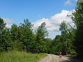
Vermont Route 58 through Hazen's Notch.
|
|
| Elevation | 546.4 m (1,793 ft) |
| Traversed by | |
| Location | Orleans County, Vermont, United States |
| Range | Green Mountains |
| Coordinates | 44°50.45′N 72°31.39′W / 44.84083°N 72.52317°W |
| Topo map | USGS Hazen's Notch |
Hazen's Notch is a mountain pass located in Westfield, Vermont. It sits in the northern part of the beautiful Green Mountains. This special place was named after Moses Hazen. He was a leader who started building a military road here in 1779.
Contents
The Story of Hazen's Notch
Who Was Moses Hazen?
Moses Hazen was a military leader during the American Revolutionary War. In 1779, he began building a very important road. This road was called the Bayley Hazen Military Road. It was meant to go from Newbury, Vermont, all the way to Saint-Jean-sur-Richelieu, Quebec. That's not far from Montreal, Canada!
A Road for War
The main goal of this road was to help American forces during the war. But the road building stopped when it reached Hazen's Notch. This means the road was never fully finished as planned. A stone tablet marks this spot today. It says "Terminus of the Hazen Road, 1779." The Orleans County Historical Society placed it there on August 21, 1903.
Exploring Hazen's Notch
Where is the Notch?
A "notch" is like a low spot or gap between mountains. Hazen's Notch is special because it's surrounded by tall cliffs. To the north, you'll see Sugarloaf Mountain. To the south, there's Haystack Mountain. The highest point of the pass is inside Hazen's Notch State Park. This park is in Orleans County.
Water Flowing Through
Water flows in two directions from Hazen's Notch. On the east side, water drains into the East Branch of the Missisquoi River. This river eventually flows into Lake Champlain. From there, it goes into Canada's Richelieu River, then the Saint Lawrence River, and finally into the Gulf of Saint Lawrence. To the west, water flows into Wade Brook. This brook joins the Trout River, which also flows into the Missisquoi River.
The Long Trail
The Long Trail is a very famous hiking path. It is 272 miles (438 km) long and runs the entire length of Vermont. This trail crosses right through Hazen's Notch. Hikers can find Haystack Mountain about 1.5 miles (2.5 km) south of the trail. Sugarloaf Mountain is immediately to the north.
Hazen's Notch Natural Area
The State of Vermont has set aside 273 acres of land here. This area is called the Hazen's Notch Natural Area. It helps protect the unique plants and animals that live there.
 | William M. Jackson |
 | Juan E. Gilbert |
 | Neil deGrasse Tyson |

