Heart Mountain (Alberta) facts for kids
Quick facts for kids Heart Mountain |
|
|---|---|

Heart Mountain
|
|
| Highest point | |
| Elevation | 2,135 m (7,005 ft) |
| Prominence | 78 m (256 ft) |
| Parent peak | Lung Peak |
| Listing | List of mountains of Alberta |
| Geography | |
| Parent range | Canadian Rockies |
| Topo map | NTS 82O3 Canmore |
| Climbing | |
| Easiest route | Scramble |
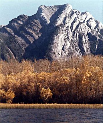
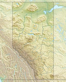
Heart Mountain is a cool mountain found in the Bow River valley. It's located in Alberta, Canada, close to a town called Exshaw. This mountain got its name in 1957 because of a special heart-shaped rock layer near its top.
Contents
Exploring Heart Mountain
Heart Mountain is part of the amazing Canadian Rockies. It stands tall at 2,135 meters (about 7,000 feet) above sea level. Even though it's not the tallest mountain, its unique shape and easy access make it a popular spot for people who love to explore.
How Heart Mountain Got Its Name
Have you ever wondered how mountains get their names? Heart Mountain has a fun story! In 1957, people noticed something special about it. Near the very top, there's a layer of light-colored limestone rock that looks just like a heart! That's why they decided to call it Heart Mountain. It's a natural landmark that truly stands out.
Climbing to the Top
If you enjoy outdoor adventures, you might like to climb Heart Mountain. The easiest way to reach the summit is by following a path called the northwest ridge. This path starts from the Heart Creek Trail. Climbing Heart Mountain is considered an "easy scramble." This means you'll mostly be walking, but there might be one part where you need to use your hands a little to climb over rocks.
Why Heart Mountain is Popular
Heart Mountain is a favorite among hikers and climbers. One reason is its location. It's in the "front ranges" of the Rockies, which means it's easier to get to. Plus, it's only about an hour's drive from Calgary, a big city in Alberta. Because it's so easy to reach, many visitors come to enjoy its trails all year round.
You can even do a full loop around the mountain! After reaching the top, you can follow the ridge line as it curves to the left. This path then goes down towards Quaite Creek, completing a fun circuit.
 | Georgia Louise Harris Brown |
 | Julian Abele |
 | Norma Merrick Sklarek |
 | William Sidney Pittman |


