Henry Fork (West Virginia) facts for kids
Quick facts for kids Henry Fork |
|
|---|---|
|
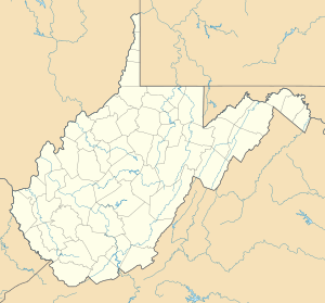
Location of the mouth of the Henry Fork in West Virginia
|
|
| Country | United States |
| State | West Virginia |
| Counties | Roane, Calhoun |
| Physical characteristics | |
| Main source | southeast of Tariff, southeastern Roane County 1,181 ft (360 m) 38°38′14″N 81°10′03″W / 38.6373168°N 81.1676141°W |
| River mouth | West Fork Little Kanawha River Boundary of Calhoun and Roane counties at Rocksdale 673 ft (205 m) 38°50′36″N 81°13′14″W / 38.8434204°N 81.2206722°W |
| Length | 21.8 mi (35.1 km) |
| Basin features | |
| Basin size | 91 sq mi (240 km2) |
| Tributaries |
|
The Henry Fork is a cool river in West Virginia, United States. It's about 21.8 miles (35.1 km) long. This river is a tributary, which means it's a smaller stream that flows into a bigger one. The Henry Fork flows into the West Fork Little Kanawha River.
The water from the Henry Fork eventually travels a long way! It joins the West Fork, then the Little Kanawha River, and then the mighty Ohio River. Finally, it becomes part of the huge Mississippi River system. This whole area that the river drains is called its watershed. The Henry Fork's watershed covers about 91 square miles (240 km2). It's located in a rural area of the Allegheny Plateau, a region that wasn't covered by glaciers a long time ago.
Exploring the Henry Fork River
The Henry Fork river starts in southeastern Roane County. Its source is southeast of a small community called Tariff. From there, the river generally flows north.
Journey Through Roane and Calhoun Counties
As the Henry Fork travels, it passes through Tariff and another community called Linden. A smaller stream, the Beech Fork, flows into the Henry Fork. After this point, the Henry Fork forms the border between Roane and Calhoun counties. It continues along this county line for the rest of its journey.
The river's path ends at a place called Rocksdale. Here, the Henry Fork flows into the West Fork Little Kanawha River from the south.
 | Emma Amos |
 | Edward Mitchell Bannister |
 | Larry D. Alexander |
 | Ernie Barnes |


