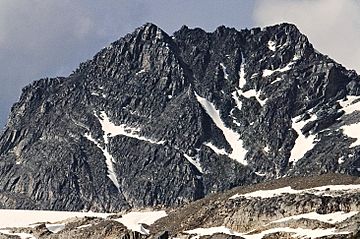
Hermit Mountain facts for kids
Quick facts for kids Hermit Mountain |
|
|---|---|

Hermit Mountain, south aspect
|
|
| Highest point | |
| Elevation | 3,050 m (10,010 ft) |
| Prominence | 180 m (590 ft) |
| Parent peak | Mount Rogers (3169 m) |
| Geography | |
| Location | Glacier National Park British Columbia, Canada |
| Parent range | Hermit Range Selkirk Mountains |
| Topo map | NTS 82N/5 |
| Climbing | |
| First ascent | 1904 Alex Gordon, Samuel Harper Gray, James Herdman, Edward Feuz, Edward Feuz Jr. |
| Easiest route | Scrambling South Couloir |
Hermit Mountain is a mountain peak that stands about 3,050 meters (10,000 feet) tall. It is located in Glacier National Park in British Columbia, Canada. This impressive mountain is part of the Hermit Range within the Selkirk Mountains.
You can find Hermit Mountain about 64 kilometers (40 miles) northeast of Revelstoke. It is also 39 kilometers (24 miles) west of Golden. The mountain is visible from the Trans-Canada Highway near Rogers Pass. The first people to climb Hermit Mountain reached its top on August 4, 1904. This group included Alex M. Gordon, Samuel Harper Gray, James C. Herdman, Edward Feuz, and Edward Feuz Jr. The mountain's name was officially recognized in 1904.
Mountain Weather
Hermit Mountain is in a subarctic climate zone. This means it has very cold and snowy winters. Summers are usually mild. Temperatures can drop below −20 °C (–4 °F). With the wind chill, it can feel even colder, sometimes below −30 °C (–22 °F).
This cold climate helps keep several glaciers on the mountain. The Tupper Glacier is on the south side, and the Hermit Glacier is on the north side. There is also another unnamed glacier on the east side. Water from melting snow and ice on these glaciers flows into streams. These streams then join the Beaver River.
Climbing Hermit Mountain
People have found several ways to climb Hermit Mountain. Climbing routes are like specific paths or trails that climbers follow to reach the top. Some of the known routes include:
- Southeast Couloir: This route was used for the first climb in 1904. It is rated as a class 4 climb, which means it is quite challenging.
- South Couloir: Also first climbed in 1904, this route is rated as class 3. It is a bit easier than the Southeast Couloir.
- West Ridge: This route was first climbed in 1920. It is considered a class 5 climb, which means it requires technical rock climbing skills.
- Rogers-Hermit Traverse: Climbers first completed this route in 1925. It is also a class 5 climb.
- Southeast Ridge: This route was first climbed in 1936 and is rated as a class 4 climb.
 | James B. Knighten |
 | Azellia White |
 | Willa Brown |


