History of Markham, Ontario facts for kids
The history of Markham, Ontario goes back thousands of years! Long before European settlers arrived, the land that is now Markham, Ontario, was home to Indigenous peoples. They lived here in different seasons between 900 BC and 1650. Their old homes were covered up before the land was used for farming.
Contents
Markham's Early Days: The 1700s
The western part of what is now Markham was bought in 1787. This was part of a deal called the Toronto Purchase. The eastern parts were acquired in 1788 through another agreement. This covered most of Markham, as well as nearby Stouffville and Scarborough.
In 1791, two new areas were created: Upper Canada and Lower Canada. Colonel John Graves Simcoe became the first leader, or Lieutenant-Governor, of Upper Canada. Simcoe named the township of Markham after his friend, William Markham, who was an important church leader. Markham was located north of the town of York (which is now Toronto).
Markham Township was first mapped out in 1793–94. Then, in 1801, it was divided into 10 main roads running north and south. There were also six side roads running east and west. Many of these roads in Markham are still used today! The boundaries of Markham were set as:
- NORTH: Whitchurch Town Line (between 19th Avenue and Stouffville Side Road)
- SOUTH: Scarborough Town Line (Steeles Avenue)
- EAST: Pickering Town Line
- WEST: Vaughan Town Line (Yonge Street)
In 1794, a man named William Berczy brought 64 German families from New York State to Markham Township. This area is known as German Mills today. Each family was given 200 acres of land. But life was very hard, and many families went back to York and Niagara. The area became almost empty. In 1797, some rich families from France came to Canada to get free land. They were not ready for the tough life here, so most of them went back home.
Markham's Growth: The 1800s
From 1803 to 1812, the biggest group of new settlers were Pennsylvania Germans, many of whom were Mennonites. These people were skilled workers and smart farmers. They had the best chance to survive because they had already lived through tough times in Pennsylvania. Before 1825, the community was called Reesorville. In 1805, the details of the Toronto Purchase land deal were made clearer. After 1830, many people from Ireland, Scotland, and England moved to Upper Canada. They were trying to escape hunger and crowded conditions in their home countries.
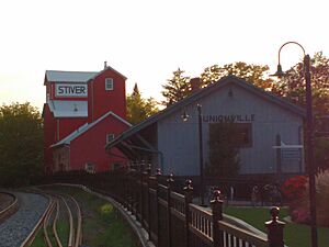
Markham's early years were a mix of hard work on farms and building new businesses. The many rivers and streams in the Township soon powered sawmills and grist mills (for grinding grain). Later, wool mills were built. As transportation improved, like Yonge Street, and more people moved in, the area became more like a town. By 1850, the Township of Markham was officially created. By 1857, most of the trees had been cleared, and the land was being farmed. Villages like Thornhill, Unionville, and Markham grew a lot. New businesses started, making wagons, leather goods, farm tools, and furniture.
In 1871, the Toronto and Nipissing Railway Company opened its train line. It had stations in Unionville and Markham. At first, the railway brought new wealth and fast growth to the area. Farmers and mill owners could easily send their products to Toronto. Other businesses also found it easier to get supplies, and business was great!
The first organized local government started in 1850 when the Township of Markham was created. On November 20, 1872, the leader of York County signed a law. This law allowed for the election of a Council for the Village of Markham. The Village of Markham grew to have 1,100 people by 1891.
Markham in the 1900s
Better ways to communicate with Toronto, like the railway, telegraph, telephone, and cars, eventually caused problems for the villages in Markham. Local businesses just couldn't compete with the bigger factories and suppliers in Toronto. Markham soon became a quiet, rural community again.
Markham's Growth After World War II

After World War II, Markham began to change very quickly. It was no longer a place where most people worked only within the area. It became a fast-growing suburb. Most residents now traveled to Toronto for work. Because of this, the rural (countryside) parts of Markham disappeared as the urban (city) areas grew hugely.
By 1969, the Township of Markham included several villages. These were Markham, Unionville, and parts of Thornhill. In 1971, the Regional Municipality of York was created by the government of Ontario. Some northern parts of Markham Township were added to the towns of Richmond Hill and Whitchurch-Stouffville. The rest of Markham Township became the Town of Markham, and its current boundaries were set.
Markham's borders changed after York County was reorganized into York Region. Today, Markham's boundaries start at the southeast corner. The border goes north along the York-Durham Line. Then it goes west until it reaches Highway 404. From there, it goes south until it meets Regional Road Seven (which used to be King's Highway 7). From this point, it goes west along Langstaff Road until Yonge Street. Then it travels south until Steeles Avenue East. The southern border runs along the middle of Steeles Avenue East until it reaches the city's southeast corner at the York-Durham Line. All the borders are straight lines, forming a shape like two connected parallelograms.
In 1976, Markham had about 56,000 people. Since then, the population has grown more than four times! A huge increase in new neighborhoods has caused the population to jump since the 1980s. Much of Markham's farmland has disappeared. Now, you find farms mostly north of 16th Avenue. Environmental concerns and worries about the future of the Oak Ridges Moraine will affect how much more Markham can grow in the north.
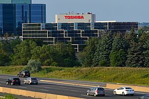
Today, Markham has several different communities. These include Markham Village, Cornell, Unionville, Wismer Commons, Milliken, and Thornhill. Since the 1980s, Markham has been known as a suburb of Toronto. However, it also has its own economy. Many high-tech companies have moved to Markham. They like the available land, lower taxes, and good transportation routes. Advanced Micro Devices Canada, IBM Canada, Motorola Canada, and many other well-known companies have chosen Markham as their Canadian home. Because of this, the town called itself Canada's "High-Tech Capital." With more diverse growth, the Town of Markham became the City of Markham. Now, it calls itself the "Diversity Capital of Canada."
Markham in the 2000s
In 2012, the Markham Town Council voted to change Markham's status from a town to a city.
See also


