Honey Branch facts for kids
Quick facts for kids Honey Branch |
|
|---|---|

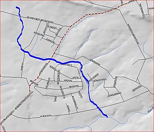
Map of Honey Branch
|
|
| Country | United States |
| Physical characteristics | |
| Main source | 40°22′15″N 74°46′6″W / 40.37083°N 74.76833°W |
| River mouth | 112 ft (34 m) 40°20′17″N 74°44′29″W / 40.33806°N 74.74139°W |
| Basin features | |
| Progression | Stony Brook (Millstone River), Millstone River, Raritan River, Atlantic Ocean |
| River system | Raritan River system |
Honey Branch is a small stream, also called a tributary, located in Mercer County, New Jersey, in the United States. It flows into a larger stream called the Stony Brook.
Contents
The Journey of Honey Branch
Honey Branch begins its journey at a specific spot: 40°22′15″N 74°46′6″W / 40.37083°N 74.76833°W. From there, it flows towards the southeast. Along its path, it crosses a road known as Moores Mill Mt. Rose Road.
Turning East and Joining Other Waters
After crossing the first road, Honey Branch makes a turn and starts flowing east. It then crosses another road, Pennington-Rocky Hill Road. As it continues, several smaller streams, called tributaries, join Honey Branch, adding to its flow.
Reaching the Stony Brook
All these waters eventually drain into an area known as the Stony Brook Fourteen Basin. After leaving the basin, Honey Branch crosses Elm Ridge Road. Finally, it flows into the Stony Brook at 40°20′17″N 74°44′29″W / 40.33806°N 74.74139°W. This meeting point is close to a place called Rosedale Park.
Other Streams in the Area
Honey Branch is one of several streams that flow into the Stony Brook. Some of these other streams include:
 | Percy Lavon Julian |
 | Katherine Johnson |
 | George Washington Carver |
 | Annie Easley |

