Honiton, South Australia facts for kids
Quick facts for kids HonitonSouth Australia |
|||||||||||||||
|---|---|---|---|---|---|---|---|---|---|---|---|---|---|---|---|
| Established | 1999 | ||||||||||||||
| Postcode(s) | 5576 | ||||||||||||||
| Time zone | ACST (UTC+9:30) | ||||||||||||||
| • Summer (DST) | ACST (UTC+10:30) | ||||||||||||||
| Location |
|
||||||||||||||
| LGA(s) | Yorke Peninsula Council | ||||||||||||||
| Region | Yorke and Mid North | ||||||||||||||
| County | Fergusson | ||||||||||||||
| State electorate(s) | Narungga | ||||||||||||||
| Federal Division(s) | Grey | ||||||||||||||
|
|||||||||||||||
|
|||||||||||||||
| Footnotes | Distances Coordinates Climate Adjoining localities |
||||||||||||||
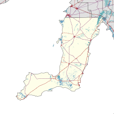
Honiton is a small place, also known as a locality, in the Australian state of South Australia. It is located on the southern coast of the Yorke Peninsula. This area is right next to the Investigator Strait.
Honiton is about 89 kilometers (55 miles) west of Adelaide, which is the capital city of South Australia. It is also only about 5 kilometers (3 miles) west of the town center of Edithburgh.
Discover Honiton's History
The boundaries for Honiton were officially set in May 1999. The name "Honiton" comes from an older government town. This original town was created on April 27, 1876.
However, the old town of Honiton stopped existing on September 26, 1982. The area where that old town once stood is now part of the current locality. The name "Honiton" itself comes from a town in Devonshire, England.
Early Days and Farming
Before Honiton was officially named, this coastal area was known as Troubridge in 1871. This was when land was first made available for farming. The town of Honiton was then surveyed in August 1874.
Honiton's coastline includes important natural features. These include Troubridge Hill and Troubridge Point. These points are along the Investigator Strait.
A Look at Honiton's Old School
The original government town of Honiton was located in a specific land area called section 376. This section was part of the Hundred of Melville. A surveyor named James W. Jones divided this land in 1874.
A school opened in Honiton in 1874. It was first called "Diamond Lake." This was an informal name for part of the area. The school's name changed to "Honiton" in 1891. It remained open until 1942.
Honiton's Heritage Sites
Honiton is home to two special places listed on the South Australian Heritage Register. These sites are protected because they are important to history.
One site is the Lake Fowler Salt Works on Lake Fowler Road. The other is a long section of dry stone walling. This wall is located near New Honiton Road and Goldsmith Beach Road.
What People Do in Honiton
As of 2014, most of the land in Honiton is used for "primary production." This means people mostly work in industries that get raw materials from nature.
This includes things like farming, fishing, or mining. In Honiton, it mainly refers to farming activities.
Honiton's Government Connections
Honiton is part of several government areas. These areas help manage local and national services.
- Federal Government: Honiton is in the federal division of Grey. This is how people vote for their representative in the national parliament. The current federal representative is Rowan Ramsey, who is a member of the Liberal Party.
- State Government: For state matters, Honiton is in the electoral district of Narungga. This is how people vote for their representative in the state parliament.
- Local Government: Honiton is also part of the Yorke Peninsula Council. This local council manages services like roads and waste collection for the community.
 | Calvin Brent |
 | Walter T. Bailey |
 | Martha Cassell Thompson |
 | Alberta Jeannette Cassell |


