Hoodoo Peak facts for kids
Quick facts for kids Hoodoo Peak |
|
|---|---|

Hoodoo Peak
|
|
| Highest point | |
| Elevation | 8,464 ft (2,580 m) |
| Prominence | 424 ft (129 m) |
| Isolation | 0.93 mi (1.50 km) |
| Geography | |
| Location | Okanogan County, Washington, U.S. |
| Parent range | North Cascades |
| Topo map | USGS Hoodoo Peak |
| Climbing | |
| Easiest route | Scrambling |
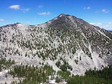
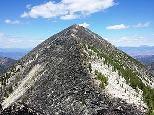
Hoodoo Peak is a tall mountain in Washington state. It stands 8,464-foot (2,580-metre) high. This peak is part of the Methow Mountains, which are a smaller group within the North Cascades.
The mountain is a protected area. It is found inside the Lake Chelan-Sawtooth Wilderness. This wilderness area is part of the Okanogan National Forest. The closest higher peak is Raven Ridge, about 0.93 miles (1.50 km) to the south. Water from the west side of Hoodoo Peak flows into Buttermilk Creek. Water from the east side goes into Libby Creek.
Understanding Hoodoo Peak's Climate
Hoodoo Peak is located east of the Cascade Range. This means the weather here is a bit drier than places to the west.
Summers can be warm, and sometimes there are thunderstorms. Because Hoodoo Peak is so high, it can have snow on its slopes. Snow might be present in late spring and early fall. Winters on the mountain are usually very cold.
How Hoodoo Peak's Geology Formed
The North Cascades area has very rugged land. You can see sharp peaks, long ridges, and deep valleys carved by glaciers. These different shapes were created by geological events that happened millions of years ago. These events also caused big changes in height across the Cascade Range. This led to different climates and types of plants in various areas.
The Cascade Mountains started forming a very long time ago. This was during the late Eocene Epoch. The North American Plate was slowly moving over the Pacific Plate. This movement caused many volcanoes to erupt. Also, small pieces of land called terranes joined together. These pieces formed the North Cascades about 50 million years ago.
Later, during the Pleistocene period, huge sheets of ice called glaciers moved across the land. This happened more than two million years ago. As the glaciers moved, they scraped the land. They left behind piles of rock and debris. The "U"-shaped valleys you see today were carved by these glaciers. The land also pushed up (called uplift) and cracked (called faulting). These processes, along with glaciation, created the tall peaks and deep valleys of the North Cascades.
 | Georgia Louise Harris Brown |
 | Julian Abele |
 | Norma Merrick Sklarek |
 | William Sidney Pittman |


