
Piercefield, New York facts for kids
Quick facts for kids
Piercefield, New York
|
|
|---|---|
.jpg)
Lakeside view in Piercefield
|
|

Map highlighting Piercefield's location within St. Lawrence County.
|
|

Piercefield, New York
Location in New York Adirondack Park
|
|
| Country | United States |
| State | New York |
| County | St. Lawrence |
| Area | |
| • Total | 111.06 sq mi (287.66 km2) |
| • Land | 104.16 sq mi (269.76 km2) |
| • Water | 6.91 sq mi (17.90 km2) |
| Elevation | 1,640 ft (500 m) |
| Population
(2020)
|
|
| • Total | 282 |
| • Density | 2.84/sq mi (1.10/km2) |
| Time zone | UTC-5 (Eastern (EST)) |
| • Summer (DST) | UTC-4 (EDT) |
| FIPS code | 36-57716 |
| GNIS feature ID | 0979364 |
Piercefield is a small town located in St. Lawrence County, New York, United States. In 2020, about 282 people lived there. The town is in the southeastern part of St. Lawrence County, southeast of a village called Canton.
Contents
Exploring Piercefield's Past
The area that is now Piercefield was first settled in the early 1800s. The town itself was officially formed in 1900. It was created from a part of a nearby town called Hopkinton.
A big paper factory, owned by International Paper, used to be a major employer in Piercefield. However, when this factory closed in 1933, it caused a difficult time for the town's economy.
One famous person who lived in the area was Abbot Augustus Low. He lived in a place known as Horseshoe within Piercefield.
Two important historical sites in Piercefield are the Arab Mountain Fire Observation Station and the Childwold Memorial Presbyterian Church. These places are listed on the National Register of Historic Places, which means they are recognized for their historical importance.
Piercefield's Natural Landscape
Piercefield covers a total area of about 111 square miles (288 square kilometers). Most of this area, about 104 square miles (270 square kilometers), is land, while the rest is water.
The eastern edge of Piercefield borders Franklin County. The southern edge borders Hamilton County.
The entire town of Piercefield is located inside the Adirondack Park. This is a very large protected area known for its beautiful mountains, forests, and lakes.
The Raquette River flows right through the town. Also, a part of Tupper Lake, a well-known lake, is found within Piercefield.
Mount Matumbla: The Highest Point
At 2,688 feet (819 meters) above sea level, Mount Matumbla is the highest point in all of St. Lawrence County. This mountain is located northeast of the small community of Piercefield. The name "Matumbla" might come from an old Native American name. It could also be an English version of "Montagne Bleue," which means "Blue Mountain" in French, given by early French settlers.
Roads in Piercefield
New York State Route 3 is a main highway that connects the northern and southern parts of Piercefield. Another shorter highway, New York State Route 421, is located in the southeastern part of the town.
Who Lives in Piercefield?
The population of Piercefield has changed over the years. Here's how it has grown and shrunk:
| Historical population | |||
|---|---|---|---|
| Census | Pop. | %± | |
| 1910 | 770 | — | |
| 1920 | 1,454 | 88.8% | |
| 1930 | 1,330 | −8.5% | |
| 1940 | 667 | −49.8% | |
| 1950 | 554 | −16.9% | |
| 1960 | 420 | −24.2% | |
| 1970 | 422 | 0.5% | |
| 1980 | 365 | −13.5% | |
| 1990 | 285 | −21.9% | |
| 2000 | 305 | 7.0% | |
| 2010 | 310 | 1.6% | |
| 2020 | 282 | −9.0% | |
According to the 2000 census, there were 305 people living in Piercefield. About 22% of the households had children under 18. Most households (about 56%) were married couples living together.
The median age of people in Piercefield was 46 years old in 2000. This means half the people were younger than 46 and half were older. About 20% of the population was under 18 years old.
Communities and Places in Piercefield
Piercefield has several small communities and interesting natural spots:
- Bridge Brook Pond – A lake located southeast of the hamlet of Mount Arab.
- Catamount Pond – A lake next to the community of Gale.
- Childwold – A small community (called a hamlet) found northwest of Piercefield village on NY-3. It's near the western border of the town.
- Childwood Station – A place located south of Piercefield village.
- Conifer – A hamlet southwest of Piercefield village.
- Eagle Crag Lake – A small lake west of the Mount Arab community.
- Gale – A hamlet on NY-3, northwest of Piercefield village.
- Horseshoe – A hamlet in the southwestern part of the town, southwest of Mount Arab.
- Horseshoe Lake – A lake located east of the hamlet of Horseshoe.
- Horseshoe Pond – A pond located east of Massawepie Lake.
- Little Trout Pond – A pond partly located in the southwestern corner of the town. The other part is in the town of Colton.
- Long Pond – A pond located east of Massawepie Lake.
- Massawepie Lake – A lake located southeast of Gale.
- Mount Arab – (1) A hamlet in the southern part of the town, south of Conifer. (2) Also, a mountain south of Piercefield village, popular for hiking.
- Mount Arab Lake – A small lake northwest of the Mount Arab community.
- Mount Arab Station – A location north of Mount Arab.
- Piercefield – This is the main community or hamlet of Piercefield. It's on NY-3, by the Raquette River and Piercefield Flow, near the center of the town.
- Piercefield Flow – A lake that formed in a wide section of the Raquette River.
- Trout Pond – A lake near the southern town line. It is also partly in the town of Colton.
Images for kids
-
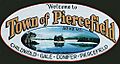
Town of Piercefield sign

See also
 In Spanish: Piercefield para niños
