Horton River (Canada) facts for kids
Quick facts for kids Horton River |
|
|---|---|

Horton River
|
|
|
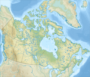
Horton River mouth location
|
|
| Country | Canada |
| Territories | Northwest Territories, Nunavut |
| Region | Inuvik, Sahtu, Kitikmeot |
| Physical characteristics | |
| Main source | Lake Kitikmeot Region, Nunavut 584 m (1,916 ft) 67°50′38″N 120°45′02″W / 67.84389°N 120.75056°W |
| River mouth | Franklin Bay Inuvik Region, Northwest Territories 0 m (0 ft) 69°56′01″N 126°48′10″W / 69.93361°N 126.80278°W |
| Length | 618 km (384 mi) |
| Basin features | |
| River system | Arctic Ocean drainage basin |
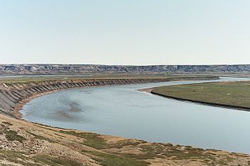
The Horton River is a long river in northern Canada. It flows through the Northwest Territories and a small part of Nunavut. This river eventually empties into the Beaufort Sea, which is part of the huge Arctic Ocean. The Horton River is about 618 kilometers (384 miles) long.
The River's Journey
The Horton River starts from a small lake in the Kitikmeot Region of Nunavut. This lake is about 100 kilometers (62 miles) north of Great Bear Lake.
As the river flows, it passes through an interesting area called the Smoking Hills. These hills get their name because they naturally release smoke from burning coal seams.
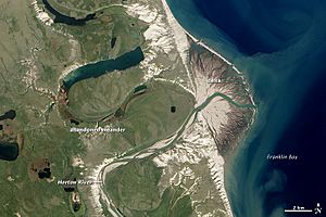
The river finally reaches its end at Franklin Bay, which is part of the Amundsen Gulf in the Beaufort Sea. Here, it forms a small delta. This delta is about 125 kilometers (78 miles) northwest of the community of Paulatuk.
Interestingly, the river's mouth used to be about 100 kilometers (62 miles) further north. But around the year 1800, the river changed its path. A meander (a bend in the river) eroded through, creating a new, shorter route to the sea.
There is also a small airstrip located just north of where the river meets the sea.
Horton River Radar Site
Near the mouth of the Horton River, there is a special radar site. It is located about 8.5 kilometers (5.3 miles) north-northwest of the river's end. This site is also known as Malloch Hills.
This location was first opened in 1957 as part of the Distant Early Warning Line (DEW Line). The DEW Line was a system of radar stations built across northern Canada and Alaska during the Cold War. Its purpose was to detect if any aircraft were flying over the Arctic towards North America. The Horton River site closed in 1963.
However, the site was reopened in 1991. It became part of the North Warning System. This is a modern radar system that continues to monitor the skies in the Arctic region.
 | Toni Morrison |
 | Barack Obama |
 | Martin Luther King Jr. |
 | Ralph Bunche |


