Hoste Island facts for kids
|
Native name:
Isla Hoste
|
|
|---|---|

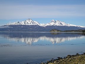
A view across the Beagle Channel to Isla Hoste from Isla Grande de Tierra del Fuego
|
|
|
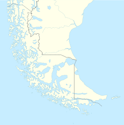
Hoste Island at the end of Tierra del Fuego
|
|
| Geography | |
| Coordinates | 55°15′S 69°0′W / 55.250°S 69.000°W |
| Archipelago | Tierra del Fuego |
| Area | 4,117 km2 (1,590 sq mi) |
| Highest elevation | 1,402 m (4,600 ft) |
| Highest point | Hoste High Point |
| Administration | |
| Region | Magallanes Region |
| Province | Antártica Chilena Province |
| Commune | Cabo de Hornos |
| Demographics | |
| Population | virtually uninhabited |
| Additional information | |
| NGA UFI -884382 | |
Hoste Island (in Spanish, Isla Hoste) is one of the most southern islands in Chile. It lies south of Isla Grande de Tierra del Fuego, across the Beagle Channel. To its west is Navarino Island, separated by the Murray Channel. Hoste Island is special because it has the southernmost trees on Earth. These trees are called Nothofagus antarctica. The famous writer Jules Verne even wrote about an imaginary republic on the island in his book Magellania.
Contents
Geography of Hoste Island
Hoste Island is very large, covering about 4,117 square kilometers (1,590 square miles). This makes it the second biggest island in the Tierra del Fuego archipelago. Only Isla Grande de Tierra del Fuego is larger. A big part of the western side of Hoste Island is part of the Alberto de Agostini National Park. This park helps protect the island's unique nature.
Peninsulas of Hoste Island
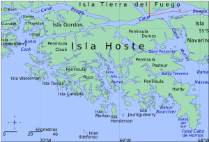
Hoste Island has five main land areas that stick out into the sea. These are called peninsulas:
- Hardy Peninsula
- Cloué Peninsula
- Rous Peninsula
- Pasteur Peninsula
- Dumas Peninsula
Hardy Peninsula and False Cape Horn
The Hardy Peninsula is located at one of the most southern points of South America. It reaches out into the Drake Passage, forming a bay called Bahía Nassau. At the very tip of this peninsula is a place known as False Cape Horn (Falso Cabo de Hornos in Spanish). It's named "False" because it's close to the real Cape Horn, but not quite it.
History of Hoste Island
Hoste Island has an interesting past, from early explorations to its role in important events.
French Scientific Exploration
The island was first explored by a French scientific team in 1881–1882. This team was part of an expedition called La Romanche. The island was named after William Hoste, who was a close friend and protégé of the famous British admiral Lord Nelson.
Tekenika Bay Settlement
Around 1894, a special house called the Stirling House was moved to Tekenika Bay on Hoste Island. This house was a pre-built house made for the South American Mission Society. It was moved to protect the Yaghan (an native group) from problems in Ushuaia, like new miners and diseases. Later, this house was moved again to Puerto Williams and became a national monument.
Life on the Island for the Yaghan People
The Chilean government tried to raise cattle on Hoste Island, but it didn't work out. For a long time into the 20th century, a few Yaghan families lived on the island. Sadly, these native people eventually disappeared after meeting adventurers and fishermen. Since then, Hoste Island has been mostly empty. A 1992 count showed only six people living in three houses in the area. However, some of these people might have lived on smaller islands nearby.
Operation Soberania
In December 1978, Hoste Island played a part in a historical event. It was used as a base for Chilean warships during something called Operation Soberania. This was a time of tension between Chile and Argentina over land claims.
See also
 In Spanish: Isla Hoste para niños
- Isla Navarino
- List of islands of Chile
 | Isaac Myers |
 | D. Hamilton Jackson |
 | A. Philip Randolph |


