
Housatonic, Massachusetts facts for kids
Quick facts for kids
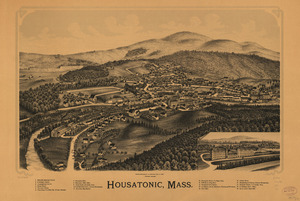
Housatonic, Massachusetts
|
|
|---|---|

Railroad tracks along the Housatonic River at Housatonic
|
|

Location in Berkshire County and the state of Massachusetts.
|
|
| Country | United States |
| State | Massachusetts |
| County | Berkshire |
| Town | Great Barrington |
| Area | |
| • Total | 0.98 sq mi (2.53 km2) |
| • Land | 0.89 sq mi (2.31 km2) |
| • Water | 0.09 sq mi (0.22 km2) |
| Elevation | 735 ft (224 m) |
| Population
(2020)
|
|
| • Total | 1,083 |
| • Density | 1,215.49/sq mi (469.17/km2) |
| Time zone | UTC-5 (Eastern (EST)) |
| • Summer (DST) | UTC-4 (EDT) |
| ZIP code |
01236
|
| Area code(s) | 413 |
| FIPS code | 25-31295 |
| GNIS feature ID | 0607478 |
Housatonic is a small community in Massachusetts, United States. It's known as a census-designated place (CDP), which means it's a special area defined for gathering population information. Housatonic is part of the larger town of Great Barrington in Berkshire County. The community gets its name from the nearby Housatonic River. In 2020, about 1,083 people lived here.
History of Housatonic
Housatonic started as a village in the early 1800s. It grew around factories that made textiles (like cloth) and paper. The biggest factory was Monument Mills, which made textiles. It was very large and employed about 500 people. Many of these workers were immigrants, and they lived in special apartment buildings called tenements.
Monument Mills closed in 1956. After this, the village became quieter for a while. But now, Housatonic is becoming lively again! Many art galleries and related businesses have opened, bringing new energy to the area. The town's public library, Ramsdell Public Library, is also located in Housatonic. Two important historical places, Monument Mills and Rising Paper Mill, are listed on the National Register of Historic Places. This means they are recognized for their historical importance.
Geography of Housatonic
Housatonic is located in the northern part of Great Barrington. It sits at coordinates 42.252122 degrees North and 73.367537 degrees West. To its north are the towns of Stockbridge and West Stockbridge.
The Housatonic River flows right through the middle of the community. Massachusetts Route 183 is a main road that goes through Housatonic. It follows the river's east bank, then crosses the river in the center of town, and continues north on the west bank.
The U.S. Census Bureau says that Housatonic covers a total area of about 0.98 square miles (2.5 square kilometers). Most of this area, about 0.89 square miles (2.3 square kilometers), is land. The rest, about 0.09 square miles (0.2 square kilometers), is water.
Population and People
| Historical population | |||
|---|---|---|---|
| Census | Pop. | %± | |
| 2020 | 1,083 | — | |
| U.S. Decennial Census | |||
In 2000, there were 1,335 people living in Housatonic. Most of the people were White (96.48%). There were also smaller numbers of African American, Asian, and Pacific Islander residents. About 1.35% of the population was Hispanic or Latino.
The average household in Housatonic had about 2.46 people. About 31.7% of households had children under 18 living with them. The community's population included people of all ages, with about 25.1% being under 18 years old and 16.0% being 65 years or older. The average age of people in Housatonic was 39 years.
See also
 In Spanish: Housatonic (Massachusetts) para niños
