Humarock facts for kids
Humarock is a charming seaside village located in Scituate, Massachusetts, in the United States. People sometimes call it Humarock Beach or Humarock Island. This pretty area is surrounded by water and sits right on Cape Cod Bay. It's about halfway between the big cities of Boston and Plymouth.
Humarock became separated from the main part of Scituate during a huge storm called the Portland Gale in 1898. This storm changed where the North River flowed into the ocean. Today, you can only get to Humarock from Scituate by boat. If you're coming by land, you have to cross a bridge from the nearby town of Marshfield.
Contents
What is Humarock? A Peninsula!

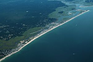
Many people think Humarock is an island because you need a boat or a bridge to get there. It feels like an island because bridges cross the South River to reach it. However, if you look at maps or pictures from above, you'll see that Humarock is actually a very long, thin piece of land called a peninsula. A peninsula is land that is almost completely surrounded by water but is still connected to the mainland on one side.
You could technically walk to Humarock from the mainland by going through a large sand dune or across Rexhame Beach. But for cars and easy access, the bridges from Marshfield are the way to go!
How Humarock Became Separate
The coast of Scituate has four main bluffs, which are like tall, steep hills along the shore. These bluffs are named First Cliff, Second Cliff, Third Cliff, and Fourth Cliff. Before the big storm in 1898, Humarock was connected to the rest of Scituate at Third Cliff.
Back then, the North River flowed south between Fourth Cliff and Marshfield. It then joined the South River and entered Massachusetts Bay about two kilometers (or about 1.2 miles) south of where it enters the ocean now.
The Great Storm of 1898
A thin strip of beach connected Third Cliff to Fourth Cliff. But during the Portland Gale of 1898, a huge storm surge broke through this narrow strip of land. This event completely separated Humarock from the main part of Scituate.
Over time, the old river entrance filled up with sand and mud. This forced the South River to find a new path. Now, it flows north between Marshfield and Fourth Cliff, where it joins the North River before flowing into the ocean.
Even though Humarock is now connected by land to the Rexhame area of Marshfield, there are no roads across the old river path. So, to get to Fourth Cliff and the rest of Humarock from Scituate, you still have to use the Marshfield Avenue and Julian Street bridges that come from Marshfield.
The change in the North River's path also made the large marsh area around the new river mouth saltier. This was a big deal because it meant people could no longer harvest valuable "salt hay" from the marsh, which was an important business.
The Name: Humarock
You might hear that the name "Humarock" comes from the Wampanoag language, meaning something like "seashell place" or "rock carving." However, this idea mostly comes from a writer named Edward Rowe Snow, who was known more for his exciting stories than for always being historically accurate.
Another common idea is that "Humarock" comes from "Humming Rocks," referring to the sound of the crashing waves. This sounds possible, but historical records suggest a different origin.
From "Hummock" to Humarock
The name likely comes from the word "hummock," which means a small hill near a marsh. As far back as 1732, town records mentioned the Fourth Cliff area as "Humock Flatt" or "Hummock Flats." In 1847, a shipwreck near this spot was noted as being off "Hummock Beach." The Scituate town map from 1879 even labels the peninsula south of Fourth Cliff as "Shore Hummock."
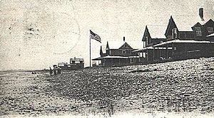
The shoreline of Humarock is famous for its countless smooth, flat rocks, about the size of a fist. There were even more of these rocks before the big Blizzard of '78. So, it seems the name "Hummock Rock-beach" slowly changed into "Humarock Beach" and finally just "Humarock."
 | Calvin Brent |
 | Walter T. Bailey |
 | Martha Cassell Thompson |
 | Alberta Jeannette Cassell |


