
Image: Livingston-Island-Map-2010-15
Size of this preview: 799 × 600 pixels. Other resolutions: 320 × 240 pixels | 5,337 × 4,006 pixels.
Original image (5,337 × 4,006 pixels, file size: 10.92 MB, MIME type: image/png)
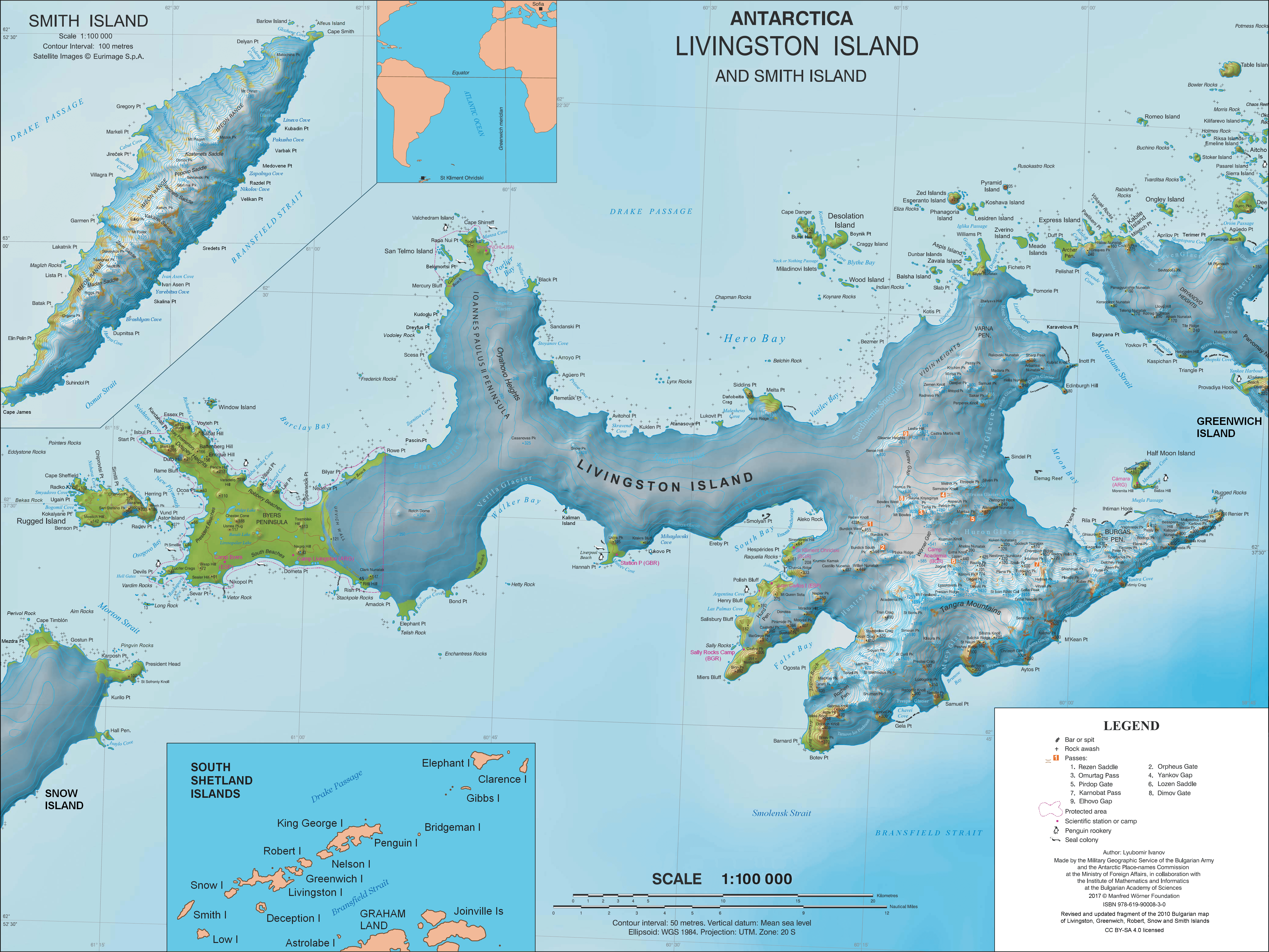
Description: L.L. Ivanov. Antarctica: Livingston Island and Smith Island. Scale 1:100000 topographic map. Manfred Wörner Foundation, 2017. ISBN 978-619-90008-3-0
Title: Livingston-Island-Map-2010-15
Credit: Own work
Author: Apcbg
Permission: Published by the Manfred Wörner Foundation under the Creative Commons Attribution ShareAlike 4.0 license.
Usage Terms: Creative Commons Attribution-Share Alike 4.0
License: CC BY-SA 4.0
License Link: http://creativecommons.org/licenses/by-sa/4.0
Attribution Required?: Yes
Image usage
The following 16 pages link to this image:
- Aspis Island
- Desolation Island (South Shetland Islands)
- Elemag Reef
- Half Moon Island
- Juan Carlos I Antarctic Base
- Kaliman Island
- Koshava Island
- Livingston Island
- Rezovski Creek
- Rugged Island (South Shetland Islands)
- San Telmo Island
- Telish Rock
- Toledo Island
- Window Island
- Zavala Island
- Zverino Island

All content from Kiddle encyclopedia articles (including the article images and facts) can be freely used under Attribution-ShareAlike license, unless stated otherwise.