
Image: Oregoncountry2
Size of this preview: 588 × 599 pixels. Other resolutions: 235 × 240 pixels | 992 × 1,011 pixels.
Original image (992 × 1,011 pixels, file size: 1.04 MB, MIME type: image/png)
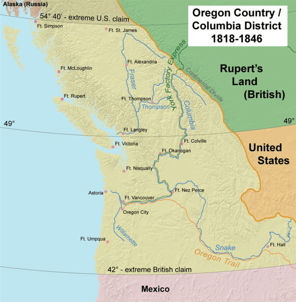
Description: This map shows Oregon Country, 1818–1846
Title: Oregoncountry2
Credit: Own work by the original uploader
Author: Kmusser
Usage Terms: Creative Commons Attribution-Share Alike 2.5
License: CC BY-SA 2.5
License Link: http://creativecommons.org/licenses/by-sa/2.5
Attribution Required?: Yes
Image usage
The following 18 pages link to this image:
- Canadian canoe routes
- Cascadia (independence movement)
- Cascadia movement
- Columbia District
- Continental Divide of the Americas
- Fort Vancouver
- Historic regions of the United States
- Historical regions of the United States
- History of British Columbia
- History of Canada
- History of U.S. foreign policy, 1829–1861
- James K. Polk
- James Sinclair (fur trader)
- Jason Lee (missionary)
- John Floyd (Virginia politician)
- Native American peoples of Oregon
- Oregon Country
- Rupert's Land

All content from Kiddle encyclopedia articles (including the article images and facts) can be freely used under Attribution-ShareAlike license, unless stated otherwise.