
Historic regions of the United States facts for kids
The United States has grown and changed a lot over time, from when it was just a few colonies to the big country it is today! This article will explore how the land of the U.S. has expanded through purchases, treaties, and even some areas that tried to become states but didn't. You'll see how different parts of the country joined the Union and how some areas got their unique names.


Contents
Colonial Era (Before 1776)
Before the United States became a country, different European nations claimed land here. The most famous were the British colonies, which eventually became the first states.


The Thirteen Colonies
These were the original British colonies that later declared independence and formed the United States:
- Connecticut Colony
- Delaware Colony
- Province of Georgia
- Province of Maryland
- Province of Massachusetts Bay
- Province of New Hampshire
- Province of New Jersey
- Province of New York
- Province of North Carolina
- Province of Pennsylvania
- Colony of Rhode Island and Providence Plantations
- Province of South Carolina
- Colony and Dominion of Virginia
Other Early Regions
Before the Revolutionary War, other areas were settled or claimed by different European powers.
- New Netherland: This was a Dutch colony that later became New York.
- New Sweden: A Swedish colony that was taken over by the Dutch.
- La Florida: This large area was claimed by Spain. It included places like St. Augustine, Florida.
- Illinois Country: This region was settled by the French. It covered parts of what are now Illinois, Missouri, Indiana, and Kentucky.
- La Louisiane: A huge French territory west of the Mississippi River. It included places like Arkansas Post and the German Coast.
- Las Californias: This vast area in the Far West was under Spanish rule.
Some colonies were started but didn't last, like the Lost Colony of Roanoke. Others were proposed but never actually created, such as the Vandalia Colony and Westsylvania.
New States and Territories
After the United States became independent, it continued to grow. This happened in several ways:
Independent Areas Joining the U.S.
Some areas were independent countries or republics before they joined the United States.
- Vermont Republic: This area was independent for 14 years before becoming a state in 1791.
- Republic of Texas: Texas was its own country for nearly 10 years. It joined the U.S. in 1845.
- Kingdom of Hawaii: Hawaii was a kingdom and then a republic. It became a U.S. territory in 1898 and a state in 1959.
Land Purchases from Other Countries
The U.S. bought huge amounts of land from other nations.


- Louisiana Purchase (1803): The U.S. bought this massive area from France for $15 million. It doubled the size of the country!
- Florida Purchase (1819): Spain sold Florida to the U.S. for $5 million.
- Gadsden Purchase (1853): The U.S. bought a small piece of land from Mexico for $10 million. This land is now part of Arizona and New Mexico.
- Alaska Purchase (1867): The U.S. bought Alaska from Russia for $7.2 million. Some people called it "Seward's Folly" because they thought it was a waste of money, but it turned out to be full of natural resources.
- Virgin Islands (1917): These islands were bought from Denmark for $25 million.
Land Gained from Treaties or Wars
The U.S. also gained land through treaties after conflicts or by settling border disputes.

- Mexican Cession (1848): After the Mexican-American War, Mexico gave up a huge amount of land to the U.S. This included California, Nevada, Utah, Arizona, and parts of New Mexico, Colorado, and Wyoming.
- Oregon Country (1846): The U.S. and Britain had shared this area. They finally agreed to split it, with the U.S. getting the southern part.
- Texas annexation (1846): The U.S. annexed Texas, which led to a dispute with Mexico.
- Republic of West Florida Annexation (1810): This area broke away from Spain and was quickly annexed by the U.S.
- Guam and Puerto Rico (1898): These islands were gained from Spain after the Spanish-American War.
- American Samoa (1899): Gained from Germany.
- The Philippine Islands (1898): Also gained from Spain, they later became independent in 1946.
- Some historic and current U.S. territories
-
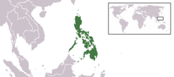
The Philippines was a commonwealth of the United States, 1935–1946
-
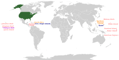
Worldwide location of current U.S. insular areas:
-
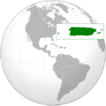
The Commonwealth of Puerto Rico


.png)
Native American Land Cessions
The U.S. also acquired land from Native American tribes through treaties and purchases.


- Indian Territory: This was land set aside for Native Americans, mostly in what is now Oklahoma. Over time, parts of it were opened for settlement.
- Black Hawk Purchase (1832): Land bought from Native Americans in what became Iowa.
- Jackson Purchase (1818): Land bought from the Chickasaw Nation in Tennessee and Kentucky.
State and Federal Land Changes
States also gave up land to the federal government or settled border disputes with each other.

- Washington, D.C.: Land given by Virginia and Maryland to create the nation's capital.
- District of Columbia retrocession: Some of the land given by Virginia was later returned to Virginia.
- Toledo Strip: A small piece of land that Ohio and Michigan both claimed. Ohio eventually got it.
- West Virginia: This state separated from Virginia during the Civil War and joined the Union.
Former U.S. Territories That Became States
Many parts of the U.S. were first organized as territories before becoming states.


Here are some examples of territories that became states:
- Northwest Territory (1787–1803): This large territory became Ohio and Indiana Territory.
- Mississippi Territory (1798–1817): Became Mississippi and Alabama Territory.
- Louisiana Territory (1805–1812): Later renamed Missouri Territory.
- Florida Territory (1822–1845): Became the state of Florida.
- Oregon Territory (1848–1859): Became the state of Oregon.
- New Mexico Territory (1850–1912): Became the state of New Mexico and Arizona Territory.
- Territory of Alaska (1912–1959): Became the state of Alaska.
Other Historical Regions
Throughout history, there have been other named areas, some official, some unofficial.
Internal Land Divisions
These are smaller areas within states or territories that had specific names or purposes.


- Ohio Country: A historical region in the Ohio Valley.
- Military Tract of 1812: Land given to soldiers after the War of 1812.
- Phelps and Gorham Purchase: A large land purchase in western New York.
- Firelands: Land in Ohio set aside for people whose homes were burned by the British during the Revolutionary War.

- Indian Land Grants: Areas set aside for Native American tribes.
- United States Military District: Land for military veterans.
Federal Military Districts
During certain times, like after the Civil War, the U.S. Army divided parts of the country into military districts to help manage them.

- Department of the Missouri: A large military area in the central U.S.
- Department of the Pacific: Covered the western U.S.
- Department of Alaska: Managed Alaska after its purchase.
- Department of the Gulf: A military area during the Civil War, covering states like Louisiana and Mississippi.
Areas Returned or Given Up
The U.S. has also given back or transferred some lands to other countries.

- Panama Canal Zone: This area around the Panama Canal was controlled by the U.S. until 1979, when it was given back to Panama.
- Chamizal, Texas: A small piece of land that was returned to Mexico in 1964 due to changes in the Rio Grande river.
- Commonwealth of the Philippines: Became an independent country in 1946.
U.S. Military Overseas Regions
After wars, the U.S. military sometimes governed other countries for a period.
- United States Military Government in Cuba (1898–1902): After the Spanish-American War.
- American Occupation Zone of Germany (1945–1949): After World War II.
- American occupation of Japan (1945–1952): After World War II.
- Trust Territory of the Pacific Islands: Islands in the Pacific managed by the U.S. after World War II.
Unofficial or Proposed Territories
Some areas had their own governments for a short time, or were proposed as states but never officially recognized.

- State of Deseret: Proposed by Mormon pioneers in the western U.S.
- State of Franklin: An area that tried to become a state in the late 1700s.
- Jefferson Territory: A proposed territory in the Rocky Mountains.
- Confederate States of America (CSA): The states that tried to separate from the U.S. during the Civil War.
- Free State of Jones: A small area in Mississippi that tried to stay loyal to the Union during the Civil War.
- State of Superior: A proposed state in the Upper Peninsula of Michigan.
- State of Sequoyah: A proposed state in what is now Oklahoma, named after the Cherokee leader.
Regional Nicknames
The U.S. has many informal regions known by popular nicknames, often based on geography, culture, or economy.

- Eastern United States: The states along the Atlantic Ocean.
- New England: States like Massachusetts and Maine.
- Mid-Atlantic States: States like New York and Pennsylvania.
- The South: States in the southeastern U.S.
- Deep South: The states most associated with the old South.
- Dixie: Another name for the Southern states.
- The Midwest: States in the central U.S.
- Great Plains: Flat, grassy areas in the Midwest.
- Dust Bowl: An area in the Great Plains that suffered from severe dust storms in the 1930s.
- The West: States in the western U.S.
- Mountain States: States with large mountain ranges like the Rockies.
- The Southwest: States like Arizona and New Mexico.
- Pacific Northwest: States like Washington and Oregon.
Belts
"Belts" are areas named for something they have in common, like their economy or climate.
- Bible Belt: A region in the South where Protestant Christianity is very strong.
- Black Belt: An area in the South named for its dark, fertile soil and historical demographics.
- Grain Belt or Corn Belt: Where a lot of corn and grain are grown.
- Rust Belt: An area in the Midwest and Northeast that used to have many factories, but now many are closed.
- Sun Belt: States in the South and West that have warm climates and have seen a lot of growth.
- Tornado Alley: An area in the central U.S. where tornadoes are common.
|
See also
 In Spanish: Anexo:Regiones históricas de Estados Unidos para niños
