Imperial, Missouri facts for kids
Quick facts for kids
Imperial, Missouri
|
|
|---|---|

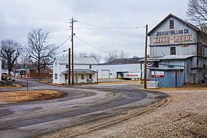
Road in Imperial, February 2018
|
|

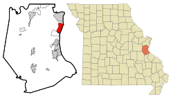
Location of Imperial, Missouri
|
|
| Country | United States |
| State | Missouri |
| County | Jefferson |
| Area | |
| • Total | 6.03 sq mi (15.62 km2) |
| • Land | 5.24 sq mi (13.58 km2) |
| • Water | 0.79 sq mi (2.04 km2) |
| Elevation | 394 ft (120 m) |
| Population
(2020)
|
|
| • Total | 4,407 |
| • Density | 840.71/sq mi (324.58/km2) |
| Time zone | UTC-6 (Central (CST)) |
| • Summer (DST) | UTC-5 (CDT) |
| ZIP code |
63052
|
| Area code(s) | 636 |
| FIPS code | 29-34354 |
| GNIS feature ID | 2393061 |
Imperial is a community in Jefferson County, Missouri, United States. It is a suburb of St. Louis. Imperial is known as a census-designated place (CDP). This means it is an area defined by the government for counting people, but it is not an officially incorporated city or town. In 2020, about 4,947 people lived here.
Long ago, Imperial was known as West Kimmswick. A historic Catholic church, St. John's, became its own parish in Imperial in 1869.
Contents
Imperial's Location and Surroundings
Imperial is in the northeastern part of Jefferson County. To the north, it borders Arnold. To the south, it borders Barnhart. The Mississippi River is to the east, which is also the border with Illinois. The community of Kimmswick is completely surrounded by Imperial.
Interstate 55 runs through Imperial. You can get on or off the highway at Exits 185 and 186. A cool place called Mastodon State Historic Site is also located in Imperial.
According to the United States Census Bureau, Imperial covers about 6.03 square miles (15.65 square kilometers). Most of this area is land, about 5.24 square miles (13.61 square kilometers). The rest, about 0.79 square miles (2.04 square kilometers), is water.
People Living in Imperial
| Historical population | |||
|---|---|---|---|
| Census | Pop. | %± | |
| 2020 | 4,947 | — | |
| U.S. Decennial Census | |||
The census helps us learn about the people living in a place.
Imperial's Population in 2010
In 2010, there were 4,709 people living in Imperial. These people lived in 1,769 homes, and 1,297 of these were families. The population density was about 895 people per square mile (345 people per square kilometer). There were 1,871 housing units in total.
Most of the people in Imperial were White (97.5%). A small number were African American (0.3%), Native American (0.3%), or Asian (1.1%). About 1.2% of the population was Hispanic or Latino.
- About 36.2% of homes had children under 18 living there.
- 58.0% of homes were married couples living together.
- 9.6% had a female head of the household with no husband.
- 5.7% had a male head of the household with no wife.
- 26.7% were not families.
- 21.3% of all homes had people living alone.
- 6.9% had someone living alone who was 65 years old or older.
The average home had 2.66 people. The average family had 3.08 people. The median age in Imperial was 38 years old.
- 24.8% of residents were under 18.
- 8.1% were between 18 and 24.
- 27.2% were between 25 and 44.
- 29.3% were between 45 and 64.
- 10.6% were 65 or older.
There were slightly more males (50.9%) than females (49.1%) in Imperial.
Schools in Imperial
Most of Imperial is part of the Windsor C-1 School District. A smaller part of Imperial and some nearby areas use the Fox C-6 School District.
The Windsor district has Windsor High School located right in Imperial. The Fox C-6 district operates Seckman High School, which is just outside of Imperial.
In the past, students in the Windsor district would go to high school in nearby towns like Crystal City High School or Herculaneum High School. The Fox district also used to be only for younger students. It became a K-12 district (meaning it included high school) when Fox High School opened in 1955.
See also
 In Spanish: Imperial (Misuri) para niños
 | Emma Amos |
 | Edward Mitchell Bannister |
 | Larry D. Alexander |
 | Ernie Barnes |

