Indian River (British Columbia) facts for kids
Quick facts for kids Indian River |
|
|---|---|
|
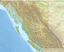
Location of the mouth of the river in British Columbia
|
|
| Country | Canada |
| Province | British Columbia |
| District | Greater Vancouver Regional District, Squamish-Lillooet Regional District |
| Physical characteristics | |
| Main source | Squamish-Lillooet Regional District 801 m (2,628 ft) 49°38′36″N 123°02′23″W / 49.64333°N 123.03972°W |
| River mouth | Indian Arm Burrard Inlet, Lower Mainland 0 m (0 ft) 49°28′00″N 122°53′00″W / 49.46667°N 122.88333°W |
| Basin features | |
| River system | Pacific Ocean drainage basin |
The Indian River is a cool river located in the Lower Mainland area of British Columbia, Canada. It's part of the huge Pacific Ocean drainage basin, which means its water eventually flows into the Pacific Ocean. This river is also a smaller stream, called a tributary, that flows into Indian Arm.
Contents
Journey of the Indian River
The Indian River starts its journey high up at Mount Baldwin. This mountain is in the Squamish-Lillooet Regional District. From there, the river flows south, making its way towards the ocean.
Where the River Ends
The Indian River finally reaches its mouth at a place called Indian Arm. Indian Arm is a long, narrow body of water that connects to Burrard Inlet. From Burrard Inlet, the water then flows out into the big Pacific Ocean. So, the Indian River is like a small path for water to get from the mountains to the sea!
Power Lines Along the River
Did you know that an electric power transmission line follows the Indian River valley? This line helps carry electricity all the way to Whistler, a famous place for skiing and snowboarding.
Smaller Streams Joining the Indian River
Just like many rivers, the Indian River has smaller streams that flow into it. These smaller streams are called tributaries. They add more water to the main river as it travels.
Here are some of the streams that join the Indian River:
- Hixon Creek (joins from the left side)
- Forestry Creek (joins from the right side)
- Brandt Creek (joins from the left side)
- Meslilloet Creek (joins from the left side)
 | Emma Amos |
 | Edward Mitchell Bannister |
 | Larry D. Alexander |
 | Ernie Barnes |


