Metro Vancouver Regional District facts for kids
Quick facts for kids
Metro Vancouver
|
|||
|---|---|---|---|
|
Regional district
|
|||
| Metro Vancouver Regional District | |||
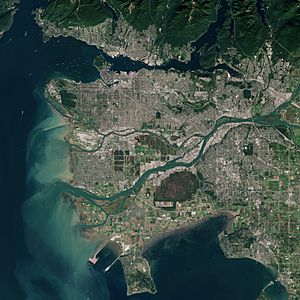
Satellite image of Metro Vancouver
|
|||
|
|||
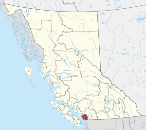
Location in British Columbia
|
|||
| Country | Canada | ||
| Province | British Columbia | ||
| Incorporated | 29 June 1967 | ||
| Name change | 13 June 1968 | ||
| Name change | 30 January 2017 | ||
| Administrative office | Burnaby | ||
| Electoral Areas | A | ||
| Government | |||
| • Type | Regional district | ||
| • Body | Board of Directors | ||
| Area
(2021)
|
|||
| • Land | 2,878.93 km2 (1,111.56 sq mi) | ||
| Highest elevation | 1,990 m (6,530 ft) | ||
| Lowest elevation | 0 m (0 ft) | ||
| Population
(2021)
|
|||
| • Total | 2,642,825 | ||
| • Estimate
(2024)
|
3,108,926 | ||
| • Rank | 2 (Canadian CD) | ||
| • Density | 918.0/km2 (2,378/sq mi) | ||
| • Density rank | 2 (Canadian CD) | ||
| Demonym(s) | Metro Vancouverite | ||
| GDP | |||
| • Total | CA$163.772 billion (2020) | ||
| Time zone | UTC−08:00 (PST) | ||
| • Summer (DST) | UTC−07:00 (PDT) | ||
| Area codes | 604 / 778 / 236 / 672 | ||
Metro Vancouver is a special kind of government in British Columbia, Canada. It helps manage the Greater Vancouver area. Think of it as a team that works for 23 different local areas, including cities and towns.
This organization provides important services and makes plans for the whole region. Its main office is in Burnaby. Metro Vancouver's borders are the same as the Vancouver census metropolitan area, which is how Statistics Canada defines the big city area.
Contents
History of Metro Vancouver
How Metro Vancouver Started
Before Metro Vancouver, there were groups that managed water and sewage for the area. The Greater Vancouver Water District started in 1924. The Greater Vancouver Sewerage and Drainage District began in 1956.
On June 29, 1967, the government of British Columbia created a new regional district. It was first called the Regional District of Fraser-Burrard.
Name Changes Over Time
Less than a year later, on June 13, 1968, its name changed to the Greater Vancouver Regional District (GVRD).
In 2007, the GVRD wanted to change its name again to "Metro Vancouver." They thought this name was easier to recognize. At first, the government said no because the name didn't include "regional district." However, they suggested the GVRD could still use "Metro Vancouver" as an unofficial brand.
After nine years, many people knew the "Metro Vancouver" brand. To avoid confusion, the GVRD decided to officially change its name. On January 30, 2017, the government formally renamed it the Metro Vancouver Regional District.
Geography of the Region
The Metro Vancouver Regional District (MVRD) is located east of the Strait of Georgia. It is north of the State of Washington. The Fraser River flows right through the middle of it. The boundaries of Metro Vancouver match the Vancouver CMA.
Who is Part of Metro Vancouver?
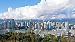
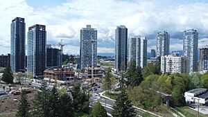
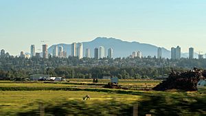
Metro Vancouver has 23 members. These include 21 cities and towns, one special "electoral area," and one First Nations community with a treaty.
| Member | Census subdivision | Population (2021) | Population (2016) | % change (2016–2021) | 2021 provincial rank |
|---|---|---|---|---|---|
| Anmore | Village | 2,356 | 2,210 | +6.6% | 185th |
| Belcarra | Village | 687 | 643 | +6.8% | 301st |
| Bowen Island | Island municipality | 4,256 | 3,680 | +15.7% | 118th |
| Burnaby | City | 249,125 | 232,755 | +7.0% | 3rd |
| Coquitlam | City | 148,625 | 139,284 | +6.7% | 6th |
| Delta | City | 108,455 | 102,238 | +6.1% | 10th |
| City of Langley | City | 28,963 | 25,888 | +11.9% | 30th |
| Township of Langley | District municipality | 132,603 | 117,285 | +13.1% | 8th |
| Lions Bay | Village | 1,390 | 1,334 | +4.2% | 251st |
| Maple Ridge | City | 90,990 | 82,256 | +10.6% | 15th |
| Metro Vancouver A | Regional district electoral area | 18,612 | 16,133 | +15.4% | 39th |
| New Westminster | City | 78,916 | 70,996 | +11.2% | 17th |
| City of North Vancouver | City | 58,120 | 52,898 | +9.9% | 20th |
| District of North Vancouver | District municipality | 88,168 | 85,649 | +2.9% | 16th |
| Pitt Meadows | City | 19,146 | 18,573 | +3.1% | 37th |
| Port Coquitlam | City | 61,498 | 58,612 | +4.9% | 19th |
| Port Moody | City | 33,535 | 33,551 | ±0.0% | 28th |
| Richmond | City | 209,937 | 198,309 | +5.9% | 4th |
| Surrey | City | 568,322 | 517,887 | +9.7% | 2nd |
| Tsawwassen | First Nation | 2,256 | 816 | +176.5% | 191st |
| Vancouver | City | 662,248 | 631,486 | +4.9% | 1st |
| West Vancouver | District municipality | 44,122 | 42,473 | +3.9% | 23rd |
| White Rock | City | 21,939 | 19,952 | +10.0% | 33rd |
| Metro Vancouver | 2,642,825 | 2,463,431 | +7.3% | – | |
| Source: Statistics Canada ; Metro Vancouver Regional District | |||||
Electoral Area A
Electoral Area A is made up of all the land within Metro Vancouver that isn't part of a city or town. This area is about 818 square kilometers. Most of it is in the northern part of the district. It includes homes along Howe Sound and Indian Arm. It also includes Barnston Island on the Fraser River and Passage Island.
The University of British Columbia campus and the University Endowment Lands are also in Electoral Area A. About 98% of the people in Electoral Area A live in these university areas.
First Nations Reserves
There are also seventeen First Nations reserves within Metro Vancouver's area. As of 2006, about 7,550 people lived on these reserves. Even though these reserves have their own rules, people living there can still vote in local elections. This helps them choose who represents them on the Metro Vancouver board.
Nearby Regions
Cities like Abbotsford, Chilliwack, and Mission are close to Vancouver. However, they are part of a different regional district called the Fraser Valley Regional District.
Population and Demographics
|
|||||||||||||||||||||||||||||||||||||||||||||||||||||||||
In the 2021 Canadian census, Metro Vancouver had a population of 2,642,825 people. This was a 7.3% increase from 2016. The area covers 2,878.93 square kilometers. This means it had about 918 people per square kilometer in 2021.
Metro Vancouver is the most crowded and most populated regional district in British Columbia. It is also the second most crowded and second most populated census division in all of Canada, after Toronto.
How Metro Vancouver is Governed
Metro Vancouver is actually made up of four different groups that work together. These are the Metro Vancouver Regional District (MVRD), the Greater Vancouver Sewerage and Drainage District (GVS&DD), the Greater Vancouver Water District (GVWD), and the Metro Vancouver Housing Corporation (MVHC). Each group has its own board of directors.
The MVRD board has 40 directors. These directors come from the 23 local areas that are members of Metro Vancouver. The number of directors from each area depends on its population. Each director is also an elected official from their local area. The only exception is the representative for Electoral Area A, which doesn't have a city council.
As of 2017, Metro Vancouver had about 1,500 employees. They work in ten different departments. These departments handle things like human resources, finances, legal matters, and services for water, parks, housing, and waste.
What Metro Vancouver Does
Metro Vancouver's main job is to manage resources and services that are needed across the entire metropolitan area. The Metro Vancouver Board has a plan for what they want to achieve between 2015 and 2018.
Most of Metro Vancouver's budget (84%) is spent on three main services: water, liquid waste (sewage), and solid waste (garbage). The organization has plans for each of these areas.
Managing Water Resources
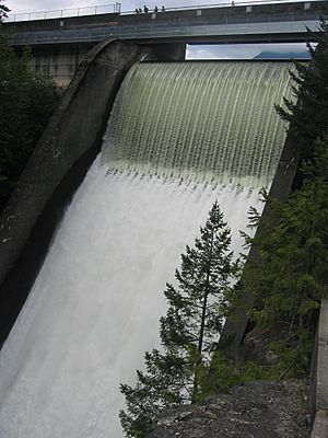
Metro Vancouver provides tap water to about 2.8 million people in the region. On busy summer days, they can provide 1.5 billion liters of water. The water comes from three main sources: the Capilano reservoir, the Seymour reservoir, and the Coquitlam reservoir.
Metro Vancouver controls the Cleveland Dam on the Capilano reservoir. This dam supplies 40% of the region's water. The water system also includes 26 storage tanks, 19 pump stations, and 520 kilometers of water mains.
Handling Liquid Waste
Metro Vancouver manages the system for liquid waste, which includes sewers and wastewater treatment plants. Their goal is to protect public health and the environment. They also try to get as many useful things (like energy) from the waste as possible.
They have a plan called the Integrated Liquid Waste and Resource Management plan. Its goals are:
- To keep people healthy and protect the environment.
- To use liquid waste as a resource.
- To manage waste effectively and affordably, working with others.
Managing Solid Waste
Metro Vancouver's plan for solid waste is called the Integrated Solid Waste and Resource Management plan. Its goals are:
- To create less waste.
- To reuse, recycle, and recover as many materials as possible.
- To get energy from waste after recycling.
- To put any remaining waste in a landfill after recycling and energy recovery.
One idea was to build a very large landfill in Ashcroft, British Columbia, because there isn't much space left in Metro Vancouver for garbage. There are concerns about the environment in that area. Another company has offered to use its mine pit instead. In the past, Metro Vancouver used landfills in the Fraser Mills area and at Port Mann.
Providing Housing
Metro Vancouver owns and manages housing buildings across the region through the Metro Vancouver Housing Corporation (MVHC). It also creates plans to help with homelessness and to provide affordable housing.
The MVHC's goals are:
- To offer more types of housing for different needs.
- To increase rental housing and keep existing homes, while helping current renters.
- To meet the housing needs of people with very low and low incomes.
- To add more rental homes near public transportation.
- To end homelessness in the region.
Regional Planning for the Future
Metro Vancouver works with its members to create a shared vision for a great place to live. This vision is in the Regional Growth Strategy (RGS), which was approved in 2011. The RGS has five goals:
- To create a compact urban area.
- To support a strong economy.
- To protect the environment and deal with climate change.
- To develop complete communities where people can live, work, and play.
- To support environmentally friendly transportation choices.
Regional planning also includes ideas for farming and food. The organization wants to:
- Grow more food close to home.
- Help the food industry be more successful.
- Encourage healthy and sustainable food choices.
- Make sure everyone can get healthy, diverse, and affordable food.
- Keep a food system that is good for the environment.
In 2018, the board also adopted the Ecological Health Framework. This plan helps Metro Vancouver work towards a "beautiful, healthy, and resilient environment." Its goals are:
- To build ecological resilience and reduce negative impacts.
- To protect natural areas and save ecosystem services.
- To help nature thrive within communities.
Improving Air Quality
Metro Vancouver has programs and rules to protect people's health and the environment by improving air quality. They also work to make the air look clearer and reduce the region's impact on climate change.
Their plan for air quality and greenhouse gases has three goals:
- To protect public health and the environment.
- To make the air look clearer.
- To reduce the region's contribution to global climate change.
Managing Regional Parks
Metro Vancouver's parks department manages 23 regional parks. They also look after nature reserves and greenways. Their plan for regional parks has four goals:
- To promote a healthy environment.
- To encourage outdoor activities for people's health.
- To support community involvement and education.
- To encourage donations and economic opportunities.
Regional parks are different from city parks. They are usually more "wild" and show off unique natural areas, like bogs and old rainforests.
See also
 In Spanish: Distrito regional del Gran Vancouver para niños
- Greater Vancouver
- Greater Victoria, British Columbia
 | Isaac Myers |
 | D. Hamilton Jackson |
 | A. Philip Randolph |


