
Surrey, British Columbia facts for kids
Quick facts for kids
Surrey
|
|||||
|---|---|---|---|---|---|
|
City
|
|||||
| City of Surrey | |||||
.jpg)   .jpg)  From top, left to right: Surrey City Centre skyline, Crescent Beach, Holland Park, Surrey City Hall, Newton Town Centre
|
|||||
|
|||||
| Nickname(s):
City of Parks
|
|||||
| Motto(s):
Progressio per diversitatem
"Progress through diversity" |
|||||

Location of Surrey in Metro Vancouver
|
|||||
| Country | Canada | ||||
| Province | British Columbia | ||||
| Regional district | Metro Vancouver | ||||
| Incorporated | November 10, 1879 (municipality status) | ||||
| September 11, 1993 (city status) | |||||
| Named for | Surrey | ||||
| Seat | Surrey City Hall | ||||
| Government | |||||
| • Type | Mayor-council government | ||||
| • Body | Surrey City Council | ||||
| Area | |||||
| • Land | 316.11 km2 (122.05 sq mi) | ||||
| Area rank | 3rd in British Columbia | ||||
| Highest elevation | 134 m (440 ft) | ||||
| Lowest elevation | 0 m (0 ft) | ||||
| Population
(2021)
|
|||||
| • Total | 568,322 | ||||
| • Estimate
(2023)
|
662,561 | ||||
| • Rank |
|
||||
| • Density | 1,797.9/km2 (4,657/sq mi) | ||||
| Demonym(s) | Surreyite | ||||
| Time zone | UTC−08:00 (PST) | ||||
| • Summer (DST) | UTC−07:00 (PDT) | ||||
| Forward sortation area |
V3R–V3X, V3Z–V4A, V4N–V4P
|
||||
| Area codes | 604, 778, 236, 672 | ||||


Surrey is a large city in British Columbia, Canada. It is located south of the Fraser River and close to the Canada–United States border. Surrey is part of the Metro Vancouver area. It is mostly a suburban city, meaning many people live there and travel to nearby cities for work.
Surrey is the second-largest city in British Columbia by population, after Vancouver. It is also the third-largest by land area. The city has seven main neighborhoods, called town centres: Cloverdale, Fleetwood, Guildford, Newton, South Surrey, and Whalley (which is also known as City Centre).
Contents
History of Surrey
Surrey became an official municipality in 1879. The land it sits on has been home to several Indigenous nations for a long time. These include the Katzie, Kwantlen, and Semiahmoo peoples.
An Englishman named H.J. Brewer thought the area looked like his home in County of Surrey in England. That's how Surrey got its name. The area used to be covered in thick forests and bogs. A part of what is now Whalley was once a burial ground for the Kwantlen Nation.
Early settlers came to areas like Cloverdale and South Surrey. They mostly farmed, fished, or opened small shops. Surrey started to grow a lot after the Pattullo Bridge was built in 1937. This bridge connected Surrey to New Westminster.
In the 1950s, after World War II, many single-family homes were built in North Surrey. The area became a "bedroom community" for people who worked in Vancouver or Burnaby. This means people lived in Surrey and commuted to work in other cities.
Surrey grew even faster in the 1980s and 1990s. Many people from different parts of Canada and the world, especially Asia, moved there. By 2013, experts thought Surrey would become the most populated city in British Columbia within 10 to 12 years.
Geography and Climate
Surrey is a spread-out city with many homes, light industries, and shopping areas. About 27% of its land is set aside for farming. This land is part of the Agricultural Land Reserve. Most of Surrey's land is made up of hills and flat areas.

Surrey's Climate
Surrey has a climate typical of the Pacific Northwest. This means it has rainy, wet winters with lots of rainfall. Winters are cool but not extremely cold. Summers are mild and sunny, and autumns are cool and cloudy.
| Climate data for Surrey (1981–2010) | |||||||||||||
|---|---|---|---|---|---|---|---|---|---|---|---|---|---|
| Month | Jan | Feb | Mar | Apr | May | Jun | Jul | Aug | Sep | Oct | Nov | Dec | Year |
| Record high °C (°F) | 15.5 (59.9) |
19.4 (66.9) |
25.0 (77.0) |
29.0 (84.2) |
34.5 (94.1) |
33.3 (91.9) |
35.0 (95.0) |
34.5 (94.1) |
34.5 (94.1) |
29.0 (84.2) |
21.0 (69.8) |
16.7 (62.1) |
35.0 (95.0) |
| Mean daily maximum °C (°F) | 6.7 (44.1) |
8.7 (47.7) |
11.7 (53.1) |
14.6 (58.3) |
17.9 (64.2) |
20.4 (68.7) |
23.1 (73.6) |
23.6 (74.5) |
20.9 (69.6) |
14.5 (58.1) |
8.7 (47.7) |
6.1 (43.0) |
14.7 (58.5) |
| Daily mean °C (°F) | 3.8 (38.8) |
5.1 (41.2) |
7.5 (45.5) |
10.0 (50.0) |
13.0 (55.4) |
15.6 (60.1) |
17.9 (64.2) |
18.2 (64.8) |
15.5 (59.9) |
10.4 (50.7) |
5.9 (42.6) |
3.4 (38.1) |
10.5 (50.9) |
| Mean daily minimum °C (°F) | 0.9 (33.6) |
1.4 (34.5) |
3.3 (37.9) |
5.3 (41.5) |
8.0 (46.4) |
10.8 (51.4) |
12.5 (54.5) |
12.7 (54.9) |
10.0 (50.0) |
6.3 (43.3) |
3.1 (37.6) |
0.6 (33.1) |
6.2 (43.2) |
| Record low °C (°F) | −17.2 (1.0) |
−13.5 (7.7) |
−8.3 (17.1) |
−2.8 (27.0) |
−1.1 (30.0) |
2.2 (36.0) |
2.8 (37.0) |
−1.1 (30.0) |
−2.2 (28.0) |
−6.5 (20.3) |
−15.0 (5.0) |
−18.9 (−2.0) |
−18.9 (−2.0) |
| Average precipitation mm (inches) | 186.4 (7.34) |
124.8 (4.91) |
121.8 (4.80) |
109.8 (4.32) |
87.9 (3.46) |
72.1 (2.84) |
49.0 (1.93) |
42.0 (1.65) |
59.7 (2.35) |
138.5 (5.45) |
225.0 (8.86) |
182.1 (7.17) |
1,399.1 (55.08) |
| Average rainfall mm (inches) | 172.0 (6.77) |
117.4 (4.62) |
120.0 (4.72) |
109.5 (4.31) |
87.9 (3.46) |
72.1 (2.84) |
49.0 (1.93) |
42.0 (1.65) |
59.7 (2.35) |
138.1 (5.44) |
223.4 (8.80) |
169.9 (6.69) |
1,360.8 (53.57) |
| Average snowfall cm (inches) | 14.5 (5.7) |
7.4 (2.9) |
1.8 (0.7) |
0.3 (0.1) |
0.0 (0.0) |
0.0 (0.0) |
0.0 (0.0) |
0.0 (0.0) |
0.0 (0.0) |
0.4 (0.2) |
1.6 (0.6) |
12.2 (4.8) |
38.2 (15.0) |
| Average precipitation days (≥ 0.2 mm) | 19.3 | 16.0 | 17.8 | 16.2 | 14.3 | 12.7 | 8.4 | 7.4 | 8.3 | 16.3 | 22.2 | 19.4 | 178.0 |
| Average rainy days (≥ 0.2 mm) | 18.4 | 15.1 | 17.8 | 16.2 | 14.3 | 12.7 | 8.4 | 7.4 | 8.3 | 16.2 | 22.1 | 18.1 | 174.7 |
| Average snowy days (≥ 0.2 cm) | 2.2 | 1.6 | 0.55 | 0.10 | 0.0 | 0.0 | 0.0 | 0.0 | 0.0 | 0.11 | 0.56 | 2.4 | 7.4 |
| Source: Environment Canada | |||||||||||||
People and Culture
Surrey is a very diverse city. In the 2021 Canadian census, Surrey had a population of 568,322 people. This made it the 11th largest city in Canada. It is also the second largest city in the Metro Vancouver area.
Surrey is growing fast, especially its downtown area in Whalley. This area is becoming a second major center for Metro Vancouver.
Diverse Neighborhoods
Surrey has many unique neighborhoods like City Centre, Newton, Guildford, Fleetwood, Cloverdale, and South Surrey. Each area has a mix of different cultures. For example, South Surrey and Cloverdale have many people of European background. Newton and Whalley have many people of South Asian background.
Many people have moved to Surrey since the 1980s. This has made the city very diverse in terms of cultures and languages. About 52% of people in Surrey do not speak English as their first language. About 38% of the city's residents are of South Asian heritage. Many South Asian families moved to Surrey from Vancouver starting in the 1990s because housing became too expensive there. This has made Surrey one of the largest centers for South Asian residents in North America.
Other large groups in Surrey include East Asians (10.9%) and Southeast Asians (9.7%). Surrey also has the largest Black population in British Columbia, making up about 2.3% of the city's total population. Most people of European heritage in Surrey (64%) have roots in the British Isles.
| Panethnic group | 2021 | 2016 | 2011 | 2006 | 2001 | |||||
|---|---|---|---|---|---|---|---|---|---|---|
| Pop. | % | Pop. | % | Pop. | % | Pop. | % | Pop. | % | |
| South Asian | 212,680 | 37.81% | 168,040 | 32.85% | 142,445 | 30.74% | 107,810 | 27.47% | 75,680 | 21.89% |
| European | 173,155 | 30.78% | 198,835 | 38.87% | 208,625 | 45.03% | 203,815 | 51.93% | 211,870 | 61.27% |
| East Asian | 61,360 | 10.91% | 52,025 | 10.17% | 39,270 | 8.48% | 29,965 | 7.64% | 23,600 | 6.83% |
| Southeast Asian | 54,635 | 9.71% | 44,875 | 8.77% | 39,560 | 8.54% | 25,795 | 6.57% | 16,440 | 4.75% |
| African | 12,870 | 2.29% | 9,455 | 1.85% | 6,150 | 1.33% | 5,015 | 1.28% | 3,810 | 1.1% |
| Middle Eastern | 12,620 | 2.24% | 9,485 | 1.85% | 5,615 | 1.21% | 3,595 | 0.92% | 2,300 | 0.67% |
| Indigenous | 12,175 | 2.16% | 13,460 | 2.63% | 10,955 | 2.36% | 7,630 | 1.94% | 6,895 | 1.99% |
| Latin American | 8,830 | 1.57% | 7,065 | 1.38% | 5,340 | 1.15% | 3,785 | 0.96% | 3,315 | 0.96% |
| Other/multiracial | 14,240 | 2.53% | 8,315 | 1.63% | 5,385 | 1.16% | 5,050 | 1.29% | 1,880 | 0.54% |
| Total responses | 562,565 | 98.99% | 511,540 | 98.77% | 463,340 | 98.95% | 392,450 | 99.36% | 345,780 | 99.41% |
| Total population | 568,322 | 100% | 517,887 | 100% | 468,251 | 100% | 394,976 | 100% | 347,825 | 100% |
| Note: Totals greater than 100% due to multiple origin responses | ||||||||||
Religions in Surrey
Surrey has a very diverse mix of religions. It has the largest percentage of Sikh people in any city in Canada, at 27.4%.
Religion in Surrey (2021) Christianity (30.2%) No religion (28.8%) Sikhism (27.4%) Islam (5.5%) Hinduism (5.4%) Buddhism (1.9%) Judaism (0.2%) Indigenous (0.1%) Other religions (0.5%)
As of 2021, the top five religions in Surrey were:
- Christianity (30.2%)
- No religion (28.6%)
- Sikhism (27.4%)
- Islam (5.5%)
- Hinduism (5.4%)
Languages Spoken in Surrey
Surrey is a city where many different languages are spoken. While English is the most common first language, many residents speak other languages at home.
| Mother tongue | Population | Percentage |
|---|---|---|
| English | 243,510 | 43.2% |
| Punjabi | 128,305 | 22.7% |
| Mandarin | 28,080 | 5.0% |
| Tagalog | 18,640 | 3.3% |
| Hindi | 14,540 | 2.6% |
| Korean | 8,690 | 1.5% |
| Cantonese | 8,165 | 1.4% |
| Spanish | 7,565 | 1.3% |
| Vietnamese | 6,860 | 1.2% |
| Arabic | 6,135 | 1.1% |
| Urdu | 5,820 | 1.0% |
| Persian (including Dari) | 3,115 | 0.6% |
| French | 2,910 | 0.5% |
| German | 2,860 | 0.5% |
Economy and Jobs
Surrey is one of the biggest industrial centers in British Columbia. It has growing industries in high technology, clean energy, advanced manufacturing, health, education, agriculture, and arts.

In 2017, many movies and TV shows were filmed in Surrey. The city had 189 productions that year. In 2018, Surrey opened a $68 million biofuel facility, which was the first of its kind in North America.
Some of the largest employers in Surrey (as of 2017) include:
- Fraser Health (25,000 staff across BC)
- School District 36 (10,560 staff)
- City of Surrey (3,400 staff)
- Coast Capital Savings (1,738 staff)
- Kwantlen Polytechnic University (1,332 staff)
Farming in Surrey
Farming is a very important part of Surrey's economy. About one-third of Surrey's land is protected for farming. This helps produce local food and creates jobs. Farming employs about 3,300 people in Surrey.
Health Care in Surrey
The health care sector is a big part of Surrey's economy. Surrey has almost 900 health-related businesses. These businesses focus on areas like infectious diseases, marine bio-science, and cancer research.
Surrey Memorial Hospital is the second-largest employer in Surrey. It has a large budget and employs over 4,100 people. Because the population is growing, a new hospital is being built in Cloverdale. It is expected to be finished in 2026.
Technology in Surrey
Surrey has a growing technology sector. The city is working to create a place where new ideas can turn into start-up companies. This helps local inventors and entrepreneurs.
City Government
Surrey is run by the Surrey City Council. This council includes a mayor and eight councillors. The mayor is Brenda Locke, who was elected in October 2022.
Culture and Fun Things to Do
Places to Visit

The Museum of Surrey is a great place to learn about the city's history. It reopened in 2018 after a big renovation. The Surrey Art Gallery is the second-largest public art museum in the Metro Vancouver area. It opened in 1975.
The historic Surrey Municipal Hall complex includes the Cenotaph in Heritage Square, the Surrey Museum, and Cloverdale Library. The Surrey City Centre Public Library is the second-largest library in Metro Vancouver.
In Heritage Square, there is a large bronze statue called "REMEMBRANCE" by André Gauthier. It shows a World War I soldier remembering his friends.
Events and Festivals

- WinterFest: This event happens every February at the Central City Plaza. It features live music, sports, food, and fireworks. About 15,000 people attend each year.
- Cloverdale Rodeo and Country Fair: Since 1888, this annual fair has been held in Cloverdale every May long weekend. It is Canada's second-largest rodeo. The fair has family entertainment, farm exhibits, a western market, and a parade.
- Vaisakhi Parade: Every year on April 13, the Sikh community celebrates Vaisakhi with a large parade called a nagar kirtan. Free food is often given out. This is the largest Vaisakhi parade outside of India, with over 500,000 people attending in 2019.
- Surrey International Writers' Conference: Since 1991, Surrey has hosted this event every October. It brings together writers, agents, editors, and publishers from around the world.
- Nicomekl River Race: This unique boat race happens every June. Teams build their own boats and race them from Nicomekl Park to Blackie Spit Park. Prizes are given for the fastest and most creative boats. All money raised goes to the BC Cancer society.
Surrey also has three live theatre venues: the Bell Centre for Performing Arts, the Chandos Pattison Auditorium, and the Surrey Arts Centre.
Sports and Recreation
Surrey is home to many sports and recreation activities.
- Canada Cup International Women's Fastpitch Tournament: Every summer, Surrey hosts this big softball tournament. It started in 1993 to help teams prepare for the Olympics.
- Surrey Eagles Hockey: The BCHL Surrey Eagles hockey team plays at the South Surrey Arena. They have won several championships, including the Fred Page Cup multiple times.
- Little League World Series: Surrey hosted the Canadian qualifying tournament in 2006. A local team competes for a spot in the Little League World Series in Williamsport, Pennsylvania.
- Kabaddi Stadium: Surrey has Canada's first stadium built specifically for kabaddi, a team sport from South Asia.
- Dance: The dance company "Brotherhood" from Surrey won gold at the World Hip Hop Dance Championships in 2013 and 2014.
- Cricket: Cricket is also popular in Surrey. There are over 85 teams and more than 20 cricket pitches in the city.
Surrey also hosted the 2016 Women's Softball World Championship.
Getting Around Surrey
Transportation History
The first non-Indigenous settlements in Surrey were near Crescent Beach and Bridgeview/Brownsville. Early trails helped people settle the area. The Kennedy Trail was built in 1861. The Semiahmoo Wagon Road was built in 1873.
Ferry service across the Fraser River started in 1882. The New Westminster Rail Bridge opened in 1904, allowing both trains and cars to cross. This bridge helped the BC Electric Railway build the Interurban line, an electric train that connected Chilliwack to Vancouver. It opened in 1910 and ran through many Surrey neighborhoods.
In 1937, the Pattullo Bridge opened, connecting New Westminster and Surrey. In the 1950s, the Interurban train stopped running, leading to more cars on Surrey's roads. New highways like Highway 10 (1953), Highway 15 (1957), and Highway 1 (1964) were built. The George Massey Tunnel opened in 1959.
In the early 1990s, rail transit returned to Surrey with the SkyTrain Expo Line extension. Four stations were added: Scott Road, Gateway, Surrey Central, and King George.
Current Transportation


Public transportation in Surrey is run by TransLink. They provide bus service throughout Surrey and to other cities in Metro Vancouver. The SkyTrain's Expo Line connects Surrey to Downtown Vancouver with four stations.
Several railway companies have tracks running through Surrey, including the Canadian National Railway and Canadian Pacific Railway.
For air travel, Vancouver International Airport is about 28 km west of Surrey. Bellingham International Airport in the US is 32 km south, and Abbotsford International Airport is 24 km east.
Future Transportation Plans
A major transportation project involved extending the SkyTrain Expo Line. The plan was to extend it from King George station to 166 Street and Fraser Highway in Fleetwood. This extension was completed in 2025. The overall plan is to extend the SkyTrain all the way to Langley in one phase, with completion expected by 2028.
Sustainable Development
In 2008, Surrey City Council created the Surrey Sustainability Charter. This document guides the city's development for the next 50 years, focusing on making Surrey a more sustainable place to live. The city council has released updates on the progress made since 2008.
Challenges for Sustainability
Making Surrey sustainable has faced some challenges.
- Urban Sprawl: Surrey has a lot of "urban sprawl," which means low-density housing areas with few businesses or industries. This causes a lot of traffic as people commute to work.
- Transportation and Land Use: The Sustainability Charter aims to reduce how much people rely on cars. This requires good public transit. The SkyTrain expansion plans faced delays and funding issues in the past.
Protecting farmland is also important for sustainability. The idea is to encourage local farming to reduce the need for food to be transported from far away. This also helps provide fresh, local food to residents.
Education in Surrey

About 23.7% of adults over 25 in Surrey have a bachelor's degree or higher. Many people in Surrey work in professional and managerial jobs.
Schools in Surrey
School District 36 Surrey manages 100 public elementary schools and 21 public secondary schools. This makes it the largest public school district in British Columbia. It is also the largest employer in Surrey. The Conseil scolaire francophone de la Colombie-Britannique runs one French-language school in Surrey, École Gabrielle-Roy.
Old Anniedale School
The Old Anniedale School was built in 1891. It is one of Surrey's oldest schools. It is now located at the modern Anniedale Elementary School. It is used for re-enactments of 19th-century lessons. The school was saved from being torn down in 1975 and was restored again in 2019.
Higher Education
Surrey has several options for higher education. The two main research universities in the Vancouver area, the University of British Columbia and Simon Fraser University, serve Surrey's needs. There are also many colleges that offer career and technical training.
- Simon Fraser University (SFU) Surrey Campus: This campus opened in 2002. It is a public research university that offers programs in Health Science, Applied Sciences, Natural Sciences, Liberal Arts, Business Administration, and Interactive Arts and Technology. In November 2022, plans were announced to open a new medical school at SFU's Surrey campus by September 2026. This will be the first new medical school in Western Canada in 55 years.
- Kwantlen Polytechnic University (KPU): KPU opened in Surrey in 1981 to provide vocational training. In 2008, it became a university. KPU has campuses in Surrey, Richmond, Langley, and a trades and technology center in Cloverdale. The Surrey campus offers programs in science, business, arts, and health. The Cloverdale campus focuses on skilled trades and technical careers.
- University of British Columbia (UBC): In November 2021, UBC announced plans to open a new location in Surrey, near Surrey Memorial Hospital.
Surrey is also home to many other colleges that offer vocational education, such as Brighton College, Sprott Shaw College, and Vancouver Career College.
Notable People from Surrey
- Carolyn Arends, singer-songwriter and author
- Karan Aujla, singer, songwriter and rapper
- Arshdeep Bains, professional hockey player
- Harry Bains, politician
- Nuvraj Bassi, professional football player
- Jean-Luc Bilodeau, actor
- Lisa Brokop, singer
- Laurent Brossoit, professional hockey goaltender
- Eleanor Collins, jazz singer, TV host and civic leader
- Ryan D'Arcy, neuroscientist researcher
- Baltej Singh Dhillon, first Royal Canadian Mounted Police officer allowed to wear a turban
- Ranj Dhaliwal, author
- Sukh Dhaliwal, politician
- Brenden Dillon, professional hockey player
- Emmalyn Estrada, singer, songwriter, actress
- Elise Estrada, singer, songwriter, actress
- Colin Fraser, professional ice hockey player
- Curtis Fraser, professional ice hockey player
- Scott Hannan, professional hockey player
- Jacob Hoggard, lead singer of Hedley
- Britt Irvin, actress, singer, voice-over artist
- Daniel Igali, 2000 Olympic gold medalist for freestyle wrestling
- Tristan Jarry, professional hockey goaltender
- Jujhar Khaira, professional hockey player
- Sydney Leroux, professional soccer player
- Adam Loewen, former professional baseball player
- Harbhajan Mann, Punjabi singer
- Laura Mennell, actress
- Merkules, rapper Cole Stevenson
- Tyler Joe Miller, country singer, songwriter
- Victoria Moors, Canadian gymnast at the 2012 Summer Olympics
- Gary Nylund, professional hockey player
- Shallon Olsen, Olympic artistic gymnast
- Missy Peregrym, actress and former fashion model
- Michael Rasmussen, NHL player for the Detroit Red Wings
- Paul Rodgers, vocalist with Free and Bad Company
- Linus Sebastian, videographer, founder of Linus Media Group
- Geroy Simon, professional football player
- Jinny Sims, politician
- Lauren Southern, internet personality, writer, and political activist
- Tony Stevens, country singer and songwriter
- Kalib Starnes, professional mixed martial artist
- John Tenta, professional wrestler nicknamed "Earthquake"
- Aaron Voros, professional hockey player
- Chris and Patrick Vörös, professional wrestlers and social media personalities
- Manmohan Waris, Punjabi singer
- Nolan Watson, businessman, philanthropist
- Dianne Watts, politician; first female Mayor of Surrey
- Parker Wotherspoon, professional ice hockey player
Sister and Friendship Cities
Surrey has two "sister cities":
| Country | City | Date | Ref. |
|---|---|---|---|
| Japan | Kōtō | April 20, 1989 | |
| China | Zhuhai | July 8, 1987 |
Surrey also has six "friendship cities":
| Country | City | Date |
|---|---|---|
| China | Ningbo | 1999 |
| South Korea | Dongjak | 2000 |
| China | Taicang | 2004 |
| India | Ludhiana | 2005 |
| India | Jalandhar | 2005 |
| China | Jincheng | 2006 |
Images for kids
-
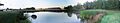
Panorama of the Cloverdale Fairgrounds
See also
 In Spanish: Surrey (Canadá) para niños
