North Vancouver (city) facts for kids
Quick facts for kids
North Vancouver
|
|
|---|---|
| The Corporation of the City of North Vancouver | |
 |
|
| Nickname(s):
North Van
|
|
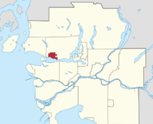
Location of the City of North Vancouver in Metro Vancouver
|
|
| Country | Canada |
| Province | British Columbia |
| Regional district | Metro Vancouver |
| Incorporated | May 13, 1907 |
| Seat | North Vancouver City Hall |
| Government | |
| • Type | Mayor-council government |
| Area | |
| • Land | 11.83 km2 (4.57 sq mi) |
| Elevation | 80 m (260 ft) |
| Population
(2021)
|
|
| • Total | 58,120 |
| • Estimate
(2023)
|
64,847 |
| • Density | 4,913.0/km2 (12,725/sq mi) |
| Demonym(s) | North Vancouverite |
| Time zone | UTC-8 (PST) |
| • Summer (DST) | UTC-7 (PDT) |
| Forward sortation area |
V7G - V7R
|
| Area codes | 604, 778, 236, 672 |
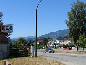
The City of North Vancouver is a city located on the North Shore of the Burrard Inlet in British Columbia, Canada. It's often called "North Van" for short. The city's main area is called Lonsdale. It is the smallest and most urban part of the communities north of Vancouver. North Vancouver is part of the Metro Vancouver area. It has important industries like shipping, chemical production, and film production. The city is kept safe by the Royal Canadian Mounted Police, the British Columbia Ambulance Service, and the North Vancouver City Fire Department.
Contents
History of North Vancouver
In the 1880s, two men named Arthur Heywood-Lonsdale and James Pemberton Fell invested a lot of money in the area. They did this through their company, Lonsdale Estates. Many places in North Vancouver are named after Lonsdale and his family.
After the District of North Vancouver was created, a land developer named James Cooper Keith helped build a road. This road stretched from West Vancouver to Deep Cove. Even today, this road is one of the most important ways to travel across the North Shore.
At first, the area grew slowly. In 1901, only 365 people lived in the district. But soon, things started to speed up around Lonsdale. The first school opened in 1902. A city hall was built in 1903, so meetings could happen in North Vancouver. The first bank and newspaper arrived in 1905. In 1906, a streetcar line opened, making it easier to get around.
Business owners on Lonsdale wanted to create a new, smaller city. They asked the district council to make this happen in 1905. There was a big debate about what to call the new city. Some suggested names like Northport or Hillmont. But most people wanted to keep "North Vancouver." They felt it was important to stay connected to the growing city of Vancouver.
The new city's boundaries, set in 1907, matched the land owned by the main developers. This was because the goal was to use local tax money to improve their properties. In 1912, residents in the western part of the District of North Vancouver decided to form their own area. This became the District of West Vancouver.
The City of North Vancouver kept growing around Lonsdale Avenue. Ferries made it easy for people to travel to Vancouver for work. Streetcars and land sales also helped the area become popular. Streets, city blocks, and houses were built around lower Lonsdale. Industries like Wallace Shipyards and the Pacific Great Eastern Railway helped the economy.
During the Great Depression, the city faced financial problems. However, World War II brought a big change. North Vancouver became a major shipbuilding center. This led to a building boom as homes were needed for shipyard workers. This growth continued after the war, making North Vancouver a popular place to live.
Geography and Climate
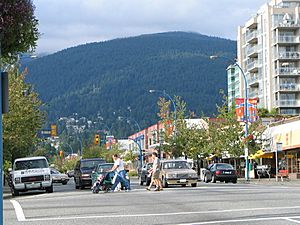
The City of North Vancouver is separated from Vancouver by the Burrard Inlet. It is surrounded on three sides by the District of North Vancouver. The city shares many features with the district and with West Vancouver. Together, these three areas are known as the North Shore.
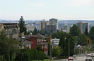
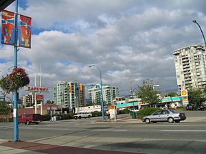
North Vancouver is quite busy, with many tall apartment buildings. These are mostly found in the Central Lonsdale and Lower Lonsdale areas. The North Shore mountains have several rivers and creeks. These include the Capilano River, MacKay Creek, Mosquito Creek, Lynn Creek, and Seymour River.
North Vancouver's Weather
North Vancouver has an oceanic climate. This means it has cool, rainy winters and dry, warm summers.
| Climate data for North Vancouver (N Vancouver 2ND Narrows) (Elevation: 4m) 1981−2010 | |||||||||||||
|---|---|---|---|---|---|---|---|---|---|---|---|---|---|
| Month | Jan | Feb | Mar | Apr | May | Jun | Jul | Aug | Sep | Oct | Nov | Dec | Year |
| Average precipitation mm (inches) | 262.2 (10.32) |
172.3 (6.78) |
168.4 (6.63) |
136.3 (5.37) |
103.3 (4.07) |
82.5 (3.25) |
53.2 (2.09) |
54.9 (2.16) |
76.8 (3.02) |
189.0 (7.44) |
293.4 (11.55) |
238.6 (9.39) |
1,830.8 (72.08) |
| Average rainfall mm (inches) | 255.3 (10.05) |
167.7 (6.60) |
166.8 (6.57) |
136.1 (5.36) |
103.3 (4.07) |
82.5 (3.25) |
53.2 (2.09) |
54.9 (2.16) |
76.8 (3.02) |
189.0 (7.44) |
290.2 (11.43) |
229.9 (9.05) |
1,805.6 (71.09) |
| Average snowfall cm (inches) | 6.9 (2.7) |
5.2 (2.0) |
1.6 (0.6) |
0.2 (0.1) |
0.0 (0.0) |
0.0 (0.0) |
0.0 (0.0) |
0.0 (0.0) |
0.0 (0.0) |
0.1 (0.0) |
2.3 (0.9) |
8.7 (3.4) |
24.9 (9.8) |
| Average precipitation days (≥ 0.2 mm) | 20.5 | 15.5 | 18.0 | 15.4 | 13.8 | 11.7 | 7.4 | 6.7 | 9.6 | 16.1 | 20.9 | 20.3 | 175.9 |
| Average rainy days (≥ 0.2 mm) | 19.7 | 15.1 | 17.9 | 15.4 | 13.8 | 11.7 | 7.4 | 6.7 | 9.6 | 16.0 | 20.7 | 19.6 | 173.5 |
| Average snowy days (≥ 0.2 cm) | 1.7 | 0.92 | 0.54 | 0.12 | 0.0 | 0.0 | 0.0 | 0.0 | 0.0 | 0.08 | 0.72 | 2.2 | 6.2 |
| Source: Environment Canada (normals, 1981−2010) | |||||||||||||
Places to Visit
The area around lower Lonsdale Avenue has several fun community spots. These include Waterfront Park, Lonsdale Quay, Ship Builders Square, and the Burrard Dry Dock Pier.
Other interesting places in the city are:
- Centennial Theatre, at 2300 Lonsdale Avenue.
- First Church of Christ, Scientist, a historic building.
- The Museum and Archives of North Vancouver, where you can learn about the city's past.
- The Polygon Gallery, a place for art and photography.
- Presentation House Theatre, at 333 Chesterfield Avenue.
- St. Edmund's Church, at 535 Mahon Avenue, another local heritage site.
- Trans Canada Trail Pavilion, located in Waterfront Park.
- The Shipyards, near Lonsdale Quay. This area includes Ship Builders Square and the Burrard Dry Dock Pier. It's built on the site of the old Wallace Shipyard.
- Lonsdale Quay Market, which is easy to reach by SeaBus. The market has great views of Vancouver's skyline and features local businesses.
Getting Around North Vancouver
The City of North Vancouver is connected to Vancouver by two highway bridges. These are the Lions Gate Bridge and the Ironworkers Memorial Second Narrows Crossing. There is also a passenger ferry called the SeaBus. The SeaBus and the bus system in North Vancouver are run by Coast Mountain Bus Company. This company is part of TransLink. The main hub for buses is Lonsdale Quay, where the SeaBus terminal is located. Currently, there are no train services on the North Shore.
The main street in the city is Lonsdale Avenue. It starts at Lonsdale Quay and goes north to 29th Street. It then continues into the District of North Vancouver.
Highway 1, also known as the Trans-Canada Highway, runs through the northern part of the city. It is a freeway here. There are six exits on Highway 1 within the City of North Vancouver:
- Main Street/Dollarton Highway (Exit 23)
- Mountain Highway and Mt Seymour Parkway (Exit 21/22)
- Lynn Valley Road (Exit 19)
- Lonsdale Avenue (Exit 18)
- Westview Drive (Exit 17)
- Capilano Road (Exit 14)
Education in North Vancouver
Public schools in North Vancouver are managed by the North Vancouver School District. This district runs 8 high schools and 30 elementary schools. These schools serve both the city and the District of North Vancouver.
The Conseil scolaire francophone de la Colombie-Britannique operates one French-language school in the city. It is called école André-Piolat and teaches both primary and secondary students.
There are also several private elementary and high schools in the area. These include Bodwell High School and Lions Gate Christian Academy.
For higher education, students can attend Capilano University in the district. Other options include Simon Fraser University and the University of British Columbia in nearby communities.
Population and People
| Historical populations | ||
|---|---|---|
| Year | Pop. | ±% |
| 1911 | 8,196 | — |
| 1921 | 7,652 | −6.6% |
| 1931 | 8,510 | +11.2% |
| 1941 | 8,914 | +4.7% |
| 1951 | 15,687 | +76.0% |
| 1961 | 23,656 | +50.8% |
| 1971 | 31,847 | +34.6% |
| 1981 | 33,640 | +5.6% |
| 1991 | 41,475 | +23.3% |
| 2001 | 44,303 | +6.8% |
| 2006 | 45,165 | +1.9% |
| 2011 | 48,196 | +6.7% |
| 2016 | 52,898 | +9.8% |
| 2021 | 58,120 | +9.9% |
In the 2021 Census, North Vancouver had a population of 58,120 people. This was a 9.9% increase from its population in 2016. The city covers an area of 11.83 square kilometers. This means it has about 4,913 people living in each square kilometer.
In 2011, the average age of people in North Vancouver was 41.2 years old. This was slightly older than the national average. The average value of a home in North Vancouver was about $599,985. This was much higher than the national average. The average household income after taxes was $52,794.
Different Backgrounds
North Vancouver is home to many different groups of people. As of 2021, a large part of the population, about 11.3%, is from the Middle East. Most of these people are Persian.
The main languages spoken in North Vancouver are English and Persian. Other languages include Tagalog, Chinese, Spanish, and Korean.
Beliefs and Religions
According to the 2021 census, many people in North Vancouver do not follow a specific religion (51.4%). Christianity is the largest religious group (36.4%). Other religions include Islam (7.4%), Sikhism (0.9%), Buddhism (0.8%), Judaism (0.7%), and Hinduism (0.6%).
See also
 In Spanish: North Vancouver (Columbia Británica) para niños
 | Valerie Thomas |
 | Frederick McKinley Jones |
 | George Edward Alcorn Jr. |
 | Thomas Mensah |


