Interstate 78 in New York facts for kids
Quick facts for kids
Interstate 78 |
||||
|---|---|---|---|---|
|
Map of Lower Manhattan with I-78 highlighted in red
|
||||
| Route information | ||||
| Maintained by PANYNJ | ||||
| Length | 0.5 mi (0.8 km) | |||
| Existed | 1978–present | |||
| Restrictions | No hazardous goods allowed in the Holland Tunnel | |||
| Major junctions | ||||
| West end | ||||
| East end | Canal Street in Tribeca | |||
| Location | ||||
| Counties: | New York | |||
| Highway system | ||||
| Main route of the Interstate Highway System Main • Auxiliary • Business Numbered highways in New York
|
||||
Interstate 78 (I-78) is a major highway that crosses the United States, connecting different states. In New York State, I-78 is very short, only about 0.5 miles (0.80 km) long. This entire short section is actually the Holland Tunnel, which goes under the Hudson River from New Jersey into New York City.
The tunnel and the roads leading to it are managed by the Port Authority of New York and New Jersey (PANYNJ). When the Interstate Highway System was first planned in the 1950s, I-78 was supposed to be much longer in New York City. It was planned to go all the way to John F. Kennedy International Airport and then north to I-95 in the Bronx. However, many parts of this original plan were never built. This was mainly because people living in the communities where the highways would have gone did not want them built. Because of this, I-78 in New York does not connect to its other related highways, like I-278.
Contents
What is I-78 in New York?
The part of I-78 in New York is about 0.5 miles (0.80 km) long. It is completely made up of the Holland Tunnel. This tunnel connects New York to I-78 in New Jersey. The Holland Tunnel is a very important landmark. When it opened in 1927, it was the longest underwater tunnel for cars in the world! It has two separate tubes, and each tube carries two lanes of traffic in one direction.
Entering and Exiting the Tunnel
When you want to go west into the tunnel, you enter from a special area called Freeman Plaza. This area is surrounded by streets like Broome, Varick, Watts, and Hudson streets. Cars can enter the tunnel from different points around this area, including from Canal Street.
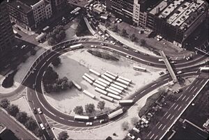
When you exit the tunnel heading east, you come out into a large circular area called the "Holland Tunnel Rotary." This area used to be a train terminal. From this rotary, there are five different exits that cars can take to get to different parts of the city. These exits are numbered 1 through 5. A special walkway for people crosses over the entrance to this exit area.
Other Highways Related to I-78
There are four other highways in New York that are related to I-78. They are called "auxiliary routes" because they are like branches off the main highway. However, none of these branches actually connect to I-78 in New York because parts of the original I-78 plan were never built.
- I-478 is currently the Brooklyn–Battery Tunnel. It connects I-278 in Brooklyn to the Battery in Manhattan. It was once planned to continue north to I-78 at the Holland Tunnel, but this project was canceled.
- I-278 starts in New Jersey and goes through all five boroughs of New York City. It ends in the Bronx. It was also planned to connect to I-78 in New Jersey.
- I-678 runs from JFK Airport in Queens north to the Bruckner Interchange in the Bronx.
- I-878 is a short highway near JFK Airport in Queens. It was originally planned to be part of I-78 itself.
History of I-78 Plans
When the Interstate highway numbers were decided in the late 1950s, I-78 was meant to be a long highway connecting Harrisburg to New York City. It was supposed to use several new roads in New York City.
Original Plans for I-78 in New York City
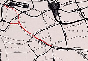
After leaving the Holland Tunnel, I-78 was planned to go onto the Lower Manhattan Expressway. This highway would cross the East River on the Williamsburg Bridge. Then, it would follow the Bushwick Expressway across Brooklyn to near JFK Airport. From there, it would use the Nassau Expressway and turn north along the Clearview Expressway through Queens. It would cross the East River again on the Throgs Neck Bridge into the Bronx.
Only two parts of this original I-78 plan in Queens and the Bronx were actually built. The Throgs Neck Bridge and its connecting roads opened in 1961 and were signed as I-78. The Clearview Expressway was finished in 1963. However, the plans for the Lower Manhattan, Bushwick, and other parts of the Clearview expressways were officially canceled by the New York state government in March 1971.
Canceled Highways
Many parts of I-78 in New York City were never built because of strong opposition from the communities where the highways would have gone.
Lower Manhattan Expressway (LOMEX)
| Lower Manhattan Expressway | |
|---|---|
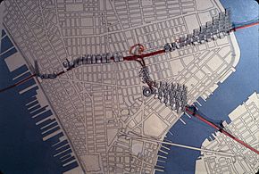
Map of Manhattan with the LOMEX in red
|
|
| Route information | |
| History | Proposed in 1941; approved in 1960; canceled in early 1971 |
| Major junctions | |
| West end | |
| East end | |
| Highway system | |
| Numbered highways in New York Interstate • U.S. • N.Y. (former) • Reference • County |
|
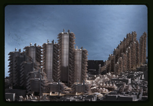
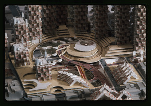
The Lower Manhattan Expressway, also known as LOMEX, was a very controversial plan for a highway through Lower Manhattan. It would have started at the Holland Tunnel and gone southeast as a 10-lane elevated highway. An "elevated highway" means it would have been built high above the ground, like a bridge, over neighborhoods like SoHo and Little Italy.
This highway was first thought of by a famous urban planner named Robert Moses in 1941. The city approved the plans in 1960. However, building the highway would have meant tearing down many buildings and forcing thousands of families and businesses to move.
Many residents started protesting against the plan. Community activist Jane Jacobs led groups to fight against LOMEX. She argued that the highway would create a "Chinese wall," separating different neighborhoods in Lower Manhattan. She believed it would harm the community spirit. Newspapers like The Village Voice reported on these protests and supported the community's efforts. Jane Jacobs became a local hero for her strong opposition to the project.
In 1962, the city started buying properties for the expressway. However, after more problems with moving people arose, the city's officials voted to block the highway plan. This was only a temporary stop. Robert Moses later proposed a revised plan.
A small section of the highway, about 156-foot (48 m) long, was actually built under Chrystie Street. This part was meant to support a subway connection if the expressway was ever completed. But it was never used because the highway was eventually canceled.
The argument over LOMEX became a big issue in the 1965 New York City mayoral election. Mayor Robert F. Wagner Jr. supported the highway, but his opponent, John Lindsay, was against the elevated highway plan. Lindsay won the election and immediately started looking for ways to change the project. People even suggested building the highway underground instead of elevated.
In 1967, Mayor Lindsay and Governor Nelson Rockefeller agreed to study an underground highway. This new plan would have sections in tunnels and open cuts. However, even this underground plan didn't satisfy the residents who still opposed it. Despite the ongoing protests, the federal and state governments set aside money for the expressway in 1967. But in 1969, scientists raised concerns about air pollution from the tunnel, and officials managed to delay the plans again.
Bushwick Expressway
The Bushwick Expressway was another part of I-78 that was canceled. It was supposed to connect the Williamsburg Bridge to the Nassau Expressway. This highway would have cut through several neighborhoods in Brooklyn and Queens, like Williamsburg, Bushwick, and East New York.
Like LOMEX, residents living along the Bushwick Expressway's path were against it. They knew it would mean destroying their homes and businesses. It was estimated that nearly 4,000 families would have to move because of this highway. Because of these concerns, a different highway, the Cross Brooklyn Expressway, was suggested instead in 1967 to reduce the number of people who would be displaced.
Why All I-78 Expressways Were Canceled
In 1969, Mayor Lindsay officially canceled plans for the Lower Manhattan and Cross Brooklyn expressways. He said it was because there wasn't enough support from the communities. Lindsay famously declared the Lower Manhattan Expressway "dead for all time." In August, the city officially removed the proposed expressway from its maps.
Finally, in March 1971, Governor Rockefeller officially canceled all three unbuilt expressways that were part of I-78 at the state level.
After these cancellations, the parts of I-78 that were built in Queens and the Bronx were given new names. The Clearview and Throgs Neck expressways became I-295. The Nassau Expressway became I-878 (now signed as NY 878).
Robert Moses had planned other expressways through Manhattan, but most were never built. The Mid-Manhattan Expressway and the Cross Harlem Expressway were also canceled. The only one of his planned Manhattan expressways that was built was the Trans-Manhattan Expressway, which connects the George Washington Bridge to the Cross Bronx Expressway.
Interestingly, singer Bob Dylan is said to have played a small part in the cancellation of the Lower Manhattan Expressway. In 1963, he supposedly wrote a song called "Listen, Robert Moses" to protest Moses's highway plans. While some experts doubted the song existed, a copy of the lyrics was later found, confirming that Dylan had indeed written it.
Exit list
The New York section of I-78 only includes the Holland Tunnel and its entrance and exit ramps. There are five eastbound exit ramps, which are numbered in order as traffic goes around the tunnel's exit area. The westbound entrance area is a few blocks north and has direct entrances from Hudson, Canal, Watts, and Varick streets.
| County | Location | Mile | Roads intersected | Notes | |
|---|---|---|---|---|---|
| Hudson River | 0.0 | New Jersey state line at the river's center | |||
| 0.0– 0.8 |
0.0– 1.3 |
Holland Tunnel (eastbound toll in New Jersey) | |||
| Tribeca | 0.90 | 1.45 | 1 | Via Laight Street west; eastern end of I-78 | |
| 1.0 | Hudson Street – Uptown | At the corner of Beach Street | |||
| none | Brooklyn | To Manhattan Bridge via Walker and Canal Streets | |||
| 1.1 | Downtown | Via Varick Street | |||
| none | Canal Street east | Via Laight Street east | |||
| 1.000 mi = 1.609 km; 1.000 km = 0.621 mi | |||||
 | Stephanie Wilson |
 | Charles Bolden |
 | Ronald McNair |
 | Frederick D. Gregory |


