Island No. 1 facts for kids

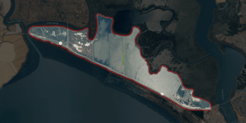
USGS aerial imagery of Island No. 1
|
|
| Geography | |
|---|---|
| Location | Northern California |
| Coordinates | 38°08′35″N 122°20′40″W / 38.14306°N 122.34444°W |
| Adjacent bodies of water | Napa River |
| Highest elevation | 3 ft (0.9 m) |
| Administration | |
|
United States
|
|
| State | |
| County | Napa and Solano |

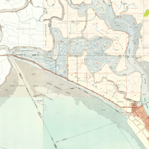
Island No. 1 as it appears on a 1951 USGS topographic map.
Island No. 1 is a partially submerged island in the Napa River, upstream of San Pablo Bay (an embayment of San Francisco Bay). It is in Napa and Solano County, California, and parts of it are managed as part of the Napa-Sonoma Marshes Wildlife Area. Its coordinates are 38°08′35″N 122°20′40″W / 38.14306°N 122.34444°W, and the United States Geological Survey measured its elevation as 3 ft (0.91 m) in 1981.

All content from Kiddle encyclopedia articles (including the article images and facts) can be freely used under Attribution-ShareAlike license, unless stated otherwise. Cite this article:
Island No. 1 Facts for Kids. Kiddle Encyclopedia.


