
Isle of Hope, Georgia facts for kids
Quick facts for kids
Isle of Hope, Georgia
|
|
|---|---|

Location in Chatham County and the state of Georgia
|
|
| Country | United States |
| State | Georgia |
| County | Chatham |
| Area | |
| • Total | 2.28 sq mi (5.91 km2) |
| • Land | 1.96 sq mi (5.08 km2) |
| • Water | 0.32 sq mi (0.83 km2) |
| Elevation | 13 ft (4 m) |
| Population
(2020)
|
|
| • Total | 2,357 |
| • Density | 1,201.94/sq mi (464.12/km2) |
| Time zone | UTC-5 (Eastern (EST)) |
| • Summer (DST) | UTC-4 (EDT) |
| FIPS code | 13-41484 |
| GNIS feature ID | 0332069 |
Isle of Hope is a lovely community in Chatham County, Georgia, United States. It's like an island because it's surrounded by water when the tide is high. This area is known for its beautiful historic homes and waterfront properties. In 2020, about 2,357 people lived here.
Contents
History of Isle of Hope
Isle of Hope is truly an island, surrounded by water on all sides during high tide. Old maps from long ago called it "L'Isle Desperance" in French, which means "The Island of Hope."
Pirate Legends and Early Settlers
Many exciting stories say that pirates used this island to hide their treasures. For generations, kids have enjoyed digging for these hidden riches! Another legend tells us that French Huguenots, who were people fleeing religious persecution, found safety on the island.
In 1733, when General James Oglethorpe started the Georgia colony, a surveyor named Noble Jones received land on the island. This land became known as Wormsloe. It might have been named after an English estate or, more likely, because of the mulberry trees grown there. People hoped these trees would help start a silk industry. A strong, fortified home made of a material called tabby was built at Skidaway Narrows. Today, you can visit this historic spot at Wormsloe Historic Site.
Noble Jones, along with James Fallowfield and Henry Parker, made Isle of Hope their permanent home.
A Summer Escape and Growing Community
During the times when Savannah had many yellow fever outbreaks, people from the city would come to the island to escape the sickness. As more people discovered the island, the large plantation lands were divided into smaller lots and sold. Isle of Hope then became a popular summer getaway.
Some homes from before the Civil War are still standing. One example is the old caretaker's cottage of Carsten Hall plantation, built in 1820. Even though the main plantation house burned down in the early 1900s, the family moved into the cottage, which has great views of the Intracoastal Waterway.
In the early 1900s, with better ways to travel, Isle of Hope changed from a summer resort to a place where many people lived all year round. A special farm at Barbee's Pavilion became famous worldwide for exporting terrapins (a type of turtle) for stew. These terrapins were sent to big restaurants in New York City and even to the Czar of Russia! The island also hosted international car races, attracting drivers from all over the world.
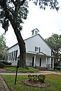
Isle of Hope United Methodist Church
The Isle of Hope United Methodist Church is another important historic place on the island. It was built before the Civil War. During the war, Confederate soldiers used the church property as a camp and the church building as a hospital. While recovering, soldiers carved their initials into the church pews, which they used as makeshift beds. Luckily, when the old church burned down during a renovation in 1984, these pews had been removed and were saved. Thirty-three Confederate soldiers are buried in the churchyard. In 2000, the church added new sections called transepts to its main building.
Isle of Hope in Movies
The island's beauty and history have attracted many Hollywood movies. Some famous films shot here include the Oscar-winning Glory, the original Cape Fear, The Last of the Belles, Forrest Gump, and The Last Song.
Geography of Isle of Hope
Isle of Hope is located southeast of Savannah. It's the northern part of a land area completely surrounded by tidal waters. These waters include the Moon River and Herb River to the northwest, Grimball Creek to the northeast, and the Skidaway River and Skidaway Narrows (part of the Intracoastal Waterway) to the southeast.
The community is next to Dutch Island to the northeast and Skidaway Island to the southeast. Isle of Hope also includes the smaller communities of Parkersburg and Wymberley.
The total area of Isle of Hope is about 5.9 square kilometers (2.28 square miles). Most of this is land (4.7 square kilometers or 1.96 square miles), and about 1.2 square kilometers (0.32 square miles) is water.
Population of Isle of Hope
| Historical population | |||
|---|---|---|---|
| Census | Pop. | %± | |
| 1990 | 2,637 | — | |
| 2000 | 2,605 | −1.2% | |
| 2010 | 2,402 | −7.8% | |
| 2020 | 2,357 | −1.9% | |
| U.S. Decennial Census 1850-1870 1870-1880 1890-1910 1920-1930 1940 1950 1960 1970 1980 1990 2000 2010 2020 |
|||
Isle of Hope was first counted as a census-designated place in the 1990 U.S. Census. In 2020, its population was 2,357 people.
Education in Isle of Hope

Isle of Hope is part of the Savannah-Chatham County Public Schools system. The main school in the area is:
- Isle of Hope K-8 School
Notable People from Isle of Hope
Some well-known people have connections to Isle of Hope:
- Anna Davenport Raines: She was a founding vice president of the United Daughters of the Confederacy.
- Clarence Thomas: He is a judge on the highest court in the United States, the Supreme Court. He attended a seminary on the Isle of Hope in the 1960s.
- Jack Kingston: He was a former representative for Georgia's 1st District in the U.S. Congress.
Gallery
-
Isle of Hope United Methodist Church
-
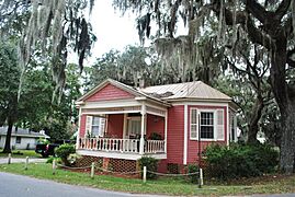
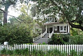
Isle of Hope Historic District
-
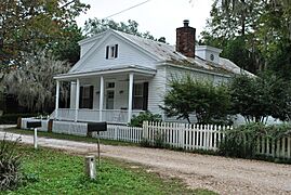
Isle of Hope Historic District
-
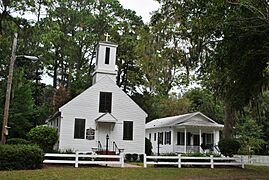
Our Lady of Good Hope Catholic Chapel
-
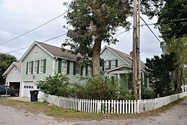
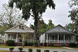
Isle of Hope Historic District
-
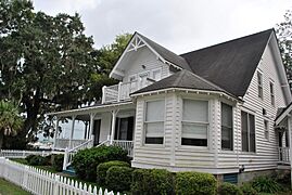
Isle of Hope Historic District
-
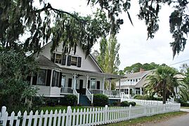
Isle of Hope Historic District
-
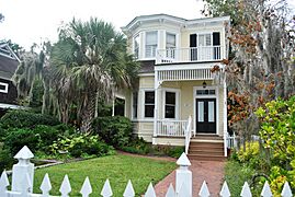
Isle of Hope Historic District
-
Isle of Hope Historic District
-
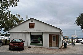
Isle of Hope Marina, 1926
-
Isle of Hope Historic District


See also
 In Spanish: Isle of Hope para niños
