Jay Cooke State Park facts for kids
Quick facts for kids Jay Cooke State Park |
|
|---|---|
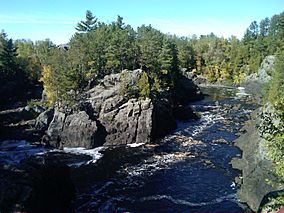
The St. Louis River in Jay Cooke State Park
|
|
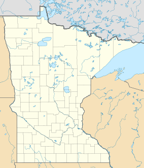
| Location | Carlton, Minnesota, United States |
| Area | 8,125 acres (32.88 km2) |
| Elevation | 928 ft (283 m) |
| Established | 1915 |
| Governing body | Minnesota Department of Natural Resources |
|
Jay Cooke State Park CCC/Rustic Style Historic District
|
|
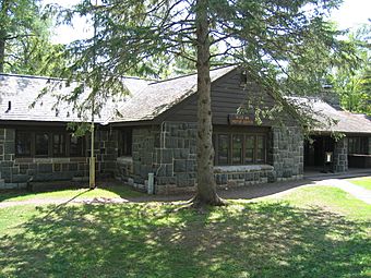
The River Inn is the visitor center for the park and was built by the Civilian Conservation Corps
|
|
| Location | Carlton County, Minnesota, Off MN 210 east of Carlton |
|---|---|
| Nearest city | Carlton, Minnesota |
| MPS | Minnesota State Park CCC/WPA/Rustic Style MPS |
| NRHP reference No. | 89001665 |
| Added to NRHP | June 11, 1992 |
|
Jay Cooke State Park CCC/WPA/Rustic Style Picnic Grounds
|
|
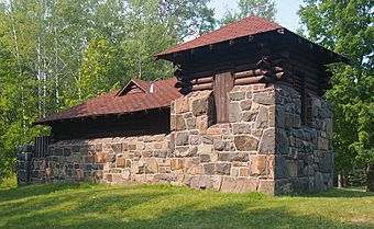
1934 water tower/latrine at Oldenburg Point
|
|
| Location | Off MN 210 SE of Forbay Lake, Thomson Township |
|---|---|
| MPS | Minnesota State Park CCC/WPA/Rustic Style MPS |
| NRHP reference No. | 92000640 |
| Added to NRHP | June 11, 1992 |
|
Jay Cooke State Park CCC/WPA/Rustic Style Service Yard
|
|
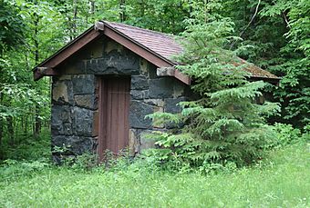 |
|
| Location | Off MN 210 E of Forbay Lake, Thomson Township |
|---|---|
| MPS | Minnesota State Park CCC/WPA/Rustic Style MPS |
| NRHP reference No. | 92000642 |
| Added to NRHP | June 11, 1992 |
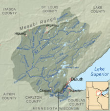
Jay Cooke State Park is a super cool state park in Minnesota, USA! It's about 10 miles (16 km) southwest of a city called Duluth. This park is really popular, with hundreds of thousands of people visiting each year. In 2015, the park celebrated its 100th birthday!
One of the most amazing parts of the park is a rocky gorge, which is like a deep, narrow valley, that stretches for about 13 miles (21 km). Long ago, this gorge was a huge challenge for Native Americans and early European travelers in their canoes. They had to go around it using a tough path called the Grand Portage of the St. Louis River. Today, this historic trail and some old park buildings from the 1930s are listed on the National Register of Historic Places.
Contents
Park History and Development
The land for Jay Cooke State Park was first given to Minnesota in 1915. This first gift was about 2,350 acres (9.5 km2) from the Saint Louis Power Company. For a while, the park didn't have many buildings or trails.
The Civilian Conservation Corps
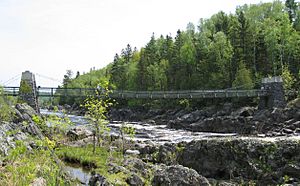
Things changed a lot in 1933 when a group called the Civilian Conservation Corps (CCC) set up a camp there. The CCC was a program during the Great Depression that helped young men find work. These workers built a rustic swinging bridge over the St. Louis River and a picnic shelter. The first CCC camp closed in 1935.
Another CCC camp opened in 1939. This group rebuilt the swinging bridge and constructed the River Inn. The River Inn is now the park's visitor center. The CCC program ended in 1942. After that, Minnesota added more land to the park, making it its current size of about 8,818 acres (3,569 ha).
Recent Challenges: The 2012 Flood
In 2012, the Duluth area had a huge rainstorm. This caused major flooding that filled the gorge with debris. The flood also damaged many of the park's roads and trails. Sadly, the historic Swinging Bridge was destroyed.
But don't worry! By 2014, a lot of repair work had been done. Most of the trails were fixed, and a new bridge was built. More work is still happening to make the park even better.
The Grand Portage: An Ancient Canoe Route
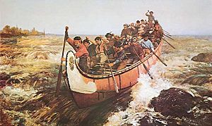
Long ago, before roads and cars, people traveled by canoe. The rocky gorge of the St. Louis River was too dangerous for canoes. So, Native Americans created a path around it. Later, French-Canadian travelers, called voyageurs, also used this path. They called it the "Grand Portage of the St. Louis."
Life as a Voyageur
The Grand Portage was a tough 6.5-mile (10.5 km) trail. It had steep hills and swamps. It started near what is now the Fond du Lac area and climbed about 450 feet (137 m) up to the city of Carlton. From Carlton, travelers could continue to Lake Vermilion or the Mississippi River.
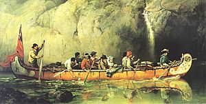
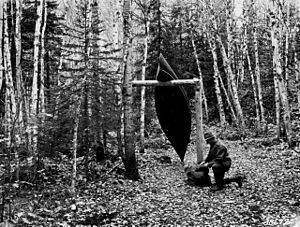
The portage was divided into 19 "pauses," which were resting spots about a third to half a mile apart. Voyageurs were incredibly strong! Each one carried two or three heavy packs, weighing up to 90 pounds (41 kg) each. They used a special strap called a portage strap that went around their forehead to help carry the load.
Once a voyageur reached a "pause" with his load, he would jog back to the last stop to get more packs. It usually took a crew three to five days to finish the Grand Portage. It was backbreaking work, and they often got covered in mud and mosquito bites.
The Grand Portage was used until about 1870. Then, new railroads made it easier to transport goods. Also, the fur trade slowed down. Today, part of the trail has been fixed up for hiking. You can find more information about it at the park's visitor center.
Geology of the Park
The rocky riverbed near the swinging bridge is a famous part of Jay Cooke State Park. But other parts of the park show signs of glaciation. This means huge sheets of ice (glaciers) once covered the land.
Most of the park sits on red clay. This clay was left behind 10,000 years ago at the bottom of a giant ancient lake. On the south side of the river, you can see several steep, curving valleys. These were once bends in the river. Over time, the river cut deeper through the old lake sediments. It eventually reached the very old bedrock, which is about 1.9 billion years old! This cutting created the rocky, 13-mile (21 km) gorge you see today.
Wildlife in Jay Cooke State Park
Jay Cooke State Park is home to many different animals! You can find 46 types of mammals here. It's an important place for White-tailed deer to spend the winter. You might even spot Black Bears, Wolf packs, and Coyotes in the park.
The park is also a great place for birdwatching, with 173 different bird species. Look for the Pileated Woodpecker, Northern Harrier, and the tall Great Blue Heron. There are also 16 types of reptiles in the park, and don't worry, none of them are venomous!
Recreation and Activities
Jay Cooke State Park is an awesome place for outdoor fun! It has over 50 miles (80 km) of hiking trails. Many of these trails offer amazing views of the Saint Louis River.
Biking and Other Trails
Some trails, like the Greely Creek Trail, Triangle Trail, and Gill Creek Trail, are also open for mountain biking. The Willard Munger State Trail goes right through the park. From here, you can bike or skate all the way to Duluth, which is about 15 miles (24 km) away. This part of the trail has beautiful views of the Duluth harbor. You can also see cuts in the rock that were made when the St. Paul and Duluth Railroad was built.
Fun for Everyone
The park offers many activities, including:
- Camping
- Hiking
- Biking
- Cross-country skiing
- Kayaking
Park rangers lead over 400 nature events every year! These include nature walks, evening campfire talks, and even lessons on how to build snowshoes. They also offer geocaching, which is like a treasure hunt using GPS.
For kids and families, the park has "I Can!" programs. These classes and guides help you learn skills like camping, canoeing, fishing, and archery.
Fishing in the Park
If you like fishing, you can catch Brown trout in the Saint Louis River. In slower parts of the river, you might find walleye and northern pike. Brook trout can be found in Silver and Otter creeks. There are two dams on the Saint Louis River near the park: the Thomson Dam and the Fond du Lac Dam.
Interesting Facts About Jay Cooke State Park
- The park is named after Jay Cooke, a Pennsylvania financier. He helped develop a power plant nearby, which is still used today.
- The oldest rock you can see in the park is called the Thomson Formation. It's incredibly old, dating back 1.9 billion years!
- The most famous landmark is the swinging bridge. It's 200 feet (61 m) long, with 126 feet (38 m) of it stretching over the river.
- The North Country National Scenic Trail passes through the park. This is the longest of the eleven National Scenic Trails, stretching about 4,600 miles (7,400 km)!
- Minnesota State Highway 210 runs right through Jay Cooke State Park.
- The 9-mile (14 km) section of Highway 210 between Carlton and Highway 23 is called the Rushing Rapids Parkway. It's a state scenic byway because of its beautiful views.
 | Precious Adams |
 | Lauren Anderson |
 | Janet Collins |


