
Jellico, Tennessee facts for kids
Quick facts for kids
Jellico, Tennessee
|
|
|---|---|
|
City
|
|

North Main Street
|
|

Location of Jellico in Campbell County, Tennessee.
|
|

Jellico, Tennessee
Location in Tennessee
|
|
| Country | United States |
| State | Tennessee |
| County | Campbell |
| Founded | 1878 |
| Incorporated | 1883 |
| Named for | Jellico coal |
| Area | |
| • Total | 6.29 sq mi (16.29 km2) |
| • Land | 6.22 sq mi (16.11 km2) |
| • Water | 0.07 sq mi (0.19 km2) |
| Elevation | 971 ft (296 m) |
| Population
(2020)
|
|
| • Total | 2,154 |
| • Density | 346.36/sq mi (133.74/km2) |
| Time zone | UTC-5 (Eastern (EST)) |
| • Summer (DST) | UTC-4 (EDT) |
| ZIP code |
37762
|
| Area code(s) | 423 |
| FIPS code | 47-38020 |
| GNIS feature ID | 1289336 |
Jellico is a city located in Campbell County, Tennessee, in the United States. It sits right on the border with Kentucky. Jellico is about 58 miles north of Knoxville by road. In 2010, about 2,355 people lived there.
Contents
History of Jellico
The name "Jellico" comes from a local change of the word "angelica." This is the name of an herb that grows a lot in the mountains around the city. The name was first used for the mountains to the west. It also named Jellico Creek, which flows about 5 miles west of the city. This creek eventually empties into the Cumberland River near Williamsburg, Kentucky.

In the early 1880s, a special type of coal was found in the Jellico Mountains. This coal was known for being very good quality. When railroad tracks were built to the area in 1883, many coal mines quickly started operating. The city of Jellico was first called "Smithburg" when it was founded in 1878. However, its name was changed to "Jellico" in 1883. This was done to connect the city with the popular Jellico coal. The city officially became a town on March 7, 1883.
During the 1890s and early 1900s, Jellico was one of the busiest coal mining areas in Kentucky and Tennessee. In 1906, a train car full of dynamite exploded in Jellico. This accident destroyed part of the town. However, the town recovered quickly. Many of the buildings you see on Main Street today were built around this time.
On July 6, 1944, a serious train accident happened near Jellico. A troop train derailed, causing some cars to fall into Clear Fork. This was a very sad event.
Later, in 1971, Indian Mountain State Park was created. This park was built on the site of an old strip mine in western Jellico. In 1999, many buildings on North and South Main Street were added to the National Register of Historic Places. This area is now known as the Jellico Commercial Historic District.
Geography of Jellico
Jellico is located right on the northern border of Tennessee. The city is nestled among the Cumberland Mountains. It sits in the valley of Elk Creek, which flows north into Kentucky. Jellico is built on the lower parts of three steep hills. These hills separate the Elk Creek valley from the larger Clear Fork valley to the east.
A tall hill called Indian Mountain rises almost 1,000 feet above Jellico to the west. You can see this mountain from most parts of the city. This mountain and a nearby lake are now part of Indian Mountain State Park. The even larger Jellico Mountain is beyond Indian Mountain to the west. To the east, beyond the Clear Fork Valley, you can see Pine Mountain.
Jellico's main area is around where two important roads meet. These are U.S. Route 25W (North Main Street and 5th Street) and Tennessee State Route 297 (South Main Street). U.S. Route 25W connects Jellico to Interstate 75 to the southeast. It also goes north to Corbin, Kentucky. Tennessee State Route 297 connects Jellico with Huntsville to the southwest. The border between Tennessee and Kentucky is Jellico's northern edge. However, some homes and businesses connected to the city are on both sides of the border.
The city covers a total area of about 6.4 square miles (16.5 square kilometers). Most of this area, about 6.2 square miles (16.3 square kilometers), is land. A small part, about 0.08 square miles (0.2 square kilometers), is water.
Population of Jellico
| Historical population | |||
|---|---|---|---|
| Census | Pop. | %± | |
| 1890 | 758 | — | |
| 1900 | 1,283 | 69.3% | |
| 1910 | 1,862 | 45.1% | |
| 1920 | 1,878 | 0.9% | |
| 1930 | 1,530 | −18.5% | |
| 1940 | 1,581 | 3.3% | |
| 1950 | 1,556 | −1.6% | |
| 1960 | 2,210 | 42.0% | |
| 1970 | 2,235 | 1.1% | |
| 1980 | 2,798 | 25.2% | |
| 1990 | 2,447 | −12.5% | |
| 2000 | 2,448 | 0.0% | |
| 2010 | 2,355 | −3.8% | |
| 2020 | 2,154 | −8.5% | |
| Sources: | |||
As of the 2020 United States census, there were 2,154 people living in Jellico. There were 974 households and 526 families in the city.
Economy in Jellico
The biggest employer in Jellico is the Jellico Community Hospital. It provides jobs for about 350 people.
You can find several restaurants, hotels, and gas stations near Jellico's exit from Interstate 75 (Exit 160). There is also a Tennessee Welcome Center along the interstate, just south of the state line. This center helps travelers with information about Tennessee.
Religion in Jellico
Since 1922, Jellico has been the main office for the Church of God Mountain Assembly. This is a Christian church group that is part of the holiness Pentecostal tradition.
Notable People from Jellico
Jellico was the childhood home of two famous people. One was Grace Moore, a talented singer who starred in opera, musical theater, and movies. The other was Homer Rodeheaver, who wrote hymns, played the trombone, and was one of the first people to record sacred music.
Gallery
-
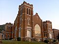
First Baptist Church
-
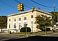
Jellico Post Office
-
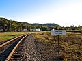
Railroad tracks at the state line
-
Grace Moore monument at Veterans Memorial Park


See also
 In Spanish: Jellico (Tennessee) para niños
