
Johnson County, Nebraska facts for kids
Quick facts for kids
Johnson County
|
|
|---|---|

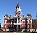
Johnson County Courthouse in Tecumseh
|
|

Location within the U.S. state of Nebraska
|
|
 Nebraska's location within the U.S. |
|
| Country | |
| State | |
| Founded | 1855 (founded) 1857 (organized) |
| Named for | Richard Mentor Johnson |
| Seat | Tecumseh |
| Largest city | Tecumseh |
| Area | |
| • Total | 377 sq mi (980 km2) |
| • Land | 376 sq mi (970 km2) |
| • Water | 0.7 sq mi (2 km2) 0.2%% |
| Population
(2020)
|
|
| • Total | 5,290 |
| • Estimate
(2021)
|
5,316 |
| • Density | 14.03/sq mi (5.418/km2) |
| Time zone | UTC−6 (Central) |
| • Summer (DST) | UTC−5 (CDT) |
| Congressional district | 3rd |
Johnson County is a county located in the state of Nebraska, United States. In 2020, about 5,290 people lived here. The main town and county seat is Tecumseh.
The county was created in 1855 and officially started in 1857. It was named after Richard Mentor Johnson. He was an important person who served as the Vice President of the United States from 1837 to 1841. Johnson County is also known by the number 57 on Nebraska license plates. This is because it had the 57th largest number of vehicles when the system began in 1922.
Contents
Exploring Johnson County's Geography
Johnson County has gentle, rolling hills. Most of these flat-topped hills are used for farming. The Big Nemaha River flows through the middle of the county, heading southeast.
The county covers a total area of about 377 square miles (976 square kilometers). Most of this is land, with only a small amount of water. Johnson County is the fourth-smallest county in Nebraska by size.
Main Roads in Johnson County
Major roads help people travel and transport goods across the county. Here are some of the main highways:
 U.S. Highway 136
 Nebraska Highway 41
 Nebraska Highway 50
 Nebraska Highway 62
Neighboring Counties
Johnson County shares its borders with several other counties:
- Otoe County - to the north
- Nemaha County - to the east
- Pawnee County - to the south
- Gage County - to the west
- Lancaster County - to the northwest
Population Changes Over Time
| Historical population | |||
|---|---|---|---|
| Census | Pop. | %± | |
| 1860 | 528 | — | |
| 1870 | 3,429 | 549.4% | |
| 1880 | 7,595 | 121.5% | |
| 1890 | 10,333 | 36.1% | |
| 1900 | 11,197 | 8.4% | |
| 1910 | 10,187 | −9.0% | |
| 1920 | 8,940 | −12.2% | |
| 1930 | 9,157 | 2.4% | |
| 1940 | 8,662 | −5.4% | |
| 1950 | 7,251 | −16.3% | |
| 1960 | 6,281 | −13.4% | |
| 1970 | 5,743 | −8.6% | |
| 1980 | 5,285 | −8.0% | |
| 1990 | 4,673 | −11.6% | |
| 2000 | 4,488 | −4.0% | |
| 2010 | 5,217 | 16.2% | |
| 2020 | 5,290 | 1.4% | |
| 2021 (est.) | 5,316 | 1.9% | |
| US Decennial Census 1790-1960 1900-1990 1990-2000 2010-2013 |
|||
The population of Johnson County has changed quite a bit over the years. In 1860, there were only 528 people. The population grew steadily until 1900, when it reached over 11,000. After that, it slowly decreased for many decades.
More recently, the population has started to grow again. In 2020, the county had 5,290 residents. This shows how communities can change and grow over time.
Towns and Villages in Johnson County
Johnson County is home to several communities, including one city and a few villages.
City
- Tecumseh (This is the county seat, meaning it's the center for county government.)
Villages
Unincorporated Communities
These are smaller places that are not officially organized as cities or villages.
Education in Johnson County
Students in Johnson County attend schools in various public school districts. These districts work to provide education for children and teens across the county.
Some of the school districts include:
- Freeman Public Schools
- Humboldt Table Rock Steinauer Public Schools
- Johnson-Brock Public Schools
- Johnson County Central Public Schools
- Lewiston Consolidated Schools
- Sterling Public Schools
- Syracuse-Dunbar-Avoca Schools
The Tecumseh Public Schools district used to exist but merged with other schools in 2007.
Images for kids
-
Johnson County Courthouse in Tecumseh
See also
 In Spanish: Condado de Johnson (Nebraska) para niños
