Gage County, Nebraska facts for kids
Quick facts for kids
Gage County
|
|
|---|---|

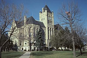
Gage County Courthouse in Beatrice, 1976
|
|

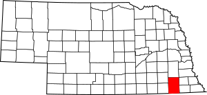
Location within the U.S. state of Nebraska
|
|
 Nebraska's location within the U.S. |
|
| Country | |
| State | |
| Founded | 1855 (authorized) 1857 (organized) |
| Seat | Beatrice |
| Largest city | Beatrice |
| Area | |
| • Total | 860 sq mi (2,200 km2) |
| • Land | 852 sq mi (2,210 km2) |
| • Water | 8.5 sq mi (22 km2) 1.0%% |
| Population | |
| • Estimate
(2021)
|
21,616 |
| • Density | 25.4/sq mi (9.8/km2) |
| Time zone | UTC−6 (Central) |
| • Summer (DST) | UTC−5 (CDT) |
| Congressional district | 3rd |
Gage County is a special area of land in the state of Nebraska, United States. It's like a big neighborhood with its own government. In 2020, about 21,704 people lived here. The main town, or county seat, is Beatrice.
Gage County was officially started in 1855 and got its government set up in 1857. The land for the county came from the Otoe people through a treaty in 1854. The county is named after William D. Gage. He was a Methodist minister and the first chaplain for the Nebraska Territorial Legislature.
Gage County is part of the Beatrice, NE Micropolitan Statistical Area. This means it's a smaller city area that's connected to a larger city area, like Lincoln.
If you look at Nebraska license plates, Gage County has the number 3. This is because it had the third-highest number of registered vehicles when the license plate system began in 1922.
Contents
Geography
Gage County is located on the southern edge of Nebraska. Its southern border touches the northern border of Kansas. The Big Blue River flows through the middle of the county, heading south.
The county covers a total area of about 860 square miles. Most of this (851 square miles) is land, and a small part (8.5 square miles) is water.
Main Roads
Neighboring Counties
Gage County shares its borders with several other counties:
- Lancaster County to the north
- Otoe County to the northeast
- Johnson County to the northeast
- Pawnee County to the east
- Marshall County, Kansas to the southeast
- Washington County, Kansas to the southwest
- Jefferson County to the west
- Saline County to the northwest
Special Areas
- Homestead National Monument is a historic site in Gage County.
- Rockford Lake State Recreation Area is a place for outdoor fun.
People of Gage County
| Historical population | |||
|---|---|---|---|
| Census | Pop. | %± | |
| 1860 | 421 | — | |
| 1870 | 3,359 | 697.9% | |
| 1880 | 13,164 | 291.9% | |
| 1890 | 36,344 | 176.1% | |
| 1900 | 30,051 | −17.3% | |
| 1910 | 30,325 | 0.9% | |
| 1920 | 29,721 | −2.0% | |
| 1930 | 30,242 | 1.8% | |
| 1940 | 29,588 | −2.2% | |
| 1950 | 28,052 | −5.2% | |
| 1960 | 26,818 | −4.4% | |
| 1970 | 25,731 | −4.1% | |
| 1980 | 24,456 | −5.0% | |
| 1990 | 22,794 | −6.8% | |
| 2000 | 22,993 | 0.9% | |
| 2010 | 22,311 | −3.0% | |
| 2020 | 21,704 | −2.7% | |
| 2021 (est.) | 21,616 | −3.1% | |
| US Decennial Census 1790-1960 1900-1990 1990-2000 2010-2013 |
|||
In 2000, there were about 22,993 people living in Gage County. Most people in the county were White (97.69%). A small number were Black or African American (0.32%), Native American (0.58%), or Asian (0.28%). About 0.85% of the population was Hispanic or Latino.
Many families lived in the county. About 30% of households had children under 18. The average age of people in Gage County was 40 years old.
Communities
Gage County has several towns and villages where people live.
Cities
- Beatrice (This is the county seat, the main town)
- Blue Springs
- Wymore
Villages
Census-designated place
Unincorporated communities
These are smaller places that don't have their own local government.
See also
 In Spanish: Condado de Gage para niños
 | William L. Dawson |
 | W. E. B. Du Bois |
 | Harry Belafonte |

