
Johnson Valley, California facts for kids
Quick facts for kids
Johnson Valley
|
|
|---|---|

Johnson Valley
Location in California

Johnson Valley
Location in the United States
|
|
| Country | United States |
| State | California |
| County | San Bernardino |
| Population
(2000)
|
|
| • Total | 2,181 |
| Time zone | UTC-8 (Pacific (PST)) |
| • Summer (DST) | UTC-7 (PDT) |
| ZIP Code |
92285
|
| Area code(s) | 760 |
Johnson Valley is a small, quiet community in San Bernardino County, located in Southern California. It's nestled in the Mojave Desert, a large desert area. You can find it north of Highway 247, between the Victor Valley and Morongo Basin areas.
This area is part of what people call the High Desert region of California. To its south are the San Bernardino Mountains. To the west is Lucerne Valley, and to the east is Landers. Geographically, Johnson Valley is like the eastern part of the larger Lucerne Valley. It opens up to the Homestead Valley in the southeast, connecting to communities like Flamingo Heights, Landers, and Yucca Valley.

People Living in Johnson Valley
Johnson Valley shares its postal code (92285) with the nearby community of Landers. When you combine the populations of both Landers and Johnson Valley, there were about 2,200 residents in 2013.
Cool Places to See
Johnson Valley is known for its desert areas. One interesting spot is Rock Corral. There are also several places with ancient rock carvings, called petroglyphs, in the northern parts of the Chaparral Desert. These are south of Pisgah Crater, which is an old volcano. Johnson Valley is also the western entrance to Big Bear Lake, California, a popular mountain getaway.
-
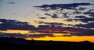
Old Woman Springs Ridge, Johnson Valley California
-
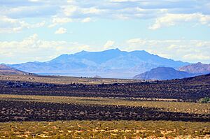
Johnson Valley looking north


Fun Outdoor Activities
Johnson Valley is famous for its OHV (Off-Highway Vehicle) area. This is a large piece of land managed by the Bureau of Land Management (BLM) where people can ride off-road vehicles like dirt bikes and ATVs.
The OHV area has clear borders:
- To the north, it's near Interstate 40.
- To the west, it's along Highway 247, which goes towards Barstow.
- To the east, it's next to Emerson Dry Lake and the US Marine Corps Air Ground Combat Center.
Off-road fans love a challenging course here called "The Hammers." This is a triangular off-road track located near Bessemer Mine Road, at the southern tip of Soggy Lake. A very popular off-road desert race called King of the Hammers uses the trails found in "The Hammers" area.
There are plans for the US Marine Corps base to expand. This expansion might include taking over parts of the OHV area, which could mean that access to these popular off-road tracks might be closed permanently in the future.
