Lucerne Valley, California facts for kids
Quick facts for kids
Lucerne Valley
|
||
|---|---|---|
 |
||
|
||
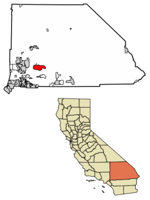
Location in San Bernardino County and the state of California
|
||
| Country | ||
| State | ||
| County | San Bernardino | |
| Area | ||
| • Total | 105.590 sq mi (273.477 km2) | |
| • Land | 105.590 sq mi (273.477 km2) | |
| • Water | 0 sq mi (0 km2) 0% | |
| Elevation | 2,953 ft (900 m) | |
| Population
(2020)
|
||
| • Total | 5,331 | |
| • Density | 50.488/sq mi (19.4934/km2) | |
| Time zone | UTC-8 (Pacific (PST)) | |
| • Summer (DST) | UTC-7 (PDT) | |
| ZIP code |
92356
|
|
| Area codes | 442/760 | |
| GNIS Feature IDs | 272271; 2627937 | |
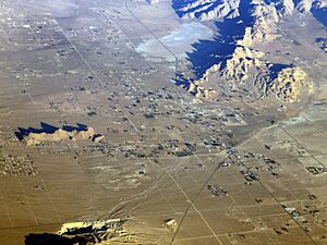
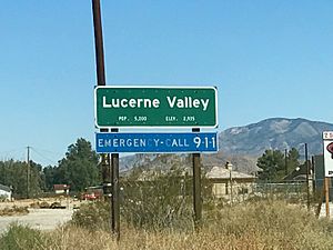
Lucerne Valley is a special kind of community called a census-designated place (CDP). This means it's an area that looks like a town but isn't officially a city with its own local government. It's also a valley (a low area between hills or mountains) located in the southern part of the Mojave Desert in San Bernardino County, California.
Contents
Exploring Lucerne Valley's Location
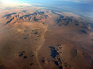
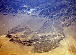
Lucerne Valley is surrounded by mountains like the Granite Mountains, Ord Mountains, and San Bernardino Mountains. It's about 19 miles (31 km) east of Apple Valley and 20 miles (32 km) north of Big Bear Lake. Other nearby towns include Yucca Valley (45 miles or 72 km east) and Barstow (26 miles or 42 km north).
The main roads that help people get around Lucerne Valley are State Route 247 and State Route 18. These highways connect through other local roads. The entire area of Lucerne Valley covers about 105.6 square miles (273.5 km2), and it's all land.
Weather in Lucerne Valley
Lucerne Valley has a semi-arid climate. This means it's generally dry, but not as dry as a true desert. It gets some rain, but not a lot.
People of Lucerne Valley
In 2010, about 5,811 people lived in Lucerne Valley. Most people (about 77.6%) were White, and about 24.9% were of Hispanic or Latino background. The average age of people living here was about 42.7 years old. Most people lived in homes, and about 65.4% of them owned their homes.
Community Development
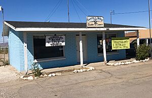
Most of the land in Lucerne Valley is used for homes in rural areas or for protecting natural resources. There are also some areas set aside for businesses, mainly along State Route 18. These businesses often have a shop in the front and a home behind it on the same property. In 2015, a Dollar General store opened, which was the first big chain grocery store in the area.
Most of the homes in Lucerne Valley were built before the 1990s. New homes are usually built one by one on private land, rather than in large housing developments.
Utilities and Services
Many projects in Lucerne Valley involve using local resources for the whole state of California. For example, there are plans for solar power plants that will send electricity to the state. Water is also collected for use by the Los Angeles Department of Water and Power.
Electricity for the entire town comes from Southern California Edison. Other services like gas, water, and trash collection can vary depending on where you live in the valley. There's also a county landfill located in the northeast part of the area.
Schools in Lucerne Valley
Most students in Lucerne Valley attend schools in the Lucerne Valley Unified School District. There are three main schools:
- Lucerne Valley Elementary School (for grades K–5), built in 1952.
- Lucerne Valley Middle School (for grades 6–8), built in 1986.
- Lucerne Valley High School (for grades 6–12), built in 1992. The first class graduated from the high school in 1995.
The school district office and other programs are now located at the old middle school site.
Local Economy
One of the main businesses in Lucerne Valley is the Mitsubishi Cement plant, called the Cushenbury plant. It's a big part of the local economy.
Interesting Places and Features
- Lucerne Dry Lake and Rabbit Springs Dry Lake: These are two dry lakes in the valley. Sometimes, small meteorites are found here! A special and rare wildflower called Parish's popcornflower grows near Rabbit Springs Dry Lake.
- Blackhawk Landslide: This is a huge, ancient landslide in the southeast part of Lucerne Valley. It's one of the biggest ever found in North America!
- Chimney Rock: This place is a registered California Historical Landmark. It's where the last battle between early settlers and a Native American tribe happened in the Mojave Desert on February 16, 1867. A historical marker is located near Highway 18 to tell visitors about this important event.
- King Clone: East of Lucerne Valley, you can find the oldest creosote bush ring in the Mojave Desert. It's called King Clone and is a very old plant!
Parks and Outdoor Fun
Lucerne Valley has several parks for everyone to enjoy:
- Pioneer Park: This is the main park for the community and is used for most public events. The Lucerne Valley Museum is also located here, where you can take self-guided tours.
- Midway Park: This park has the Midway Schoolhouse and an Equestrian Arena for horse riding.
- Visalia Park: This used to be a pool club, but after it closed, the pool was filled in and turned into a town park.
- Johnson Valley OHV Area: This is a popular place for off-road vehicles, like dirt bikes and ATVs. It's mostly in Johnson Valley, but borders Lucerne Valley. A famous race called the King of the Hammers happens here every year.
- Mojave Trails National Monument: This large protected area is located to the east and north of Lucerne Valley, offering beautiful desert landscapes.
See also
 In Spanish: Lucerne Valley para niños
 | Bayard Rustin |
 | Jeannette Carter |
 | Jeremiah A. Brown |


