Jonesboro, Texas facts for kids
Quick facts for kids
Jonesboro, Texas
|
|
|---|---|
| Country | United States |
| State | Texas |
| County | Coryell and Hamilton |
| Time zone | UTC-6 (Central (CST)) |
| • Summer (DST) | UTC-5 (CDT) |
| ZIP code |
76538
|
| Area code(s) | 254 |
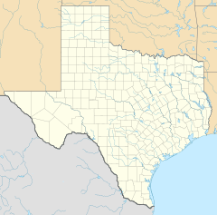
Jonesboro is a small community in Central Texas, United States. It's not a city with its own government, so it's called an "unincorporated community." Jonesboro is located in both Coryell and Hamilton counties. The part of Jonesboro in Coryell County is also part of a larger area called the Killeen–Temple–Fort Hood Metropolitan Statistical Area. This means it's connected to the bigger cities of Killeen and Temple. The community also has its own post office, run by the United States Postal Service.
Contents
History of Jonesboro
Early Settlement and Growth
Jonesboro began to form after the American Civil War. In 1866, two brothers, William L. and David Jones, built a special mill. This mill used steam power to cut wood (a sawmill) and grind grain (a gristmill) near the Leon River. Because of their mill, the area first became known as Jones Mill.
From 1869 to 1873, the local church and a group called the Masons shared a big building. In 1871, the community got its own post office. Charles Pate was the first person in charge of it.
Name Change and Population Boom
The community's name officially changed to Jonesboro in 1877. By the mid-1880s, about 350 people lived there. They had two steam-powered gristmills, machines to separate cotton fibers (called cotton gins), a sawmill, and three churches.
In the next ten years, Jonesboro grew a lot, and its population reached 700 people.
Changes and Decline
However, the population started to shrink after 1911. This happened because the Stephenville North and South Texas Railway built its tracks in a different area, bypassing Jonesboro. By 1914, the population had dropped to 450.
Even though the economy got a bit better in the 1930s, the community faced another challenge. When Texas State Highway 36 was built, it also didn't go directly through the heart of Jonesboro. This led to another decline. From the 1930s to the mid-1960s, the population stayed around 378. It continued to fall, reaching about 200 people from the mid-1970s through the year 2000.
Geography and Location
Jonesboro is found where two roads meet: Texas State Highway 36 and Farm to Market Road 1602. It's located about 19 miles (31 km) northwest of Gatesville. It's also about 13 miles (21 km) southeast of Hamilton. If you travel west from Waco, Jonesboro is about 57 miles (92 km) away. The community sits right on the border between Hamilton and Coryell counties.
Climate in Jonesboro
The weather in Jonesboro has hot and humid summers. The winters are usually mild to cool. This type of weather is called a humid subtropical climate. On climate maps, you might see this type of climate abbreviated as "Cfa."
Education in Jonesboro
In the mid-1880s, Jonesboro had its own school. It was held in the same building that the church and Masonic organization used. Today, the community is served by the Jonesboro Independent School District. This school district includes the Jonesboro School, which provides education for the local students.
Notable Person from Jonesboro
- Cloyce Box: He was a football player who played for the Jonesboro School team. His brother, Boyce, also played football there.
 | Kyle Baker |
 | Joseph Yoakum |
 | Laura Wheeler Waring |
 | Henry Ossawa Tanner |


