Jordan Valley, Oregon facts for kids
Quick facts for kids
Jordan Valley, Oregon
|
|
|---|---|
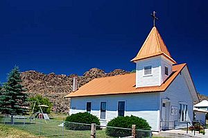
The Jordan Valley Methodist Church
|
|
| Motto(s):
"Heart of the Owyhees"
|
|
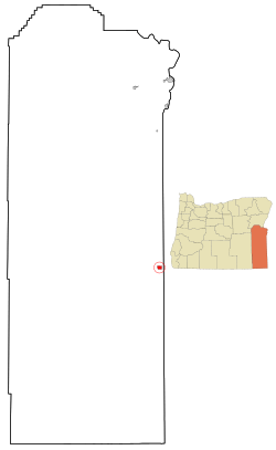
Location in Oregon
|
|
| Country | United States |
| State | Oregon |
| County | Malheur |
| Incorporated | 1911 |
| Area | |
| • Total | 2.08 sq mi (5.39 km2) |
| • Land | 2.08 sq mi (5.39 km2) |
| • Water | 0.00 sq mi (0.00 km2) |
| Elevation | 4,385 ft (1,337 m) |
| Population
(2020)
|
|
| • Total | 130 |
| • Density | 62.50/sq mi (24.13/km2) |
| Time zone | UTC-7 (Mountain) |
| • Summer (DST) | UTC-6 (Mountain) |
| ZIP code |
97910
|
| Area code(s) | 458 and 541 |
| FIPS code | 41-37850 |
| GNIS feature ID | 1122534 |
| Website | www.cityofjordanvalley.com |
Jordan Valley is a small city in Malheur County, Oregon, United States. It's part of the Ontario, Oregon–ID Micropolitan Statistical Area. The city is located along Jordan Creek, which flows into the Owyhee River. This creek was named after Michael M. Jordan, a gold prospector from the 1800s. In 2010, the city had a population of 181 people.
Contents
History of Jordan Valley
Early Inhabitants: Native American Peoples
The Northern Paiute people were the first to live in the Jordan Valley area. They often visited the nearby mountains and streams to find food. When the first settlers arrived, there were disagreements over resources. This led to a conflict known as the Snake War, which lasted from 1864 to 1868. After the war, the surviving Paiute people were moved to a reservation.
Gold Rush and First Settlements
Non-native settlers came to Jordan Valley mainly because gold was found there in 1863. A group of prospectors discovered gold along Jordan Creek. Soon after, the area was named Jordan Valley, honoring Michael M. Jordan, one of the prospectors. Jean Baptiste Charbonneau, the son of Sacagawea, was one of the early miners who came to this area.
A miner named Silas Skinner built a road to make it easier to reach Jordan Creek. This road went through where Jordan Valley is today. The town quickly became a pack station, a place where miners would wait for the snow to melt so they could get to the mining areas. It also served as a rest stop for travelers going between bigger mining towns like Silver City and De Lamar. In 1867, a post office opened in the cabin of John Baxter, one of the first people to live permanently in Jordan Valley.
Changing Economy: From Mining to Ranching
Around 1875, gold mining in the area started to slow down. Many mining towns, like Silver City, became less populated. To survive, the people of Jordan Valley switched to ranching. By 1867, there were already 11 ranches operating nearby. By 1888, it's estimated that about 100,000 cattle were in the area. Ranching helped the community grow until the Great Depression hit in 1929.
Basque Culture and Immigration
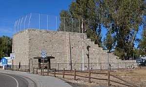
Many Basque immigrants began arriving in Jordan Valley around 1889. José Navarro and Antone Azcuenaga were among the first. Local stories say that soon, about two-thirds of the town's population was Basque. In 1915, a pelota court, called the Pelota Fronton, was built. It is still a historic landmark today.
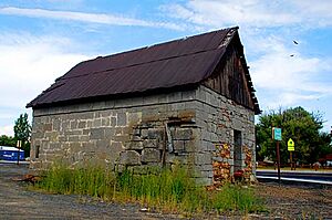
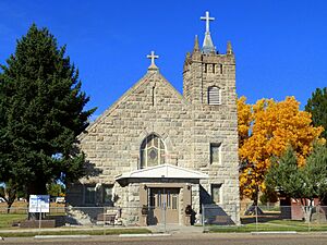
The Basque people also built several sandstone buildings, including three boarding houses. With help from local Irish immigrants, they built the St. Bernard's Catholic Church, which you can still see today. Fewer Basques came to the area after the Taylor Grazing Act of 1934. This law favored cattle ranching over sheep, which was the Basques' preferred livestock. Today, many people in Jordan Valley still identify as having Basque heritage.
Population Changes Over Time
Jordan Valley's population generally got smaller after the 1920s. There was some growth when the DeLamar Mine opened in 1977 and again when it reopened in 1993. During these times, the population grew from 376 to 446. The mine closed in 1999, and by 2016, the population of Jordan Valley was about 175. In 2017, a company bought the mine, and they are still planning for future silver mining operations.
Geography and Local Attractions
Jordan Valley covers about 2.08 square miles (5.39 square kilometers) of land. The most noticeable natural feature near the town is Pharmacy Hill, a flat-topped plateau across Jordan Creek.
The main jobs in Jordan Valley are cattle ranching and sheep herding. Many people who work in these jobs live on ranches outside of town. However, they use Jordan Valley as their main place for shopping and community activities. People living in the city often provide services to tourists traveling on U.S. Route 95, which is a major road between Boise, Idaho and Reno, Nevada.
Jordan Valley is known for great hunting and fishing. It's also close to Jordan Craters, which is an extinct volcanic field. Other popular spots nearby include Leslie Gulch, Cow Lakes, Antelope Reservoir, and Three Forks to the south.
Population Information
| Historical population | |||
|---|---|---|---|
| Census | Pop. | %± | |
| 1900 | 110 | — | |
| 1910 | 200 | 81.8% | |
| 1920 | 355 | 77.5% | |
| 1930 | 306 | −13.8% | |
| 1940 | 274 | −10.5% | |
| 1950 | 236 | −13.9% | |
| 1960 | 204 | −13.6% | |
| 1970 | 196 | −3.9% | |
| 1980 | 473 | 141.3% | |
| 1990 | 364 | −23.0% | |
| 2000 | 239 | −34.3% | |
| 2010 | 181 | −24.3% | |
| 2020 | 130 | −28.2% | |
| source: | |||
2010 Census Details
In 2010, Jordan Valley had 181 people living in 94 households. About 17% of these households had children under 18. Many households were married couples living together (41.5%). The average household had 1.93 people, and the average family had 2.45 people.
The average age of people in the city was 55.9 years old. About 14.9% of residents were under 18. About 32% of the population was 65 years old or older. The population was almost evenly split between males (49.7%) and females (50.3%).
Education in Jordan Valley
Students in Jordan Valley attend schools within the Jordan Valley School District 3. This includes Jordan Valley High School. The part of Malheur County where Jordan Valley is located does not have its own community college district.
See also
 In Spanish: Jordan Valley para niños
 | John T. Biggers |
 | Thomas Blackshear |
 | Mark Bradford |
 | Beverly Buchanan |


