
Joshua Tree, California facts for kids
Quick facts for kids
Joshua Tree, California
|
|
|---|---|
| Joshua Tree | |

Central Joshua Tree in 2013
|
|

Location in San Bernardino County and the state of California
|
|

Joshua Tree, California
Location in the United States
|
|
| Country | |
| State | |
| County | |
| Area | |
| • Total | 37.044 sq mi (95.943 km2) |
| • Land | 37.044 sq mi (95.943 km2) |
| • Water | 0 sq mi (0 km2) 0% |
| Elevation | 2,923 ft (891 m) |
| Population
(2020)
|
|
| • Total | 6,489 |
| • Density | 175.170/sq mi (67.634/km2) |
| Time zone | UTC−08:00 (PST) |
| • Summer (DST) | UTC−07:00 (PDT) |
| ZIP Code |
92252
|
| Area codes | 442/760 |
| FIPS code | 06-37554 |
| GNIS feature ID | 2408454 |
Joshua Tree is a small community in San Bernardino County, California, United States. It's known as a census-designated place (CDP), which means it's a special area counted by the census. In 2020, about 6,489 people lived here.
Joshua Tree is located in the High Desert of California, about 2,700 feet (823 meters) above sea level. The main part of town is found along California State Route 62.
Contents
Geography of Joshua Tree
Joshua Tree is located in the Mojave Desert. It covers about 37 square miles (95.9 square kilometers) of land.
The town is famous for being next to Joshua Tree National Park. It shares borders with other towns like Twentynine Palms to the east and Yucca Valley to the west. The Bartlett Mountains are located northwest of the community.
People and Population

In 2010, the population of Joshua Tree was 7,414 people. Most people lived in homes, while a small number lived in group housing or institutions.
The community is made up of people from many different backgrounds. Most residents were White, with smaller groups of African American, Native American, Asian, and Pacific Islander people. About 17.6% of the population was Hispanic or Latino.
The average age in Joshua Tree in 2010 was about 38.8 years old. About 21.9% of the population was under 18, and 15.7% was 65 or older.

Fun Things to Do
Joshua Tree has some cool places to visit:
- Joshua Tree National Park Visitor Center: This is where you can learn all about Joshua Tree National Park. It's right in downtown Joshua Tree. The park's west entrance is only about 5 miles (8 kilometers) south of town.
- Noah Purifoy Desert Art Museum of Assemblage Art: This is a large outdoor art museum with sculptures and art pieces made from recycled materials by artist Noah Purifoy. It covers 10 acres!
- World Famous Crochet Museum: A unique and quirky museum in the area.
Wildlife in Joshua Tree
The area around Joshua Tree is home to many different animals. Joshua Tree National Park has 57 types of mammals, including bighorn sheep and coyotes. There are also 46 kinds of reptiles, like the desert tortoise, which is becoming rare.
The park is also a great place for birdwatching, with over 250 bird species. You can see common ravens and many migrating birds. In the town of Joshua Tree itself, you might often spot cottontail rabbits, coyotes, roadrunners, and quails.
Famous People
Many interesting people have lived in or been connected to Joshua Tree.
Born in Joshua Tree
- Less Bells, a musician
- Brent Bolthouse, a business person
- Josh Homme (born 1973), a musician
Lived in Joshua Tree
- Alma Allen (born 1970), a sculptor
- Tara Beier, a singer
- Marjorie Cameron (1922–1995), an actress
- Joey Castillo (born 1966), a musician
- Dave Catching (born 1961), a musician
- Edie Fake (born 1980), an artist
- Lou Harrison (1917–2003), a composer
- Conrad Lambert, a musician known as "Merz"
- Myshkin, a singer
- Johnette Napolitano, a musician and artist
- Simon Rex (born 1974), an actor
- Wayne Static (1965–2014), a musician
- John Whooley, a musician
- Charles M. Wysocki (1928–2002), a painter
Died in Joshua Tree
- Charles H. Gray (1921–2008), an actor
- Ish Kabibble (1908–1994), a comedian
- Art Kunkin (1928–2019), a journalist
- John F. Logan (1946–2013), a musician known as "Juke"
- Gram Parsons (1946–1973), a musician
- Noah Purifoy (1917–2004), an artist
Climate
| Climate data for Joshua Tree, California. | |||||||||||||
|---|---|---|---|---|---|---|---|---|---|---|---|---|---|
| Month | Jan | Feb | Mar | Apr | May | Jun | Jul | Aug | Sep | Oct | Nov | Dec | Year |
| Record high °F (°C) | 79 (26) |
86 (30) |
90 (32) |
99 (37) |
102 (39) |
113 (45) |
115 (46) |
110 (43) |
105 (41) |
102 (39) |
86 (30) |
78 (26) |
115 (46) |
| Mean daily maximum °F (°C) | 62.2 (16.8) |
61.5 (16.4) |
69.8 (21.0) |
76.4 (24.7) |
86.0 (30.0) |
93.9 (34.4) |
101.1 (38.4) |
100.4 (38.0) |
95.8 (35.4) |
81.2 (27.3) |
69.1 (20.6) |
58.2 (14.6) |
79.6 (26.4) |
| Mean daily minimum °F (°C) | 37.9 (3.3) |
37.5 (3.1) |
41.0 (5.0) |
46.0 (7.8) |
53.4 (11.9) |
60.0 (15.6) |
70.8 (21.6) |
70.1 (21.2) |
65.8 (18.8) |
53.4 (11.9) |
43.0 (6.1) |
35.8 (2.1) |
51.2 (10.7) |
| Record low °F (°C) | 18 (−8) |
18 (−8) |
29 (−2) |
32 (0) |
36 (2) |
40 (4) |
55 (13) |
52 (11) |
46 (8) |
37 (3) |
26 (−3) |
17 (−8) |
17 (−8) |
| Average precipitation inches (mm) | 0.62 (16) |
0.48 (12) |
0.39 (9.9) |
0.13 (3.3) |
0.17 (4.3) |
0.01 (0.25) |
0.33 (8.4) |
0.50 (13) |
0.33 (8.4) |
0.33 (8.4) |
0.61 (15) |
0.79 (20) |
4.69 (119) |
| Average snowfall inches (cm) | 0.5 (1.3) |
0.0 (0.0) |
0.0 (0.0) |
0.0 (0.0) |
0.0 (0.0) |
0.0 (0.0) |
0.0 (0.0) |
0.0 (0.0) |
0.0 (0.0) |
0.0 (0.0) |
0.0 (0.0) |
1.6 (4.1) |
2.1 (5.3) |
| Source: The Western Regional Climate Center | |||||||||||||
Images for kids
-
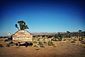
Joshua Tree Welcome sign off Highway 62
-
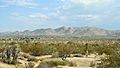
Southward view of Joshua Tree Town Center in front of the mountains of Joshua Tree National Park
-
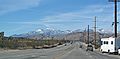
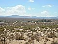
Southwesterly view of the San Bernardino Mountains from Twenty-Nine Palms Highway (CA Route 62)
-
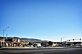
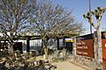
Downtown Joshua Tree looking southwest
-
Joshua Tree National Park Visitor Center
-
Southwesterly view of the Joshua Tree Retreat Center
-

Copper Mountain College
-

Backcountry road off of Olympic Road in Joshua Tree


See also
 In Spanish: Joshua Tree para niños
