Kamerunga, Queensland facts for kids
Quick facts for kids KamerungaCairns, Queensland |
|||||||||||||||
|---|---|---|---|---|---|---|---|---|---|---|---|---|---|---|---|

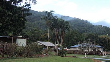
Looking west along Hastings Street, 2018
|
|||||||||||||||
| Population | 962 (2021 census) | ||||||||||||||
| • Density | 223.7/km2 (579/sq mi) | ||||||||||||||
| Established | 1980 | ||||||||||||||
| Postcode(s) | 4870 | ||||||||||||||
| Area | 4.3 km2 (1.7 sq mi) | ||||||||||||||
| Time zone | AEST (UTC+10:00) | ||||||||||||||
| Location |
|
||||||||||||||
| LGA(s) | Cairns Region | ||||||||||||||
| State electorate(s) | Barron River | ||||||||||||||
| Federal Division(s) | Leichhardt | ||||||||||||||
|
|||||||||||||||
Kamerunga is a town and a suburb located near Cairns in Queensland, Australia. It is part of the Cairns Region. In 2021, about 962 people lived in Kamerunga.
Contents
Exploring Kamerunga's Geography
The Barron River flows through the northern part of Kamerunga. It enters from the north-west and then exits towards the north-east.
Kamerunga Island and Park
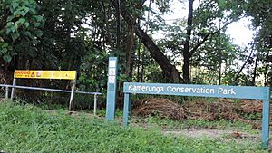
Kamerunga Island is a large island in the Barron River. It covers about 29.6 hectares. The entire island, along with parts of the riverbanks, forms the Kamerunga Conservation Park. This park helps protect the local environment.
Kamerunga Crossing and Bridges
Kamerunga Crossing is a place where you can cross the Barron River to get to Caravonica. There is an old bridge here that is no longer used by cars. It is now a great spot for walking, cycling, and fishing. A newer, higher bridge was built in 1980 for vehicles.
Land Use in Kamerunga
In the eastern part of Kamerunga, you will find mostly farmland. The middle of the suburb is where people live in homes. The western side has undeveloped bushland, which is part of the foothills leading to the Atherton Tableland.
A Look Back at Kamerunga's History
Kamerunga was first known as Barronville in early 1887. Later that year, its name was changed to Kamerunga. This name comes from the Yidinji language and refers to the Barron Gorge.
From 1890 to 1919, Kamerunga was part of the Shire of Barron. After that, it became part of the Shire of Cairns, which is now known as the Cairns Region.
School Days in Kamerunga
Kamerunga State School first opened its doors on May 28, 1913. However, a strong cyclone damaged it in February 1927. The school reopened on April 6, 1927, but at a new location. It was then renamed Caravonica State School.
Peace Lutheran College, a private school, opened in Kamerunga in 1994.
Education Opportunities
Peace Lutheran College is a private school in Kamerunga. It teaches students from Prep (the year before Year 1) all the way through to Year 12. It is located on Cowley Street. In 2018, the school had 670 students.
Kamerunga does not have its own government schools. Students usually attend nearby schools. The closest government primary schools are Caravonica State School and Freshwater State School. For high school, students often go to Redlynch State College.
Places to Visit and Enjoy
Kamerunga has a few places for the community to gather and relax.
Community Church
St John the Forerunner & Baptist Greek Orthodox Church is located on Kamerunga Road. It serves as a place of worship for the local community.
Local Parks
There are several parks in Kamerunga where you can enjoy the outdoors:
- Barronville Park is found between Romney and Hastings Street.
- Douglas Track South Park is at the end of Douglas Track Road.
- Douglas Track Park is another park along Douglas Track.
- Harley Street North Park is located on Harley Street.
 | Shirley Ann Jackson |
 | Garett Morgan |
 | J. Ernest Wilkins Jr. |
 | Elijah McCoy |


