Kashagawigamog Lake facts for kids
Quick facts for kids Kashagawigamog Lake |
|
|---|---|
| Location | Haliburton County, Ontario |
| Coordinates | 45°00′21″N 78°34′04″W / 45.0057°N 78.5679°W |
| Type | Glacial lake |
| Primary inflows | Drag River |
| Primary outflows | Burnt River |
| Basin countries | Canada |
| Surface area | 817 Hectares (2,019 acres) |
| Frozen | Mid-December to Late April |
| Islands | Puffers Island |
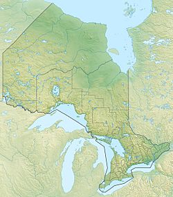
Kashagawigamog Lake is a beautiful lake located in Haliburton County, Ontario, Canada. It is a popular spot in Ontario's "cottage country," with many cottages along its shores. This lake is the main part of a chain of five lakes. This chain stretches southwest from the town of Haliburton all the way to Minden.
Kashagawigamog Lake is connected to Grass Lake and Head Lake to the east. It also connects to Soyers Lake to the north and Canning Lake to the west. The lake is long and narrow. It is essentially a wider part of the Drag River. This river flows from Drag Lake into the chain of lakes at Head Lake. It then flows out again at Canning Lake. A dam at Canning Lake controls the water flow. This dam is managed by the Trent–Severn Waterway.
The Lake Kashagawigamog Organization represents the people who live around the lake.
Contents
What's in a Name?
The name Kashagawigamog comes from the Anishnaabeg people. It is a First Nations name. It means "lake of long and winding waters." This name perfectly describes the shape of the lake!
Where is the Lake? (Geography)
Kashagawigamog Lake is part of the Great Lakes Basin. The main river flowing into it is the Drag River. The main river flowing out is the Burnt River. Dams control the outflow of water.
The lake has two main parts. These parts are connected by a narrow channel. The southwest part is a bit larger and wider than the northeast part. Most of the shoreline has cottages and resorts. However, these are often hidden by deciduous and conifer trees. These trees grow right to the water's edge.
The land around the lake has granite bedrock. This rock is usually covered by a thin layer of topsoil. You can also see some rock outcrops and sandy beaches along the shore. There is one important island called Puffers Island. It is in the southwest part of the lake and has four cottages.
A Look Back in Time (History)
Kashagawigamog Lake has a rich history. It was an important pathway for First Nations peoples. They used it to travel to their traditional hunting grounds. Early European settlers also arrived at the lake in the late 1800s. They used it for transportation too.
The lake was chosen as a route to move lumber south. This happened during the region's early lumbering years. Kashagawigamog Lake and the nearby Canning Lake were the first water links. They connected the villages of Minden and Haliburton. This was before the main roads were finished in 1868. After roads were built, connecting the area to southern Ontario, Kashagawigamog became a popular place for cottages. It has the oldest and most developed cottage history in the county.
Life in the Lake (Ecology)
In 2015, a group called Watersheds Canada studied the lake. They found that 74% of properties on Kashagawigamog Lake had submergent aquatic plants. These are plants that grow completely underwater. They also found that 24% of properties had emergent vegetation. These plants stick out of the water. Both types of plants are very important. They provide homes and food for the lake's fish and other water creatures.
Floating plants were less common on Kashagawigamog Lake. But they are still a key part of the lake's ecosystem. They offer habitat for birds, frogs, dragonflies, and other wildlife. The most common types of natural areas near the shore were fallen logs. Overhanging plants were also common.
The same survey found some invasive species in the lake. These are plants that are not native to the area. They can sometimes harm the local ecosystem. Examples found were Eurasian milfoil and Purple loosestrife.
 | Ernest Everett Just |
 | Mary Jackson |
 | Emmett Chappelle |
 | Marie Maynard Daly |


