Kearsarge North facts for kids
Quick facts for kids Kearsarge North |
|
|---|---|
| Pequawket | |

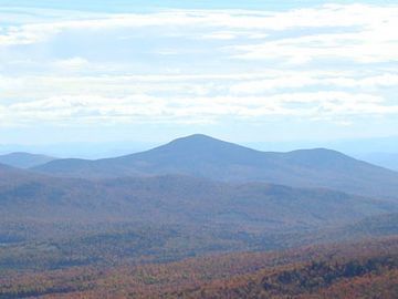
Kearsarge North as seen from South Baldface
|
|
| Highest point | |
| Elevation | 3,268 ft (996 m) |
| Prominence | 1,748 ft (533 m) |
| Geography | |
| Location | Carroll County, New Hampshire, U.S. |
| Parent range | White Mountains |
| Topo map | USGS North Conway East |
| Climbing | |
| Easiest route | Hike Kearsarge North Trail from Hurricane Mtn Road. |
Kearsarge North is a cool mountain located about 4 miles (6 km) northeast of North Conway, New Hampshire. It's part of the beautiful White Mountains. This mountain is also known as Pequawket Mountain. It was named after the Pequawket people, who are a group of the Abenaki people who used to live in this area.
The U.S. Board on Geographic Names first accepted the name "Pequawket Mountain" in 1915. However, the mountain was renamed Kearsarge North in 1957. This helps avoid confusion with another mountain called Mount Kearsarge in Merrimack County.
Contents
Exploring Kearsarge North: Location and Waterways
Kearsarge North is found on the eastern edge of the White Mountains. Water from the mountain flows into different brooks. These brooks eventually lead to the Saco River.
Hiking Adventures: Trails to the Summit
There are two main paths you can take to hike up Kearsarge North.
Popular Hiking Route: Mount Kearsarge North Trail
The most popular way to reach the top is the Mount Kearsarge North Trail. This trail is about 3.1 miles (5 km) long. It climbs about 2,600 feet (790 meters) from the North Conway side of Hurricane Mountain Road. This starting point is near Intervale.
Less-Used Route: Weeks Brook Trail
Another option is the Weeks Brook Trail. This path is not used as often. It's a longer route, about 4.7 miles (7.6 km) long. This trail approaches Kearsarge from the east. You can find its starting point on Forest Road 317 in Chatham.
History of the Summit: From Inn to Lookout
Years ago, an inn was built right on the summit of Kearsarge North. Sadly, this inn was destroyed twice by strong storms. In 1909, the Appalachian Mountain Club allowed the New Hampshire Forestry Commission to use the remains of the old hotel. They turned it into a station for watching out for fires.
Pequawket Fire Tower: A Historic Lookout
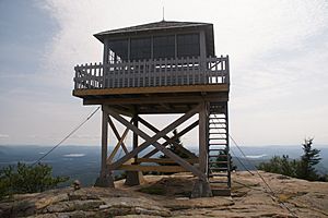
The Pequawket Fire Tower was built in 1913. It was used by the state and the U.S. Forest Service to spot forest fires. People staffed this tower until 1960. In 1991, the fire tower was added to the National Historic Lookout Register. Today, visitors to the summit of Kearsarge North can still explore this historic tower.
 | Janet Taylor Pickett |
 | Synthia Saint James |
 | Howardena Pindell |
 | Faith Ringgold |


