Keeler Creek facts for kids
Quick facts for kids Keeler Creek |
|
|---|---|

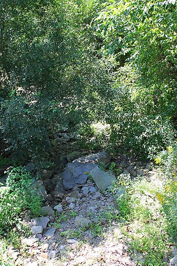
Keeler Creek looking downstream in its lower reaches
|
|
| Physical characteristics | |
| Main source | valley in Falls Township, Wyoming County, Pennsylvania between 980 and 1,000 feet (299 and 305 m) |
| River mouth | Susquehanna River in Falls Township, Wyoming County, Pennsylvania 554 ft (169 m) 41°26′00″N 75°50′45″W / 41.4333°N 75.8457°W |
| Length | 2.0 mi (3.2 km) |
| Basin features | |
| Progression | Susquehanna River → Chesapeake Bay |
| Basin size | 1.86 sq mi (4.8 km2) |
Keeler Creek is a small stream, or tributary, located in Wyoming County, Pennsylvania. It flows into the larger Susquehanna River. The creek is about 2.0 miles (3.2 km) long. It runs entirely through an area called Falls Township.
The land area that drains into Keeler Creek, known as its watershed, covers about 1.86 square miles (4.8 km2). This creek is considered a healthy waterway. It is also an important home for fish, designated as a Coldwater Fishery and a Migratory Fishery.
Contents
Where Keeler Creek Flows
Keeler Creek starts in a valley within Falls Township. From its source, it flows generally southwest. The creek's path winds through its valley, sometimes turning west-southwest before heading back towards the southwest.
Eventually, Keeler Creek leaves its narrow valley. It then turns south for a short distance before flowing southwest again. After this journey, the creek reaches its meeting point, or confluence, with the Susquehanna River. Keeler Creek joins the Susquehanna River about 206.56 miles (332.43 km) upstream from where the Susquehanna River itself flows into the Chesapeake Bay.
The Creek's Surroundings

The elevation where Keeler Creek meets the Susquehanna River is about 554 feet (169 m) above sea level. Upstream, where the creek begins, its elevation is higher, between 980 and 1,000 feet (300 and 300 m) above sea level. This difference in height helps the water flow downhill.
The ground around the lower parts of Keeler Creek is mostly made of alluvium. This is a mix of sand, silt, and gravel that has been deposited by flowing water. You can also find areas of outwash, which are deposits left by glaciers. Further upstream, the ground is mainly covered by a type of glacial deposit called Wisconsinan Till.
Keeler Creek is a small stream. Back in 1827, people noted that it was big enough to power mills.
The Keeler Creek Watershed
The entire watershed of Keeler Creek covers an area of 1.86 square miles (4.8 km2). Most of this watershed is located in Falls Township, Wyoming County. However, a small part of the watershed extends into Newton Township, Lackawanna County.
The creek's watershed is important for aquatic life. This means it supports the plants and animals that live in and around the water. Major roads like State Route 2013 and State Route 2029 pass through the watershed.
History of Keeler Creek
Keeler Creek was officially added to the Geographic Names Information System on August 2, 1979. This system helps keep track of names and locations of places in the United States. Its special ID number in the system is 1198964.
In the past, the North Branch Canal used to cross over Keeler Creek. It did this using an aqueduct, which is like a bridge built to carry water. This aqueduct was 34 feet (10 m) long and had two sections, or spans.
Wildlife and Fish
The area around Keeler Creek is a great place for fish. It is officially known as a Coldwater Fishery. This means the water is cold enough for certain types of fish to thrive. It is also a Migratory Fishery, which means it's a place where fish travel through during their migration.


