Kentwood, Michigan facts for kids
Quick facts for kids
Kentwood, Michigan
|
|
|---|---|
| City of Kentwood | |

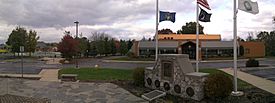
Veterans Memorial Park
|
|

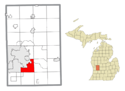
Location within Kent County
|
|
| Country | United States |
| State | Michigan |
| County | Kent |
| Incorporated | 1967 |
| Government | |
| • Type | City commission |
| Area | |
| • Total | 20.96 sq mi (54.30 km2) |
| • Land | 20.91 sq mi (54.17 km2) |
| • Water | 0.05 sq mi (0.13 km2) |
| Elevation | 738 ft (225 m) |
| Population
(2020)
|
|
| • Total | 54,304 |
| • Density | 2,596.41/sq mi (1,002.50/km2) |
| Time zone | UTC-5 (EST) |
| • Summer (DST) | UTC-4 (EDT) |
| ZIP code(s) |
49508, 49512, 49548
49546 (Grand Rapids) |
| Area code(s) | 616 |
| FIPS code | 26-42820 |
| GNIS feature ID | 1626558 |
Kentwood is a city located in Kent County, Michigan. It's a busy place with a population of over 54,000 people, according to the 2020 census. The city is very close to Grand Rapids. In fact, it's the third-largest city in the Grand Rapids metropolitan area.
Contents
History of Kentwood
Kentwood became an official city in 1967. Before that, it was part of something called Paris Township. The main reason it became a city was to stop nearby cities like Grand Rapids and Wyoming from taking over more of its land.
The name "Kentwood" was chosen after a lot of thought. The person who really pushed for the city to be formed, Peter M. Lamberts, decided to name it after the biggest school system in the area, the Kentwood Public Schools. Other names were considered, like Plaster Creek and Paris, but they wanted to avoid confusion with other places in Michigan.
Leaders of Kentwood: The Mayors
Peter M. Lamberts was Kentwood's very first mayor. He served for 12 years, from 1967 to 1979. Since then, several other people have been mayor, including Stephen Kepley, who is the current mayor.
The Kentwood Mine: A Look Back
From 1971 to 2000, there was a gypsum mine in Kentwood. It was called the Kentwood Mine. Gypsum is a soft mineral often used to make things like drywall. The mine was run by a company called Georgia-Pacific.
Geography and Climate
Kentwood covers an area of about 20.95 square miles (54.3 square kilometers). Most of this area is land, with a small amount of water. The city is surrounded by other towns and townships. These include Wyoming to the west and Grand Rapids to the north.
Major Roads and Highways
Several important roads and highways pass through Kentwood. These roads help people travel easily in and out of the city.
- I-96 goes through the northeast part of the city.
- M-11 runs along 28th Street.
- M-37 follows East Beltline Avenue and Broadmoor Avenue.
- M-6 crosses the southern part of Kentwood.
Fun Trails to Explore
Kentwood has two trails where you can walk, run, or bike:
- The Paul Henry Rail Trail stretches from 44th Street and Kalamazoo to 60th Street and Wing Avenue.
- The East-West Trail runs from Division Avenue to Breton Avenue.
Kentwood's Climate
Kentwood has a "Humid continental climate." This means it has warm summers and cold, snowy winters.
| Climate data for Kentwood, Michigan | |||||||||||||
|---|---|---|---|---|---|---|---|---|---|---|---|---|---|
| Month | Jan | Feb | Mar | Apr | May | Jun | Jul | Aug | Sep | Oct | Nov | Dec | Year |
| Mean daily maximum °C (°F) | −1 (30) |
0 (32) |
5 (41) |
13 (55) |
20 (68) |
25 (77) |
28 (82) |
27 (80) |
22 (71) |
16 (60) |
7 (44) |
1 (33) |
14 (56) |
| Mean daily minimum °C (°F) | −9 (15) |
−8 (17) |
−3 (26) |
2 (35) |
7 (44) |
13 (55) |
15 (59) |
14 (57) |
10 (50) |
4 (39) |
0 (32) |
−5 (23) |
3 (38) |
| Average precipitation mm (inches) | 56 (2.2) |
46 (1.8) |
64 (2.5) |
76 (3.0) |
84 (3.3) |
91 (3.6) |
76 (3.0) |
74 (2.9) |
91 (3.6) |
71 (2.8) |
71 (2.8) |
61 (2.4) |
861 (33.9) |
| Source: Weatherbase | |||||||||||||
People of Kentwood
| Historical population | |||
|---|---|---|---|
| Census | Pop. | %± | |
| 1970 | 20,310 | — | |
| 1980 | 30,438 | 49.9% | |
| 1990 | 37,826 | 24.3% | |
| 2000 | 45,255 | 19.6% | |
| 2010 | 48,707 | 7.6% | |
| 2020 | 54,304 | 11.5% | |
| 2023 (est.) | 53,987 | 10.8% | |
| U.S. Decennial Census | |||
Kentwood is a diverse city with many different people living there. In 2020, the population was 54,304. The city is home to people from various backgrounds, including White, Black or African American, Asian, Native American, and people of two or more races. Many residents also identify as Hispanic or Latino.
Education in Kentwood
Kentwood offers great educational opportunities, including a modern library and several public schools.
The Richard L. Root Library
The Kentwood Branch Library opened in 2010. It's located right next to Kentwood City Hall. This library was named the Richard L. Root Library. Richard L. Root was Kentwood's fifth mayor. He helped the city get the funding to build this new library.
The library is built near a former landfill. Don't worry, it's safe! The Environmental Protection Agency (EPA) and Kent County worked together to make sure the area is clean and safe.
Public Schools in Kentwood
The main school district in Kentwood is the Kentwood Public Schools. This district includes:
- One high school: East Kentwood High School
- One freshman campus: East Kentwood Freshman Campus
- Three middle schools: Crestwood, Pinewood, and Valleywood Middle Schools
- Ten elementary schools: Bowen, Brookwood, Challenger, Discovery, Endeavor, Explorer, Glenwood, Meadowlawn, Southwood, and Townline Elementary Schools
- One early childhood center: Hamilton Early Childhood Center
Some parts of Kentwood are also served by the Forest Hills Public Schools and Kelloggsville Public Schools.
Notable People from Kentwood
Many talented people have come from Kentwood, Michigan!
- Kristen Kish: A famous chef who won Top Chef.
- Mike Knuble: A former professional NHL hockey player.
- Loy Vaught: A former professional NBA basketball player.
- Joe Warren: A two-time world champion in Bellator fighting.
- Mazi Smith: A Defensive Tackle for the Dallas Cowboys.
See also
 In Spanish: Kentwood (Míchigan) para niños


