Kingswood, South Gloucestershire facts for kids
Quick facts for kids Kingswood |
|
|---|---|
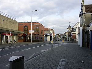
 Regent Street, Kingswood |
|
| Population | 40,734 |
| OS grid reference | ST649736 |
| Civil parish |
|
| Unitary authority | |
| Ceremonial county | |
| Region | |
| Country | England |
| Sovereign state | United Kingdom |
| Post town | BRISTOL |
| Postcode district | BS15 |
| Dialling code | 0117 |
| Police | Avon and Somerset |
| Fire | Avon |
| Ambulance | Great Western |
| EU Parliament | South West England |
| UK Parliament |
|
Kingswood is a town in South Gloucestershire, England. It's about 3 miles (5 km) east of the big city of Bristol.
Kingswood stretches from John Cabot Academy in the west to the A4174 ring road in the east. Some nearby areas, like Two Mile Hill and parts of Hanham, are often thought of as part of Kingswood by local people.
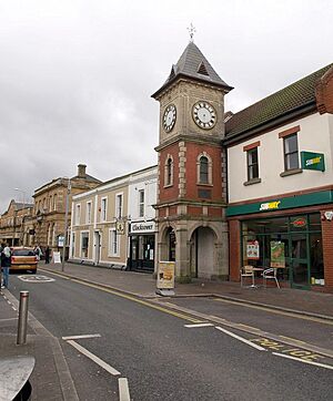
The border between South Gloucestershire and the City of Bristol runs through Kingswood's High Street. Even though some shops are technically in Bristol, many locals still see them as part of Kingswood. In 2011, about 40,734 people lived here.
Contents
How Kingswood is Governed
Kingswood has changed how it is governed over the years. In 1894, it became an urban district. This meant it had its own local council to manage things like roads and services.
Later, in 1974, Kingswood became part of the Kingswood district within a larger county called Avon. When Avon county was removed in 1996, Kingswood joined the South Gloucestershire area.
Recently, in 2023, Kingswood became a civil parish again. This means it now has a local parish council that looks after local community matters.
Kingswood's Royal History
Long ago, in Saxon times, the area around Kingswood was a huge royal hunting ground. It was known as 'The King's Wood'. This forest covered a large area, even reaching Filwood in South Bristol.
The person in charge of Bristol Castle, called the Constable, was also the main ranger of the Kingswood Forest. One of the earliest known rangers was Ella, who died in 920. Near the edge of this forest was a small village called Stapleton. Its name comes from Saxon words meaning 'the farm near the post or pillar'.
Who Lives in Kingswood?
For a long time, the government's official statistics counted Kingswood as part of Bristol. This meant it wasn't seen as its own separate town in official numbers.
However, in the 2021 Census, Kingswood was counted separately from Bristol. This change means Kingswood is now officially recognized as its own town. When you combine Kingswood with the nearby area of Fishponds, it becomes the largest built-up area by population in the county of Gloucestershire.
Kingswood is divided into three smaller areas called wards: Woodstock, New Cheltenham, and Kingswood Wards. In 2011, these wards together had a population of 40,734 people. Most of the people living in Kingswood are white British.
Getting Around Kingswood
Kingswood High Street is about 3 miles (5 km) south of the M4 motorway, which is a major road. It's also about 2.5 miles (4 km) east of Lawrence Hill railway station, where you can catch trains.
Buses are a popular way to travel in Kingswood. They connect the town to many nearby places. You can take a bus to Bristol city centre, Southmead Hospital, Keynsham, and Cribbs Causeway, which is a big shopping area.
There are six train stations in the wider South Gloucestershire area. However, most of these are located in the northern part, around Filton and Bradley Stoke. The mayor of Bristol has also suggested a plan for an underground train system, which might include a line serving the east side of Bristol, including Kingswood.
Kingswood's Coal Mining Past
Kingswood became important for industry in the late 1600s because of coal mining. There were many coal fields in areas like Easton and Coalpit Heath.
Even today, the history of coal mining still affects the town. Sometimes, gardens in Kingswood can have issues because of old mine shafts underneath. The local Member of Parliament (MP) has even asked the government to do full surveys of the coal mines under the town to make sure everyone is safe.
The Whit Walk Tradition
Every year, on the morning of the Whit Bank Holiday, there is a special procession called the Whit Walk. No one is exactly sure when it started, but it has been happening since at least 1939. This walk is a local tradition that brings the community together.
 | James Van Der Zee |
 | Alma Thomas |
 | Ellis Wilson |
 | Margaret Taylor-Burroughs |


