Knipe Point facts for kids
Quick facts for kids Knipe Point |
|
|---|---|
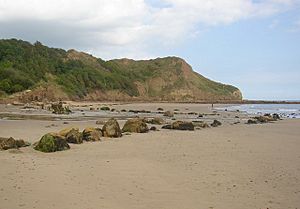
 Knipe Point viewed from the beach at Cayton Bay |
|
| OS grid reference | TA0685 |
| Civil parish |
|
| Unitary authority |
|
| Ceremonial county | |
| Region | |
| Country | England |
| Sovereign state | United Kingdom |
| Post town | SCARBOROUGH |
| Postcode district | YO11 |
| Dialling code | 01723 |
| Police | North Yorkshire |
| Fire | North Yorkshire |
| Ambulance | Yorkshire |
| EU Parliament | Yorkshire and the Humber |
| UK Parliament |
|
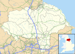
Knipe Point (also known as Osgodby Point) is a rocky piece of land on the coast of the North Sea. It is located in North Yorkshire, England, between Cornelian Bay and Cayton Bay. South of Knipe Point, there is a steep cliff made of clay. This is where Knipe Point Drive was built.
The Cayton Cliff often has landslides, which means parts of the land slide down. A big landslide happened in 2008, known as the Knipe Point Landslide. It was a big news story because three homes were lost.
History of Knipe Point
Knipe Point was once home to the first holiday camp for workers in the North of England. It was owned by an organization called NALGO and opened in 1933. The camp had 124 wooden bungalows, which could host 252 visitors.
It offered many fun things to do. There was a dining hall with waiters, a rest room, and rooms for games like cards and billiards. There was also a theatre for shows and dancing. Outside, visitors could play tennis or bowls. There was even a special play area for children. Guests could walk to the beach, where they found a sun terrace and a small shop.
The famous poet Philip Larkin and his family were some of the first visitors. During the Second World War, the camp became a safe home for children who were moved from Middlesbrough. The NALGO camp closed in 1974 and was later sold.
In 1985, the site became a place for permanent homes. Before this, the buildings were only allowed to be used for holidays.
Who Lives There Now?
Today, Knipe Point is a private neighborhood with many bungalows. These homes have great views of the Cayton Bay area, which is a special place for nature called a Site of Special Scientific Interest (SSSI).
The people who live there manage their own community. They have an organization called the Knipe Point Owners' Association. In 2002, this group bought the land that the homes are on. This land is now owned by another company run by the residents, called Knipe Point Freeholders Limited. Each member owns an equal share of this company. About half of the people living there are permanent residents.
The Knipe Point Landslide
In 2008, three homes at Knipe Point had to be taken down because of a landslide. This old landslide became active again after a long time of heavy rain.
Experts studied the land to understand why the landslide happened. They found that water moving through the ground near the coast was the main reason for the land slipping.
In December 2009, the government department Defra started a special project with the local council. This project helps the Knipe Point Drive community plan for and manage changes to the coastline. This project ran until spring 2011.
 | Leon Lynch |
 | Milton P. Webster |
 | Ferdinand Smith |


