La Poudre Pass facts for kids
Quick facts for kids La Poudre Pass |
|
|---|---|

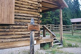
La Poudre Pass Ranger Station, Rocky Mountain National Park
|
|
| Elevation | 10,184 ft (3,104 m) |
| Traversed by | Trail, Grand Ditch, private maintenance road for Grand Ditch |
| Location | Grand / Larimer counties, Colorado, U.S. |
| Range | Rocky Mountains |
| Coordinates | 40°28′36″N 105°49′24″W / 40.47667°N 105.82333°W |
| Topo map | USGS Fall River Pass |
La Poudre Pass is a high mountain pass located in the Rocky Mountains of northern Colorado in the United States. It sits at an elevation of 10,184 ft (3,104 m) above sea level. This special place is important because it crosses the Continental Divide.
Contents
What is the Continental Divide?
The Continental Divide is like a giant imaginary line that runs through the Americas. It separates the rivers that flow to the Pacific Ocean from those that flow to the Atlantic Ocean (or the Arctic Ocean). At La Poudre Pass, the divide separates the beginnings of two major rivers.
Where Rivers Begin
One side of the pass is where La Poudre Pass Creek starts. This creek flows into the Cache la Poudre River, which eventually reaches the Gulf of Mexico. On the other side, the mighty Colorado River begins its long journey. The Colorado River flows all the way to the Gulf of California.
County and Park Borders
The Continental Divide at La Poudre Pass also marks a border. It is the boundary between Grand County and Larimer County. It is also the northern edge of Rocky Mountain National Park.
Exploring La Poudre Pass
The pass itself is a wide, flat, and sometimes wet area. In a marshy meadow just south of the divide, the Colorado River starts as a tiny stream. It emerges from this area, which once included a small lake called La Poudre Pass Lake. The Rocky Mountain National Park La Poudre Pass Ranger Station is also located right in the pass.
How People Use the Pass
La Poudre Pass is used in a few ways:
- There's a hiking trail for people who want to explore on foot.
- The Grand Ditch crosses the pass. This ditch carries water from the Never Summer Mountains to the Cache la Poudre River.
- There's a private road for maintaining the Grand Ditch. This road is usually gated and not open to the public.
How to Visit La Poudre Pass
To get to La Poudre Pass, you need to follow Long Draw Road. This road turns south from Colorado State Highway 14 in Poudre Canyon. Highway 14 is just east of Cameron Pass.
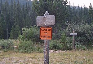
Long Draw Road is unpaved, but most regular cars can drive on it. After you pass Long Draw Reservoir, the road ends at the La Poudre Pass Trailhead parking area. From there, it's a very short walk to the pass. You'll know you're there when you see the entrance sign for Rocky Mountain National Park. This sign also shows you where the Continental Divide is!
 | Jackie Robinson |
 | Jack Johnson |
 | Althea Gibson |
 | Arthur Ashe |
 | Muhammad Ali |


