Lac aux Montagnais facts for kids
Quick facts for kids Lac aux Montagnais |
|
|---|---|
| Location | Lac-Jacques-Cartier (TNO), La Côte-de-Beaupré Regional County Municipality, Capitale-Nationale |
| Coordinates | 47°53′05″N 71°52′32″W / 47.88472°N 71.87556°W |
| Lake type | Natural |
| Primary inflows | (clockwise from the mouth) Ruisseaux riverains, décharge du lac Houlette, rivière aux Montagnais, ruisseau de l’Amitié.. |
| Primary outflows | Rivière aux Montagnais |
| Basin countries | Canada |
| Max. length | 4.0 km (2.5 mi) |
| Max. width | 1.0 km (0.62 mi) |
| Surface elevation | 494 m (1,621 ft) |
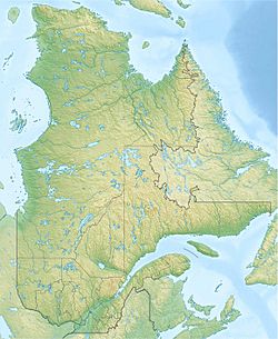
The Lac aux Montagnais is a beautiful freshwater lake located in the Laurentides Wildlife Reserve in Quebec, Canada. It's found in an area called Lac-Jacques-Cartier, which is part of the La Côte-de-Beaupré Regional County Municipality. This lake is where the rivière aux Montagnais begins its journey.
The lake is situated between two main roads, Route 169 and Route 155. These roads connect important cities like Quebec City and Alma. There are also smaller forest roads around the lake. These roads are used for activities like logging and outdoor fun.
The main jobs in this area are related to forestry (cutting down trees). After that, tourism, like fishing and hunting, is also very important.
The surface of Lac aux Montagnais usually freezes over from early December until the end of March. It's generally safe to walk or play on the ice from mid-December to mid-March.
Contents
About the Lake's Location
Lac aux Montagnais is surrounded by many other lakes and rivers. Knowing these helps us understand where the lake fits into the larger natural landscape.
- To the north: You'll find Moufettes lake, Carbonneau lake, and the rivière aux Écorces.
- To the east: There's Métascouac Lake, lac Tomachiche, lac Monbrion, and more of the rivière aux Écorces.
- To the south: You can find lac aux Cailloux, Berthiaume Lake, the Métascouac River, the Métabetchouane River, and Saint-Henri Lake.
- To the west: The Montagnais River, Moncouche River, and Métabetchouane River are nearby, along with ruisseau Contourné and the large Lac Saint-Jean.
Size and Shape of the Lake
Lac aux Montagnais is about 4.0 kilometres (2.5 mi) long and 1.0 kilometre (0.62 mi) wide. It sits at an elevation of 494 metres (1,621 ft) above sea level. The lake gets its water from several sources. These include small streams along its banks, water flowing from Lake Houlette, the Montagnais River (which flows in from the south), and the Friendship stream.
A long piece of land, like a finger, sticks out from the north shore into the lake for about 1.3 kilometres (0.81 mi). On the east side, a narrow strip of land, also about 1.3 kilometres (0.81 mi) long, separates Lac aux Montagnais from another lake called Lac de l'Amitié.
Where the Water Goes
The water from Lac aux Montagnais flows out from a bay at the very southeast end of the lake. From there, the water travels a long way through several rivers and lakes before reaching the ocean.
Here's the path the water takes:
- First, it flows into the rivière aux Montagnais for about 20.7 kilometres (12.9 mi) towards the northeast.
- Then, it joins the Moncouche River for about 5.0 kilometres (3.1 mi) towards the southwest.
- Next, it enters the Métabetchouane River and flows for about 83.9 kilometres (52.1 mi) towards the northwest.
- After that, it reaches lac Saint-Jean and travels about 22.25 kilometres (13.83 mi) northeast to a spot called la petite Décharge.
- Finally, the water enters the Saguenay River via la petite Décharge. It flows for about 172.3 kilometres (107.1 mi) eastwards until it reaches Tadoussac, where it mixes with the waters of the Saint Lawrence estuary.
Why the Lake is Called "Montagnais"
The name "Montagnais" comes from an Indigenous group of people. They are part of the Algonquian family and are now known as the "Innu" people. Long ago, before French settlers arrived, the Innu lived in a huge area of eastern Canada. Their territory stretched for about 600 kilometres (370 mi) along the north side of the St. Lawrence River, from Quebec City all the way to the Labrador Sea. On the south side of the river, their land included the areas around the Rivière du Loup and the Matane River.
In 1892, a surveyor named Henry O'Sullivan described the lake as "a magnificent sheet of water... Well provided with spotted trout." This suggests that the lake was a great place for fishing. Today, there are places around the lake where vacationers, hunters, and fishermen can stay. It's very likely that the Innu people also visited this lake often, especially since it's close to Lac Saint-Jean, which was important to them.
The name "Lac aux Montagnais" was officially recognized on December 5, 1968, by the Commission de toponymie du Québec, which is the organization in Quebec responsible for naming places.
 | Misty Copeland |
 | Raven Wilkinson |
 | Debra Austin |
 | Aesha Ash |


