Laguna Seca (Santa Clara County) facts for kids
Quick facts for kids Laguna Seca |
|
|---|---|

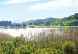
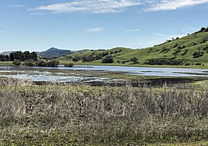
Laguna Seca is the largest freshwater lake and wetland in Santa Clara County.
|
|
| Location | Santa Clara County, California, United States |
| Coordinates | 37°12′46″N 121°45′20″W / 37.2127224°N 121.7555049°W |
| Basin countries | United States |
| Surface elevation | 243 ft (74 m) |
Laguna Seca is a special lake in the southern part of Santa Clara Valley in an area called Coyote Valley. It's a seasonal lake, meaning it has water for part of the year and can dry up during droughts. This area is super important for wildlife because it's a narrow pathway connecting the Mt. Hamilton and Diablo Range mountains on the east to the Santa Cruz Mountains on the west.
Laguna Seca is the biggest freshwater wetland in Santa Clara County, California. You can find it between Tulare Hill and the Santa Teresa Hills, just west of Santa Teresa Boulevard. Water flows into Laguna Seca from Fisher Creek. There's also a channel built by people that connects Fisher Creek to Coyote Creek.
History of Laguna Seca
The first time anyone wrote about this lake was on October 31, 1797. They called it La Laguna Zeca, which means 'the dry lake' in Spanish.
A large piece of land nearby, called Rancho Laguna Seca, was probably named after this seasonal lake. This land grant was given to Juan Alvires in 1834.
Long ago, Laguna Seca was a huge wetland, about 1,000 acres in size. It had wet meadows and smaller freshwater marshes that were always full of water, even though the main lake sometimes dried up in very dry years. However, between 1916 and 1917, a lot of Laguna Seca was filled in so people could use the land for farming.
Geology and Ecosystem
Today, the parts of Laguna Seca that are left are west of Santa Teresa Boulevard. They are located at the northern end of Coyote Valley, right where Tulare Hill and the Santa Teresa Hills meet. The marshes and wet areas formed because groundwater from the Santa Teresa Hills was pushed to the surface. Also, natural barriers from Coyote Creek stopped the water from draining away.
The soil here is very heavy clay, often called "black adobe" soil. This type of soil can also force groundwater to the surface, creating springs and wet spots. The lake helps refill the underground water supply (called an aquifer) in Coyote Valley.
Laguna Seca's waters are usually visible above the ground from December to May. But even when you can't see the water, it's very close to the surface all year round.
Wildlife and Conservation
Laguna Seca is a home for many animals, including some that are endangered. For example, you can find the California tiger salamander (Ambystoma californiense) and the California red-legged frog (Rana draytonii) here. It's also a very important resting spot for birds that are migrating, or flying long distances.
There's a great chance to bring Laguna Seca back to its natural state. Restoring this wetland could help many threatened species, including rare plants, amphibians, and water birds. It would also bring back important natural functions to this large valley wetland.
 | Laphonza Butler |
 | Daisy Bates |
 | Elizabeth Piper Ensley |


