
Coyote Creek (Santa Clara County) facts for kids
Quick facts for kids Coyote Creek |
|
|---|---|

Coyote Creek (lower right) where it flows into San Francisco Bay
|
|

Location of the mouth of Coyote Creek in California
|
|
| Other name(s) | Arroyo del Coyote |
| Country | United States |
| State | California |
| Region | Santa Clara County, Alameda County |
| City | San Jose, California |
| Physical characteristics | |
| Main source | East Fork Coyote Creek 14 mi (20 km) northeast of Morgan Hill 2,630 ft (800 m) 37°19′0″N 121°29′47″W / 37.31667°N 121.49639°W |
| 2nd source | Middle Fork Coyote Creek 3,400 ft (1,000 m) 37°16′53″N 121°33′40″W / 37.28139°N 121.56111°W |
| River mouth | San Francisco Bay 8 mi (13 km) west of Milpitas, California 0 ft (0 m) 37°27′26″N 122°2′56″W / 37.45722°N 122.04889°W |
| Length | 63.6 mi (102.4 km)confluence to mouth |
Coyote Creek is a cool river that flows through the Santa Clara Valley in California, United States. It's an important waterway for the area, providing water and a home for many animals.

Contents
History of Coyote Creek
Long ago, in 1776, a Spanish explorer named Padre Pedro Font discovered this river. He called it Arroyo del Coyote, which means 'Coyote Stream' in Spanish. This name stuck, and today we know it as Coyote Creek.
Where Does Coyote Creek Flow?

.jpg)
Even though it's called a "creek," Coyote Creek is actually a river! It collects water from a large area, about 320 square miles (829 square kilometers). The river flows for about 63.6 miles (102.4 kilometers).
The main source of the river is near Mount Sizer and Henry W. Coe State Park. This area is in the Diablo Range mountains, northeast of Morgan Hill, California.
Dams and Reservoirs
As the creek leaves the mountains, its water is held back by two large dams. These dams create two important lakes: Coyote Reservoir and Anderson Lake. Many smaller streams flow into these reservoirs, adding to the water supply.
The Santa Clara Valley Water District (SCVWD) built the Coyote Reservoir Dam between 1934 and 1936. It can hold a lot of water, about 10,000 acre-feet (12.3 million cubic meters).
Journey to the Bay
From Anderson Lake, Coyote Creek flows north through the Coyote Valley. It then enters the city of San Jose, California. As it goes through San Jose, other streams like Silver Creek and Penitencia Creek join it. Finally, Coyote Creek flows into the San Francisco Bay.
There's a chain of parks along the creek called the Coyote Creek Park Chain. You can find the Coyote Creek Trail there, which is great for walking or biking. The SCVWD helps manage the river. They have a plan to protect the creek, prevent floods, and improve the natural areas around it.
Safety of Anderson Dam
Scientists have been studying Anderson Dam. In 2010, they found that the dam could be at risk if a very strong earthquake happened nearby. If the dam broke, a huge amount of water could rush into nearby towns like Morgan Hill and San Jose.
Because of this risk, the SCVWD has lowered the water level in Anderson Lake. This makes it safer. They are planning a big project to fix the dam, which will take several years and cost a lot of money.
Also, the Coyote Reservoir Dam, which is upstream from Anderson Dam, was built right on a fault line. An earthquake there could also cause problems. Because of these concerns, in 2020, the Federal Energy Regulatory Commission ordered that Anderson Lake should be drained to keep people safe.
The 2017 Coyote Creek Flood

In February 2017, there was a lot of rain. Anderson Reservoir became very full, and water flowed over its spillway into Coyote Creek. The creek then overflowed its banks, causing big floods in parts of San Jose, California.
This flood was the worst since 1997. Many people had to leave their homes for safety. Roads, including parts of US Highway 101, were closed. Even a parking garage at San Jose International Airport was flooded. About 14,000 people had to evacuate.
After the flood, there were discussions about how the city and the water district handled the emergency. They worked together to figure out what happened and how to prevent future floods. The damage from this flood cost more than $100 million to fix.
Animals and Nature in Coyote Creek

Coyote Creek is home to many different kinds of fish. It has more types of native fish than other streams in the Santa Clara Valley. Some of the fish you might find include Pacific lamprey, steelhead trout, chinook salmon, and Sacramento sucker.
Sadly, some fish species, like the thicktail chub, are no longer found here. The thicktail chub is now extinct.
Fish Migration Challenges
Historically, steelhead trout used Coyote Creek to travel from the ocean to lay their eggs upstream. However, dams and other structures have made it harder for these fish to migrate. For example, the Standish Dam used to block their path, but it hasn't been used since 2000.
Also, ponds built along the creek can make the water warmer. This warm water can be bad for young steelhead and can attract fish like largemouth bass that eat them. Moving these ponds away from the main creek would help the steelhead.
In 2017, a professor named Jerry Smith said that steelhead trout were no longer reproducing in Coyote Creek. This was because they couldn't travel to the ocean or back upstream to lay eggs.
Salmon in the Creek
Chinook salmon also live in Coyote Creek. They lay their eggs in early winter, and the young salmon swim to the ocean in the spring. This means they can use parts of the creek that might get too warm in the summer.
Another type of salmon, Coho salmon, used to live in Coyote Creek until the 1950s. The construction of Anderson Dam in 1950 likely blocked their access to good habitats.
Beavers Return!
Did you know that beavers used to live in Coyote Creek a long time ago? They were even traded for their fur! In 2018, beavers returned to Coyote Creek. They likely swam from the Guadalupe River through the Bay to get there. You can even see a photo of a beaver dam on the creek!
Sometimes, pollution from city runoff can affect the creek. This is why groups like the South Bay Clean Creeks Coalition work to keep the water clean and healthy for all the animals that live there.
Images for kids
-
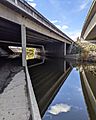
Coyote Creek under highway 237

See also
 In Spanish: Arroyo del Coyote para niños
