Fisher Creek facts for kids
Quick facts for kids Fisher Creek |
|
|---|---|

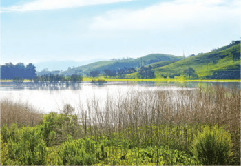
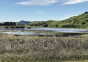
Laguna Seca in Spring, 2017
|
|
| Country | United States |
| State | California |
| Region | Santa Clara County |
| Cities | Morgan Hill, Coyote |
| Physical characteristics | |
| Main source | Morgan Hill 351 ft (107 m) 37°08′36″N 121°39′56″W / 37.14333°N 121.66556°W |
| River mouth | Coyote Creek Coyote 234 ft (71 m) 37°13′28″N 121°44′51″W / 37.22444°N 121.74750°W |
| Length | 13.8 mi (22.2 km)confluence to mouth |
Fisher Creek is a stream that flows for about 13.8 miles (22.2 km). It runs northwest through the Coyote Valley in southern Santa Clara County, California, United States. This creek is important because it flows into Laguna Seca. Laguna Seca is the biggest seasonal freshwater wetland in Santa Clara County. It helps to refill the underground water supply, known as groundwater recharge. From Laguna Seca, Fisher Creek is connected to Coyote Creek by a channel built by people.
The Story of Fisher Creek's Name
Fisher Creek is named after Captain William James Fisher. He was one of the first American settlers in Santa Clara County. Born in Boston, Massachusetts, in 1810, he started working on ships at age 13.
Captain Fisher lived in Lower California for some years. In 1845, he bought a large piece of land called Rancho Laguna Seca. He married Señorita Liberata Ceseña in 1834 and they had four children. Captain Fisher passed away in 1850.
In 1846, Captain John Frémont set up camp at Fisher's ranch. From there, Frémont went on to briefly raise the American flag on a nearby mountain. That mountain is now called Fremont Peak.
The place where Fisher Creek used to end, Laguna Seca, was also known as Laguna de San Benvenuto. The land grant for Rancho Laguna Seca was given in 1834. "Laguna Seca" means "Dry Lake" in Spanish. This name refers to the lake that dries up during parts of the year.
In 2020, a group called the Santa Clara Valley Habitat Agency bought a large part of the Tilton Ranch. This land is important because it includes Willow Springs Creek, which is likely where Fisher Creek starts. This ranch will eventually be managed by the Santa Clara Valley Open Space Authority.
Where Fisher Creek Flows
Fisher Creek flows northwest along the western side of the Coyote Valley. It gets water from several smaller creeks. These creeks flow east from the foothills of the Santa Cruz Mountains.
One of these creeks is Willow Springs Creek. It starts at about 800 feet (240 m) high. It flows northwest for about 1.5 miles (2.4 km) before joining Fisher Creek. Another creek that adds water to Fisher Creek is San Bruno Canyon Creek.
From Laguna Avenue to north of Bailey Avenue, seasonal wetlands collect the creek's water. Historically, this water ended up in Laguna Seca. Today, a channel built by people extends Fisher Creek from Laguna Seca to Coyote Creek.
Animals and Plants of Fisher Creek
The area around Fisher Creek is a very important place for wildlife. It helps animals move safely between different natural areas. Experts have suggested restoring the plants along Fisher Creek. This would mean planting more California sycamore trees, Fremont cottonwood trees, and willows. They also want to plant more valley oak trees throughout the valley.
Fisher Creek flows into Laguna Seca, which is the biggest freshwater wetland in Santa Clara County. Restoring Laguna Seca would create a wonderful home for many different wetland animals and plants. It would also be very important for migratory birds that pass through the area.
The seasonal pools of water in Laguna Seca are special. They provide a home for endangered animals. These include the California tiger salamander (Ambystoma californiense) and the California red-legged frog (Rana draytonii). Protecting these areas helps these rare creatures survive.
 | Jessica Watkins |
 | Robert Henry Lawrence Jr. |
 | Mae Jemison |
 | Sian Proctor |
 | Guion Bluford |


