Mount Hamilton (California) facts for kids
Quick facts for kids Mount Hamilton |
|
|---|---|
| Sierra de Santa Isabel | |
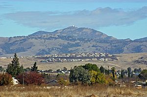
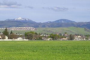
Lick Observatory is visible atop Mount Hamilton; hillsides show typical summer golden (dry) vegetation
|
|
| Highest point | |
| Elevation | 4,265 ft (1,300 m) NAVD 88 |
| Prominence | 16 m (52 ft) |
| Geography | |
| Location | Santa Clara County, California, U.S. |
| Parent range | Diablo Range |
| Topo map | USGS Lick Observatory |
| Geology | |
| Age of rock | Upper Cretaceous |
| Climbing | |
| First ascent | 1861 |
| Easiest route | Hike |
Mount Hamilton is a tall mountain in Santa Clara County, California. It is part of the Diablo Range. The top of the mountain is about 4,265 feet (1,300 meters) high.
From the peak, you can see the busy Santa Clara Valley below. Mount Hamilton is also home to Lick Observatory. This was the world's first observatory built permanently on a mountaintop. An asteroid discovered in 1899, called 452 Hamiltonia, is named after this mountain.
You can find Golden eagles nesting on the slopes of Mount Hamilton. On clear days, you can see far away from the summit. You might spot Mount Tamalpais, the Santa Cruz Mountains, Monterey Bay, the Monterey Peninsula, and even Yosemite National Park.
Contents
History of Mount Hamilton
Mount Hamilton got its name in 1861. A scientist named William Henry Brewer was exploring California. He invited his friend, Laurentine Hamilton, a preacher from San Jose, to join him on a hike.
As they got close to the top, Hamilton excitedly ran ahead. He was the first to reach the summit! Brewer then suggested naming the mountain after his friend, Hamilton.
Before this, the Spanish had a name for the mountain: Sierra de Santa Isabel. The highest point was known as Mount Isabel. Brewer and his fellow geologist, Charles F. Hoffmann, did not know this name. They still named it Mount Hamilton. Later, in 1895, another peak nearby was officially named Mount Isabel. This peak is about two miles southeast of Mount Hamilton.
Mountain Climate and Weather
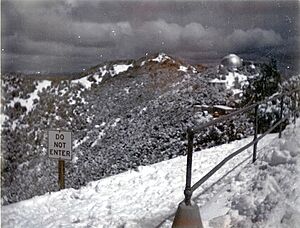
These mountains are high enough to get snow in the winter. This can happen up to a dozen times each year. Sometimes, when a very cold storm comes from places like Gulf of Alaska or Canada, Mount Hamilton gets a lot of snowfall. For example, in February 2001, 30 inches (76 cm) of snow fell. In March 2006, the peak had over a foot (30 cm) of snow in just one night.
The National Weather Service has had a weather station on Mount Hamilton for a long time. It helps us understand the extreme weather conditions here. This is especially true during the winter months.
February is usually the coldest month on Mount Hamilton. The average high temperature is about 48.7°F (9.3°C). The average low is about 37.8°F (3.2°C). July is usually the warmest month. The average high is about 78.7°F (25.9°C). The average low is about 65.1°F (18.4°C).
Sometimes, it can be warmer on Mount Hamilton than in San Jose. This happens because of "thermal inversions." This is when warm air gets trapped higher up in the mountains. The highest temperature ever recorded was 103°F (39°C) on August 5, 1978. The lowest was 7°F (-14°C) on December 21, 1990.
Mount Hamilton gets about 23.71 inches (602 mm) of rain each year. It rains on about 78 days. The most rain in one month was 21.55 inches (547 mm) in December 1955. Summers often have no rain at all.
The mountain gets about 18.1 inches (46 cm) of snow each year. The most snow in one year was 59.0 inches (150 cm) in 1955. Snow has been recorded from October through May.
| Climate data for Mount Hamilton, California (Station Elevation 4,206ft), 1991–2020 normals, extremes 1948–present | |||||||||||||
|---|---|---|---|---|---|---|---|---|---|---|---|---|---|
| Month | Jan | Feb | Mar | Apr | May | Jun | Jul | Aug | Sep | Oct | Nov | Dec | Year |
| Record high °F (°C) | 74 (23) |
73 (23) |
77 (25) |
84 (29) |
91 (33) |
94 (34) |
100 (38) |
103 (39) |
99 (37) |
93 (34) |
81 (27) |
76 (24) |
103 (39) |
| Mean maximum °F (°C) | 65.0 (18.3) |
63.8 (17.7) |
66.3 (19.1) |
72.3 (22.4) |
78.4 (25.8) |
85.5 (29.7) |
89.4 (31.9) |
89.0 (31.7) |
86.8 (30.4) |
80.3 (26.8) |
71.2 (21.8) |
63.3 (17.4) |
91.6 (33.1) |
| Mean daily maximum °F (°C) | 49.6 (9.8) |
48.7 (9.3) |
51.2 (10.7) |
55.2 (12.9) |
62.3 (16.8) |
71.1 (21.7) |
78.7 (25.9) |
78.5 (25.8) |
74.5 (23.6) |
65.5 (18.6) |
54.7 (12.6) |
48.6 (9.2) |
61.6 (16.4) |
| Daily mean °F (°C) | 44.4 (6.9) |
43.2 (6.2) |
45.1 (7.3) |
48.0 (8.9) |
54.9 (12.7) |
63.5 (17.5) |
71.9 (22.2) |
71.5 (21.9) |
67.4 (19.7) |
58.9 (14.9) |
49.1 (9.5) |
43.3 (6.3) |
55.1 (12.8) |
| Mean daily minimum °F (°C) | 39.1 (3.9) |
37.8 (3.2) |
38.9 (3.8) |
40.7 (4.8) |
47.4 (8.6) |
55.9 (13.3) |
65.1 (18.4) |
64.6 (18.1) |
60.3 (15.7) |
52.4 (11.3) |
43.4 (6.3) |
38.0 (3.3) |
48.6 (9.2) |
| Mean minimum °F (°C) | 25.7 (−3.5) |
25.6 (−3.6) |
26.4 (−3.1) |
27.6 (−2.4) |
32.8 (0.4) |
37.4 (3.0) |
50.2 (10.1) |
50.0 (10.0) |
41.4 (5.2) |
36.3 (2.4) |
29.8 (−1.2) |
25.6 (−3.6) |
21.6 (−5.8) |
| Record low °F (°C) | 10 (−12) |
12 (−11) |
17 (−8) |
19 (−7) |
25 (−4) |
28 (−2) |
34 (1) |
38 (3) |
35 (2) |
20 (−7) |
18 (−8) |
7 (−14) |
7 (−14) |
| Average precipitation inches (mm) | 5.03 (128) |
4.79 (122) |
4.42 (112) |
2.22 (56) |
1.30 (33) |
0.28 (7.1) |
0.00 (0.00) |
0.05 (1.3) |
0.17 (4.3) |
1.34 (34) |
2.99 (76) |
4.72 (120) |
27.31 (694) |
| Average snowfall inches (cm) | 4.2 (11) |
5.3 (13) |
3.8 (9.7) |
1.8 (4.6) |
0.0 (0.0) |
0.0 (0.0) |
0.0 (0.0) |
0.0 (0.0) |
0.0 (0.0) |
0.0 (0.0) |
0.9 (2.3) |
2.1 (5.3) |
18.1 (46) |
| Average precipitation days (≥ 0.01 in) | 12.1 | 11.9 | 11.2 | 8.4 | 5.5 | 2.0 | 0.1 | 0.5 | 1.6 | 4.3 | 8.5 | 12.1 | 78.2 |
| Average snowy days (≥ 0.1 in) | 2.3 | 2.6 | 2.3 | 1.7 | 0.0 | 0.0 | 0.0 | 0.0 | 0.0 | 0.0 | 0.5 | 1.4 | 10.8 |
| Source 1: NOAA | |||||||||||||
| Source 2: National Weather Service | |||||||||||||
Geography of Mount Hamilton
Mount Hamilton is part of a ridge that is about a mile long. Other peaks on this ridge have names related to space, like Kepler.
Copernicus Peak: The Highest Point
The tallest peak on this ridge is Copernicus Peak. It is about 4,360 feet (1,329 meters) high. Copernicus Peak is about 0.8 miles (1.3 km) northeast of Mount Hamilton. It is the highest point in all of Santa Clara County.
Mount Hamilton Road: A Scenic Drive
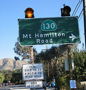
The winding 19-mile (31 km) long Mount Hamilton Road is a popular route. Many bicyclists and motorcyclists enjoy riding here. The road was built between 1875 and 1876. It was made to help carry building materials and equipment up the mountain for the observatory. The road is not too steep, usually less than 6.5 percent.
The road climbs over 4,000 feet (1,219 meters) from San Jose to the mountaintop. On a clear day from the summit, you can even see the Sierra Nevada mountains.
Cyclists love this road because the climb is long but not too hard. There isn't much car traffic on most of it. Plus, the views of San Jose and the Santa Clara Valley are amazing. There is an annual cycling challenge climb in April. Many cyclists also come on Thanksgiving.
The main observatory building offers free 15-minute tours. You can see the Great Lick refracting telescope.
Geology and Hydrology
The lower slopes of Mount Hamilton are mostly made of sandstone from the Miocene age. This rock can be soft near the surface. But it becomes very hard deeper down. The water underground in these areas is about 240 feet (73 meters) deep. Babb Creek is one of the streams that drains water from the slopes of Mount Hamilton. The Calaveras and Hayward earthquake faults also run through the slopes of Mount Hamilton.
Ecology and Conservation
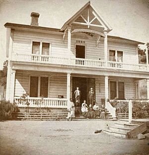
You can find several rare species on Mount Hamilton. The Mount Hamilton jewelflower is a special plant that only grows in this area. In June 2011, five young California condors were seen flying over Mount Hamilton. They even landed on the Lick Observatory! This was the first time these large birds had been seen there in at least 30 years.
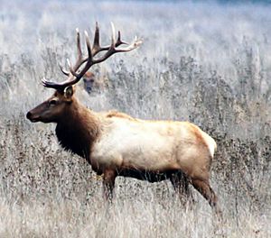
In 1978, the California Department of Fish and Game decided to bring tule elk back to the Mount Hamilton area. This was part of a plan to help these animals return to different parts of California.

A group called The Nature Conservancy is working on the "Mount Hamilton Project." They have bought or protected over 100,000 acres (405 square kilometers) of land. Their goal is to protect 500,000 acres (2,023 square kilometers) in the eastern Santa Clara County area. This helps protect the homes of many animals and plants.
The Community
Mount Hamilton has its own zip code, 95140. It is mostly open land. In 2000, only 35 people lived there. Mount Hamilton Elementary was a small school with just one classroom. It closed in 2006.
 | John T. Biggers |
 | Thomas Blackshear |
 | Mark Bradford |
 | Beverly Buchanan |


