Lajitas, Texas facts for kids
Quick facts for kids
Lajitas, Texas
|
|
|---|---|
|
Unincorporated community
|
|

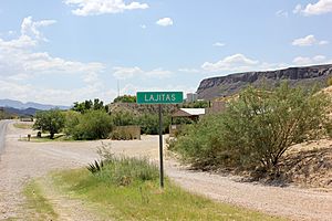
Lajitas in 2014
|
|
| Country | United States |
| State | Texas |
| County | Brewster |
| Elevation | 2,342 ft (714 m) |
| Time zone | UTC-6 (Central (CST)) |
| • Summer (DST) | UTC-5 (CDT) |
| ZIP codes |
79852
|
| Area code | 432 |
| GNIS feature ID | 1339481 |
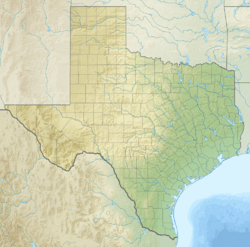
Lajitas is a small community in Brewster County, Texas, in the United States. It is located very close to the famous Big Bend National Park. In 2010, about 75 people lived there.
Contents
History of Lajitas
The name "Lajitas" comes from the flat stones found in the area. In Spanish, "Lajitas" means "little flat rocks." Native Mexican people lived here for many years. Later, the Apache and Comanche tribes moved them out in the 1700s and 1800s. The first white settlers arrived in the mid-1800s.
Growth and Changes
Lajitas grew quickly when a valuable metal called quicksilver was found nearby. This happened in the late 1850s. The community became a busy port of entry for trade. Many cattle ranches and mines in Mexico started trading across the Rio Grande River. The river crossing here was known for its smooth, rocky bottom.
Farming along the river also helped Lajitas grow. By 1912, the town had a store, a saloon, and a customs office. A man named H.W. McGuirk ran the store and saloon. He also helped manage a mining company and paid for a church to be built.
A post office opened in Lajitas in 1904. It closed for a short time in 1910 but reopened six years later. Later, the land was sold to Thomas V. Skaggs. He became successful selling candelilla wax from the area.
Troubles and Rebirth
Trade was stopped for a while when Pancho Villa and his group caused problems. This led to John J. Pershing and his soldiers setting up a military post in Lajitas in 1916.
Later, in 1949, Rex Ivey, Jr. bought the Lajitas area. He brought electricity to the community. He then sold part of it to Walter M. Mischer, a businessman from Houston. Mischer helped fix up the community in 1976.
When the quicksilver mines closed, Lajitas became very small, with only four people living there. But by the mid-1980s, Lajitas became a popular resort town. It had 15 businesses and about 50 residents. The old church was fixed up. The town grew to have three motels, a hotel, a restaurant, a golf course, a swimming pool, an RV park, and even an airstrip. There was also a museum with items from the Big Bend area. The old trading post stayed open too. The population grew to 75 people by 2010.
The Goat Mayor
For many years, Lajitas had a very unusual mayor: a "beer-drinking" goat named Clay Henry III! This started as a joke in the 1980s. After the first Clay Henry, there were two more goats named Clay Henry who became mayor. The place where the goat mayor lived is now closed. The election for mayor included a human, a wooden Indian statue, and a dog. Since Clay Henry, goats have continued to be the mayors of Lajitas.
Geography of Lajitas
Lajitas is located at the eastern edge of the Big Bend Ranch State Park. It sits on a high area that looks over the Rio Grande river. This spot was once a crossing point on the old Comanche Trail. Lajitas is in the northern part of the Chihuahuan Desert in southwestern Brewster County. It is about 95 miles (153 km) south of Alpine and 50 miles (80 km) east of Presidio.
North of Lajitas, you can find interesting rock formations called Columnar basalt. These rocks look similar to those found at the Devils Postpile National Monument in California.
Climate in Lajitas
Lajitas has a very hot and dry climate. Summers are extremely hot, and winters are mild.
| Climate data for Lajitas, Texas, 1991–2020 normals, extremes 1978–present | |||||||||||||
|---|---|---|---|---|---|---|---|---|---|---|---|---|---|
| Month | Jan | Feb | Mar | Apr | May | Jun | Jul | Aug | Sep | Oct | Nov | Dec | Year |
| Record high °F (°C) | 89 (32) |
98 (37) |
103 (39) |
109 (43) |
115 (46) |
115 (46) |
113 (45) |
113 (45) |
110 (43) |
104 (40) |
97 (36) |
91 (33) |
115 (46) |
| Mean maximum °F (°C) | 83.5 (28.6) |
89.9 (32.2) |
95.5 (35.3) |
101.5 (38.6) |
107.8 (42.1) |
110.8 (43.8) |
108.5 (42.5) |
106.3 (41.3) |
104.0 (40.0) |
99.7 (37.6) |
90.1 (32.3) |
83.0 (28.3) |
111.4 (44.1) |
| Mean daily maximum °F (°C) | 67.9 (19.9) |
74.0 (23.3) |
82.0 (27.8) |
90.3 (32.4) |
97.5 (36.4) |
102.4 (39.1) |
100.6 (38.1) |
99.6 (37.6) |
94.7 (34.8) |
88.1 (31.2) |
76.4 (24.7) |
68.1 (20.1) |
86.8 (30.5) |
| Daily mean °F (°C) | 50.5 (10.3) |
55.9 (13.3) |
63.7 (17.6) |
72.1 (22.3) |
80.9 (27.2) |
87.9 (31.1) |
87.4 (30.8) |
86.4 (30.2) |
81.1 (27.3) |
72.0 (22.2) |
59.5 (15.3) |
50.7 (10.4) |
70.7 (21.5) |
| Mean daily minimum °F (°C) | 33.0 (0.6) |
37.9 (3.3) |
45.4 (7.4) |
53.9 (12.2) |
64.3 (17.9) |
73.4 (23.0) |
74.3 (23.5) |
73.2 (22.9) |
67.5 (19.7) |
55.9 (13.3) |
42.7 (5.9) |
33.3 (0.7) |
54.6 (12.5) |
| Mean minimum °F (°C) | 23.1 (−4.9) |
26.2 (−3.2) |
32.5 (0.3) |
41.1 (5.1) |
51.4 (10.8) |
64.7 (18.2) |
68.4 (20.2) |
66.8 (19.3) |
56.9 (13.8) |
41.2 (5.1) |
30.1 (−1.1) |
21.6 (−5.8) |
19.3 (−7.1) |
| Record low °F (°C) | 14 (−10) |
5 (−15) |
19 (−7) |
29 (−2) |
35 (2) |
59 (15) |
61 (16) |
53 (12) |
47 (8) |
27 (−3) |
21 (−6) |
4 (−16) |
4 (−16) |
| Average precipitation inches (mm) | 0.36 (9.1) |
0.24 (6.1) |
0.30 (7.6) |
0.31 (7.9) |
0.88 (22) |
1.28 (33) |
1.86 (47) |
1.22 (31) |
1.32 (34) |
0.90 (23) |
0.37 (9.4) |
0.25 (6.4) |
9.29 (236.5) |
| Average snowfall inches (cm) | 0.1 (0.25) |
0.0 (0.0) |
0.0 (0.0) |
0.0 (0.0) |
0.0 (0.0) |
0.0 (0.0) |
0.0 (0.0) |
0.0 (0.0) |
0.0 (0.0) |
0.0 (0.0) |
0.0 (0.0) |
0.4 (1.0) |
0.5 (1.25) |
| Average precipitation days (≥ 0.01 in) | 2.1 | 1.6 | 1.6 | 1.5 | 3.2 | 4.3 | 6.3 | 4.5 | 5.1 | 3.4 | 2.4 | 1.7 | 37.7 |
| Average snowy days (≥ 0.1 in) | 0.1 | 0.0 | 0.0 | 0.0 | 0.0 | 0.0 | 0.0 | 0.0 | 0.0 | 0.0 | 0.0 | 0.0 | 0.1 |
| Source 1: NOAA | |||||||||||||
| Source 2: National Weather Service | |||||||||||||
Economy and Tourism
The Lajitas Golf Resort and Spa is a huge golf resort in Lajitas. It covers 20,000 acres. A Texas businessman named Kelcy Warren owns it. He bought the resort when it was having some money troubles. The resort is right on the Rio Grande, next to Mexico. It is located between Big Bend National Park and Big Bend Ranch State Park. A statue of Robert E. Lee on Traveller is on display at the resort.
Education in Lajitas
Students in Lajitas attend schools in the Terlingua Common School District. Long ago, in 1912, Lajitas had its own school with 50 students. H.W. McGuirk, who helped build the church, also helped pay for the school.
Media and Entertainment
In the 1970s, Lajitas was very isolated. The community had only one telephone. Newspapers arrived a day late. There were also no televisions, which was very unusual for communities at that time.
Lajitas has been a filming location! In 1972, Frank Q. Dobbs directed his first movie, Enter the Devil, there. The TV miniseries, Streets of Laredo, was also filmed in Lajitas. Filmmakers chose Lajitas because they could film in any direction without seeing modern buildings.
Infrastructure
Airport Access
Because Lajitas is so far away from big cities, it has its own private airport. It's called the Lajitas International Airport. It has a concrete runway that is about 6,503 feet (1,982 meters) long. There are regular flights between Lajitas and Dallas Love Field on JSX.
 | Bessie Coleman |
 | Spann Watson |
 | Jill E. Brown |
 | Sherman W. White |


